tidal river inlet with stone jetties or bulkheads on both sides
Depth:
30 ft
This inlet has a long slightly L-shaped jetty on the north side and a longer straight jetty on the south side. Both jetties are made of large stones and concrete, and the ends are built out of man-made concrete "jacks", shaped like an H with a 90-degree twist in the middle.
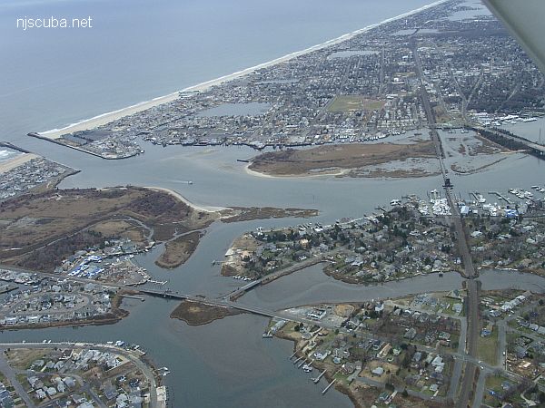
Aerial shot of the entire Manasquan River estuary, looking southeast. The Railroad Bridge dive site is at the upper-right.
The Manasquan River is overall not as nice a place to dive as the Shark River. The currents are stronger, the water never seems as clean, and the bottom is silty wherever it is not covered with mussels. The inlet jetties can be downright dangerous, and the boat traffic in the channel there is often very heavy. Off the north jetty is the so-called "Manasquan Wreck", but this is a long swim from shore and probably best approached with a boat.