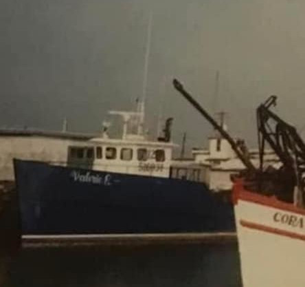
Valerie E

Type:
shipwreck, clam dredge
Built:
1968, Kennedy Brown, Palatka FL
Specs:
( 71 ft ) 116 gross tons, 3 crew
Sunk:
Thursday January 16, 1992; winter storm - no survivors
Depth:
75 ft

The Valerie E sank in the same storm as the John Marvin, off Atlantic City. Although the Valerie E sank off Long Island, her home port was Belford NJ.

Valerie E
CDROM

The Valerie E was a 71 ft clam dredge that was reported overdue at 12:30 PM on January 16, 1992. At the time she had three crewmen aboard. The Coast Guard located the sunken wreck the next day, but unfortunately in the frigid winter waters, there was little hope for the crew. They were never recovered and are presumed lost.
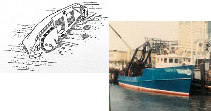
Shipwreck Valerie E

The wreck now sits on her port side in 75 feet of water. When we first visited this wreck in the spring of 1992 she was in near perfect condition. At that time her bronze propeller was still shiny. After a powerful Nor'easter in the fall of the same year, the wreck was moved about 200 feet inshore. Apparently, the storm was so powerful that the wreck actually bounced across the bottom because one of the propeller blades bent forward 90 degrees. In 1995 the Valerie E's 600 pound, four-foot diameter bronze propeller was successfully salvaged.

Excerpted from Wreck Valley CDROM by Dan Berg
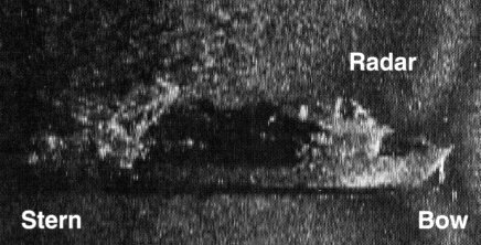
Shipwreck Valerie E
side-scan sonar image

516934


Comments on Valerie E

Questions or Inquiries?

Just want to say Hello? Sign the .

Submit a Comment

Your email address will not be published. Required fields are marked *


Click image to replace if unable to read.

Enter the digits from the image above, except for the last one:

This site uses Akismet to reduce spam. Learn how your comment data is processed.


H10284/88 -- OPR-C147-WH-88; AN OBSTRUCTION WAS FOUND WITH AN ESTIMATED DEPTH OF 33 FT; OBSTRUCTION IS 269M SW OF CHARTED POSITION OF THIS ITEM AND 81M SW OF POSITION OF ITEM 1571; EVALUATOR BELIEVES THAT THIS CONTACT IS THIS ITEM OR ITEM 4600; THERE ARE OTHER OBSTRUCTIONS IN THE VICINITY OF THE AWOIS ITEM THAT WERE LOCATED BY THE PRESENT SURVEY, BUT THIS IS THE MOST SIGNIFICANT AND HAS AN ESTIMATED HEIGHT THAT IS CLOSE TO THE CHARTED INFORMATION. (UPDATED MSD 6/91)

FE330SS/89 -- OPR-C147-HE-89; CONTACT #22 FROM SURVEY H-10284/88; DIVERS INVESTIGATION REVEALED THE REMAINS OF A LARGE WOODEN WRECK WHICH IS BADLY BROKEN UP, DETERIORATED, AND STREWN ABOUT THE BOTTOM; SEVERAL LARGE TIMBERS RISE AT ANGLES ABOVE THE GENERAL TREND OF THE WRECK; TIMBERS ARE MOST LIKELY THE RIBS FROM THE WRECK; LEADLINE LEAST DEPTH WAS TAKEN BY DIVERS ON THE AFTERMOST VERTICAL TIMBER; DUE TO THE DETERIORATED CONDITION OF WRECK, POSITIVE IDENTIFICATION IS NOT POSSIBLE; HOWEVER, DIVERS REPORTED THAT THE WRECKAGE WAS MORE LIKELY A BARGE THAN A WAR VESSEL (AWOIS ITEM 1571) (UPDATED MSD 6/91)