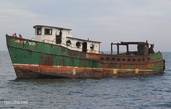
Plymouth
- Type:
- shipwreck, schooner barge
- Built:
- 1916, Elkton MD USA
- Specs:
- ( 199 x 24 ft ) 474 tons
- Sunk:
- Monday March 31, 1924
foundered in storm, 5 casualties ( see Pocono ) - Depth:
- 65 ft
from AWOIS: 1531
FE331SS/89 -- OPR-C147-HE-89; CONTACT #9; SIDE-SCAN SONAR CONTACT, FOUND ON ABOVE SURVEY, INVESTIGATED BY DIVERS; LOCATED THE REMAINS OF A LARGE SUNKEN WOODEN SHIP; APPEARED TO HAVE SETTLED KEEL DOWN AND TO ONE SIDE; ONLY ONE SHEER STRAKE RUNNING 40 M LONG AND SOME DECK PLANKS WERE EXPOSED; MOST OF THE SHIP WAS BURIED IN THE SAND; CURRENT SCOUR ALONG THE OUTBOARD SIDE OF THE WRECK ACCOUNTED FOR THE DIVERS MAXIMUM DEPTH OF 64 FT; SHOALEST POINT ROSE APPROXIMATELY 3 FT OFF A SANDY BOTTOM; PNEUMATIC DEPTH GAUGE LEAST DEPTH OF 54 FT. (UPDATED MSD 7/91)
24 NO. 361; SUNK 1939, CGS WD CLEARED TO 42 FT IN 1939
27 NO.644; LOCATED BY U.S.C. & G.S. IN SEPT. 1939, CLEARED TO 42 FT.
Dive Sites, Manasquan Dive Sites, New Jersey Dive Sites, Sandy Hook Dive Sites, Schooner Barges,
Sandy Hook / Rockaway Inlet Chart
- Barge #10
- 120 Wreck
- 3 Sisters
- Ambrose Buoy
- A Street - Shark River
- Acara
- Across
- Adele
- Ajace
- Alex Mac
- Allenhurst Jetty
- Antioch
- Arnoff
- Arundo
- Asfalto
- Aurora
- Ayuruoca
- BA Wreck
- Shark River - Back Bay
- Balaena
- Bald Eagle
- BD1738
- USS Benson
- Beth Dee Bob
- Blue Boy
- Bronx Queen
- Bug Light
- Charles Dunlap
- Cecilia M Dunlap
- Catherine Jackson
- Chauncy Jerome
- Cornelia Soule
- Choapa
- coal (Lido)
- Continent
- crane barge
- Daghestan
- Dragger
- drydock
- Dryland
- Edwin Duke / Stone Barge
- dump
- Dutch Springs
- Edmund Phinney
- East Rockaway Inlet
- Ed's Schooner
- Elberon Rocks
- Eureka
- Finance
- Fort Victoria
- German
- GL78
- Glen II
- I.P. Goulandris
- Gypsy
- Horseshoe Cove
- Alexander Hamilton
- Howard
- Iberia
- Immaculata
- Inshore Schooner
- Jack I
- Joan La Rie III
- Jones Inlet
- Jones Tug
- Klondike Rocks
- Larsen
- Lizzie D
- Long Branch locomotives
- Logwood
- H.W. Long
- Macedonia
- Mahogany
- Malta
- Manasquan Inlet
- Margaret
- Marion
- Mistletoe
- R.C. Mohawk
- Manasquan Wreck
- Nautilus
- Navesink River
- Northeast Sailor
- New Reef
- New Deal
- New Era
- HMS Pentland Firth
- Long Branch Pier Rubble
- Pinta
- Pipe Barge
- Pliny
- Plymouth
- Pocopson
- Princess Anne
- Ruth Shaw
- Robert A Snow
- Ramos
- Ranger
- Relief Lightship
- Rickseckers
- Rjukan
- Rockaway Inlet
- Rockaway Belle
- Round Valley
- Roy's barge
- Rudder Wreck - Pocono
- Rusland / Adonis
- Scotland Buoy
- Sandy Hook Pilot Boat
- SC-60
- Sea Girt Inlet
- Sea Girt Wreck
- Shark River Inlet
- Shrewsbury Rocks
- Spring Lake Sailor
- Steel Wreck
- Stolt Dagali
- Sylvanus
- Tampa III
- USS Turner
- AWOIS 8087
- AWOIS 8097
- u11
- AWOIS 7509
- AWOIS 7932
- AWOIS 9768
- AWOIS 12966/11422
- AWOIS 1609
- AWOIS 8084
- AWOIS 7940
- AWOIS 7938
- AWOIS 8076
- AWOIS 4600
- AWOIS 8075
- Valerie E
- Vega
- Warrior
- Delaware River Water Gap
- Western World
- Edward W Winslow
More: Sandy Hook Dive Sites Chart ...
Manasquan Chart
- Barge #10
- 120 Wreck
- 3 Sisters
- Ambrose Buoy
- A Street - Shark River
- Across
- Adele
- Ajace
- Alex Mac
- Allenhurst Jetty
- Anastasia
- Antioch
- Arnoff
- Arundo
- Asfalto
- Aurora
- Ayuruoca
- BA Wreck
- Shark River - Back Bay
- Balaena
- Bald Eagle
- Barnegat Inlet
- BD1738
- USS Benson
- Beth Dee Bob
- Blue Boy
- Bonanza
- Brick barge
- Bronx Queen
- Brunette
- Cecilia M Dunlap
- Cornelius Grinnell
- Catherine Jackson
- Chauncy Jerome
- Caddo
- Cadet
- Capt Smitty
- Catamount
- Charlemagne Tower
- Chaparra
- Chesapeake
- Choapa
- clam boat
- Continent
- crane barge
- Creole
- Daghestan
- Delaware
- drydock
- Dryland
- dump
- Duncan
- Edmund Phinney
- Elberon Rocks
- Emerald / USS Hibiscus
- Eureka
- Francis A Perkins
- William R Farrell
- FF Clain
- Finance
- Fort Victoria
- Gassoon
- German
- Lady Gertrude
- GL78
- Glen II
- Glory Wreck
- I.P. Goulandris
- Granite Wreck
- Great Isaac
- Gulftrade (stern)
- Gulftrade (bow)
- Gypsy
- Horseshoe Cove
- Alexander Hamilton
- Hankins (Big)
- Hankins (Offshore)
- Hankins 3
- Happy Days
- Cornelius Hargraves
- Harry Rush
- Harvey's Schooner
- Thomas Hebert
- Ida K
- Immaculata
- Inshore barge/tug
- Irene/Truro
- Irma C
- John Minturn
- Jack I
- Joan La Rie III
- Klondike Rocks
- Lizzie H. Brayton
- Lana Carol
- Larsen
- Lavallette Wreck
- Leon Walter
- Lillian
- Lizzie D
- Long Branch locomotives
- Logwood
- H.W. Long
- Macedonia
- Mahogany
- Malta
- Manasquan Inlet
- Marion
- Maurice Tracy
- Mediator
- Meta
- Middle Barge
- Mistletoe
- R.C. Mohawk
- Mohawk
- Manasquan Wreck
- Nautilus
- Navesink River
- Northeast Sailor
- New Reef
- New Deal
- New Era
- NW Barges
- Olsen
- HMS Pentland Firth
- Park City
- Peerless
- Persephone
- Long Branch Pier Rubble
- Pinta
- Pliny
- Plymouth
- Pocopson
- Remedios Pascual
- Ruth Shaw
- Ramos
- Ranger
- Reliable
- Relief Lightship
- Rickseckers
- Ridge Schooner
- Riggy
- Rjukan
- Rockaway Belle
- Roy's barge
- RP Resor
- Manasquan River Railroad Bridge
- Rudder Wreck - Pocono
- Rump
- Rusland / Adonis
- Scotland Buoy
- San Saba
- Sandy Hook Pilot Boat
- SC-60
- Sea Girt Inlet
- Sea Girt Wreck
- Sea Hag
- Seaside Crane Barge
- Shark River Inlet
- Shrewsbury Rocks
- Simala
- Spring Lake Sailor
- Steel Wreck
- Stolt Dagali
- Sumner
- Southwest Mohawk
- Sylvanus
- Tampa III
- Thurmond
- Tolten
- Train Wheel
- Troop Carrier
- USS Turner
- AWOIS 8087
- AWOIS 8097
- u11
- AWOIS 7509
- AWOIS 7932
- AWOIS 9768
- AWOIS 12966/11422
- AWOIS 1609
- AWOIS 8084
- AWOIS 7940
- AWOIS 7938
- AWOIS 8076
- AWOIS 4600
- AWOIS 8075
- Valerie E
- Vega
- Vivian
- Vizcaya
- Warrior
- Western World
- Edward W Winslow
- Yankee (G+D)
- Yellow Flag
- ZPG-3W
More: Manasquan Dive Sites Chart ...
Questions or Inquiries?
Just want to say Hello? Sign the .