Manasquan River (1/3)
The Manasquan River is overall not as nice a place to dive as the Shark River. The currents are stronger, the water never seems as clean, and the bottom is silty wherever it is not covered with mussels. The inlet jetties can be downright dangerous, and the boat traffic in the channel there is often very heavy. Off the north jetty is the so-called "Manasquan Wreck", but this is a long swim from shore and probably best approached with a boat.
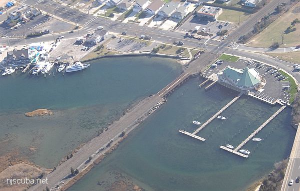
The best place to dive in the Manasquan River is the Railroad Bridge at Gull Island Park, which is set up specifically for divers. This location is used heavily for training dives, but if you can avoid the crowds it can be a very interesting spot, with a wide variety of marine life. Powerful tidal currents will limit your dive time, but otherwise, there are no time restrictions, unlike the inlet.
Warning:
Not all fishermen are thieves, but some certainly are, and anything you leave onshore, or even in the back of your vehicle, is likely to be gone when you get back from your dive!
History
The name Manasquan is derived from the Indian words Man-A-Squaw-Han, or "Stream of the Island of the Squaws". In old records, and even up to World War Two, the area was known simply as Squam or Squan.
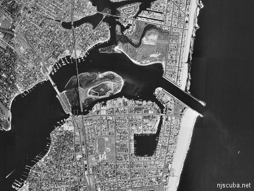
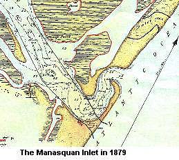
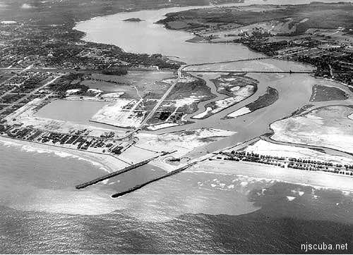
Manasquan was first settled as a part of Shrewsbury in the late 1600s. It takes its name, Man - A - Squaw - Han ( stream of the Island of Squaws ) from the Lenni Lenape Indians who were summer visitors here for hundreds of years. The entire coastline from Manasquan south to Barnegat was once referred to as "Squan Beach." the inlet itself was once a very crooked channel determined by currents and drifting sands, and prone to shifting around, as all natural inlets are.
In 1926, the Point Pleasant Canal opened a connection between the Manasquan River and the north end of Barnegat Bay. This had two consequences: Initially, saltwater intrusion into the freshwater bay destroyed the existing ecosystem there, wiping out oyster beds and many sport fish. Secondly, the canal also diverted much of the river's outward flow away from the ocean inlet, such that in 1931 the inlet actually closed off! This had a disastrous effect on the local economy, rather than the hoped-for boon.
To reopen the inlet, the Army Corps of Engineers built two stone jetties with rock from the New York City subway diggings. They then dredged the sand from in between them, finally opening the inlet again in August 1931 at a total cost of $600,000. The jetties were reinforced in the early 1980s and again in the late 1990s.
Apart from the ecological issues, the vicious tidal flow in the Point Pleasant Canal has made it a maintenance problem since its opening. Such an ill-conceived project could never gain approval today.

Dive Sites, Manasquan Dive Sites, New Jersey Dive Sites,
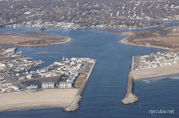
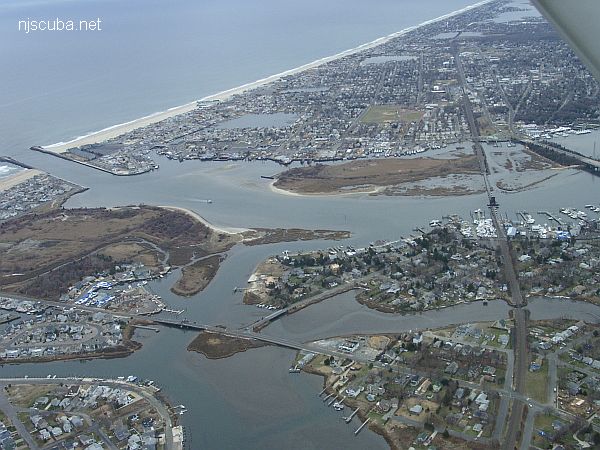
Point Pleasant on the left /south
Manasquan on the right / north
- Type:
- tidal river inlet with stone jetties or bulkheads on both sides
- Depth:
- 30 ft
This inlet has a long slightly L-shaped jetty on the north side and a longer straight jetty on the south side. Both jetties are made of large stones and concrete, and the ends are built out of man-made concrete "jacks", shaped like an H with a 90-degree twist in the middle.
More: Manasquan River Inlet ...
- Type:
- inland tidal river
- Depth:
- 20 ft, mostly a lot shallower
This spot is upstream on the Manasquan River. The diving area is rather small and not very deep. Visibility tends to be poor, and this is worsened whenever an O/W training class is in session, which is often. Also, the current under the bridge becomes very strong, so slack water is essential. For a long time, a dredge barge has been anchored in the channel, but otherwise, there is no boat traffic.
More: Manasquan River Railroad Bridge ...