Shark River Artificial Reef
Shark River Artificial Reef
15.6 Nautical Miles off Manasquan, 0.83 sq miles
Depth: 120-140 ft [download]


The Shark River reef is tucked into a corner between the Mud Hole and the Barnegat shipping lane, which happens to be in close proximity to the wreck of the Stolt Dagali. It has a minimum depth for navigational purposes of 50 ft ( 8 fathoms ) at mean low water. Shark River is the deepest of all New Jersey reef sites, with an average bottom depth of 125 ft, although scour holes around larger vessels may be much deeper.
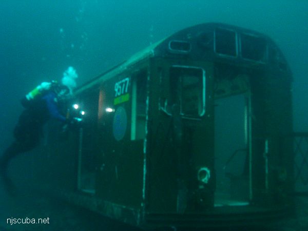
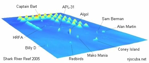
I have omitted the Redbirds from the chart, as they are no longer there. There were two clusters in the mud at the southern end of the reef, and one cluster atop the rock ridge at the northern end. Those are the cars in the pictures below. The Billy D sank just short of the reef and is omitted from state records. The actual location of the New England Coast is a secret.
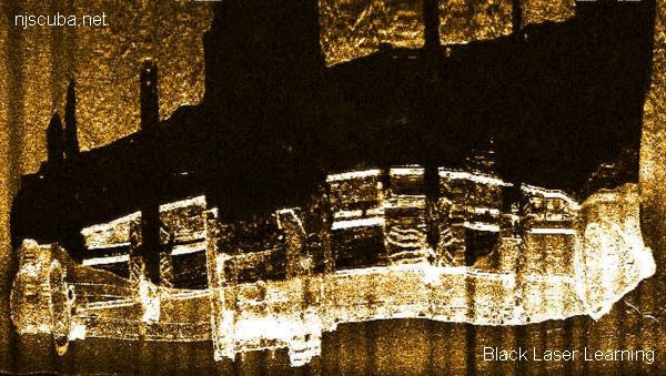
Side-scan sonar animation courtesy of Army Corps of Engineers
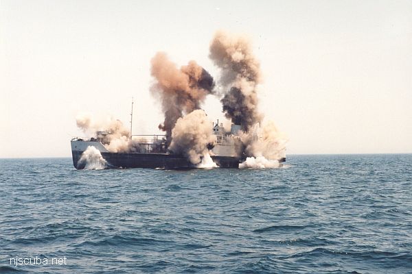
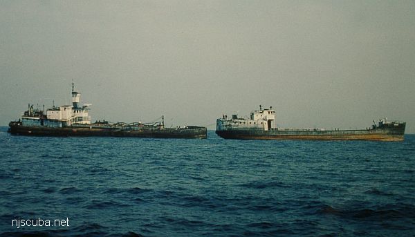
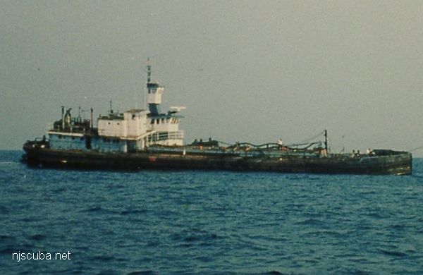
This reef got off to a big start, with three tankers sunk in one day - the Coney Island first, and then the "twins" Sam Berman and Alan Martin. The Shark River Reef is often referred to as "The Parking Lot" by charter boat operators. In addition to the vessels shown, the Shark River Reef also contains a great deal of rock and rubble.
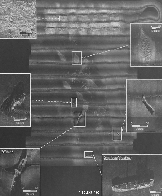
Side-scan sonar mosaic of the Shark River Reef, showing the partially-built rock ridges along the top, the Coney Island at lower right, and the massive Algol at the center, along with various other wrecks and concrete drops. The Captain Bart is visible just below the rock ridges, the APL-31 is NNW of the Algol, and the Alan Martin / Sam Berman duo is NW of the Coney Island. The tiny HRFA is just a speck among the concrete mounds, and the Mako Mania is visible south of the Algol. Mosaic image courtesy of SAIC.
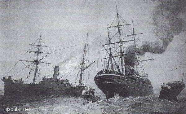
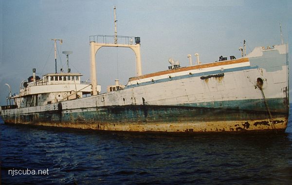
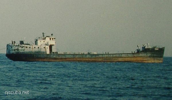
Not quite twins.
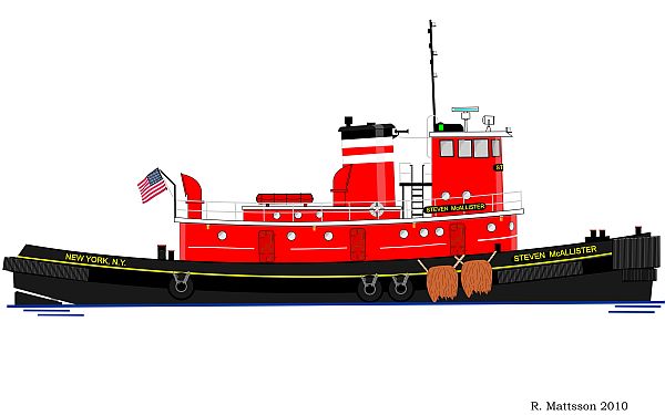
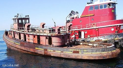
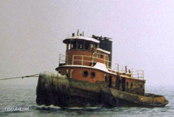
- Type:
- artificial reef, tugboat, McAllister Towing, USA
- Built:
- 1949, Jakobson Shipyard, Oyster Bay, NY USA, as Paterson
- Specs:
- ( 95 x 25 ft )
- Sponsor:
- Hudson River Fishermen's Association of New Jersey
- Sunk:
- Friday September 22, 2000 - Sea Girt Artificial Reef
- GPS:
- 40°06.883' -73°41.534'
- Depth:
- 125 ft
More: Steven McAllister ...
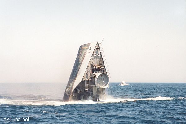
- Type:
- artificial reef, tanker, US Navy, YO-20 class
- Built:
- 1918, Todd Shipyards, New York NY USA, as YO-31
- Specs:
- ( 161 x 25 ft ) 335 tons light, 911 tons full-load
- Sponsor:
- Crystal Oil Corporation, Marine Trades Assn. of NJ, Fisherman Magazine
- Sunk:
- Thursday September 10, 1987 - Sea Girt Artificial Reef
- GPS:
- 40°06.440' -73°41.130'
- Depth:
- 125 ft
More: Alan Martin YO-31 ...
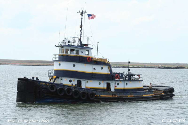
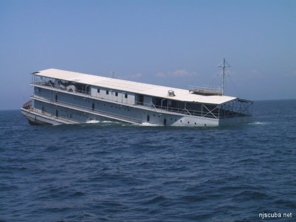
- Type:
- artificial reef, tugboat, Dann Marine, USA
- Built:
- 1966 - Main Iron Works, Houma LA, as New England Sun
- Specs:
- ( 105 x 30 ft ) 184 gross tons
- Sunk:
- Friday July 7, 2023 - Shark River Artificial Reef
- GPS:
- NJDEP Private Fishing Hole
- Depth:
- 125 ft
More: New England Coast ...
- Type:
- artificial reef, tugboat, US Army
- Built:
- 1945, American Machinery Company, Orlando CA USA, as ST-842, R.J. Wales
- Specs:
- ( 80 x 23 ft )
- Sponsor:
- Artificial Reef Association
- Sunk:
- Sunday July 27, 1997 - Shark River Artificial Reef
- GPS:
- 40°06.320' -73°41.855'
- Depth:
- 125 ft
More: Billy D ST-842 ...
All manner of concrete, steel, and stone rubble from dredging, demolition projects, and other construction is used as artificial reef materials. This material is generally available at very low cost or free from construction companies who are more than happy to get rid of it. Transportation costs determine where this material is used by the Reef Program.
More: Rock & Rubble ...
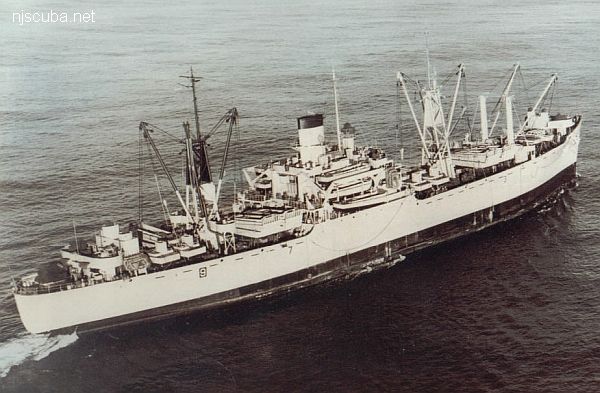
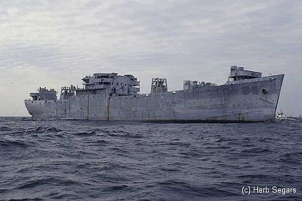
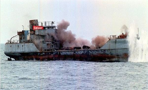
- Type:
- artificial reef, Andromeda class attack transport ( freighter ), U.S. Navy, also known as a "Victory Ship", although often incorrectly referred to as a Liberty Ship
- Name:
- One of a series of Navy transports named for stars;
Algol is a star in the constellation Perseus, also known as the Demon star. - Built:
- 1943, Moore Drydock, Oakland CA USA, as James Barnes
- Specs:
- ( 459 x 63 ft ) 13910 displacement tons, 429 crew *
* this figure almost certainly includes embarked Marines - Sponsor:
- Federal Aid in Sportfish Restoration
- Sunk:
- Thursday November 22, 1991 - Sea Girt Artificial Reef
- GPS:
- 40°06.545' -73°41.450'
- Depth:
- 145 ft +, starts at 70 ft, main deck at 110 ft
More: USS Algol AKA-54 ...