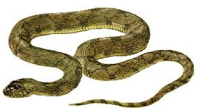
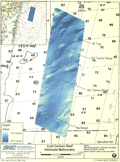
Axel Carlson Artificial Reef
Axel Carlson Artificial Reef
- "small old wreck"
- Austin
- Barbara Ann
- Bay King
- big barge
- Brooklyn
- Manasquan Inlet Buoy
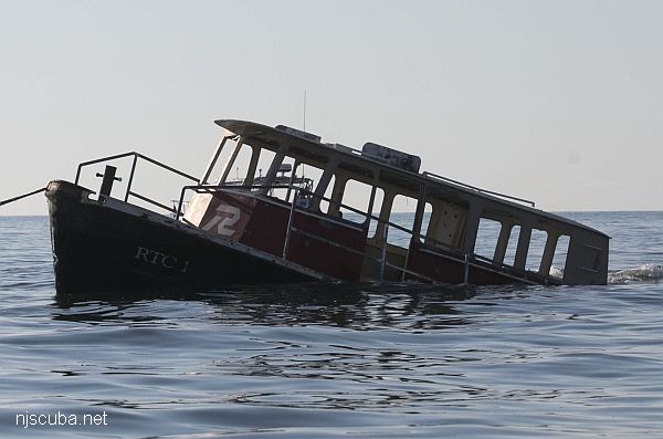
- Captain Bill
- Carrabassett
- Caterina.D
- Colleen
- crab barge
- Delaware
- Ed Schmidiger
- Glory Wreck
- Hail Mary
- Harbor Charlie
- Hillman III
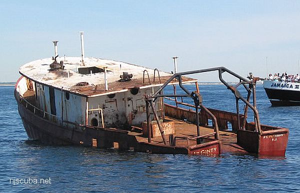
- Jim Lynch
- Manasquan Inlet
- McGinty
- Megan Sue
- Middle Barge
- MRMTC 8
- MRMTC 9
- OWD III
- Patrick McHugh
- Riggy
- Rump
- Shark River Inlet
- Snug Harbor
- Swensen
2.0 Nautical Miles off Mantoloking, 5.19 sq miles
Depth: 65-80 ft [download]
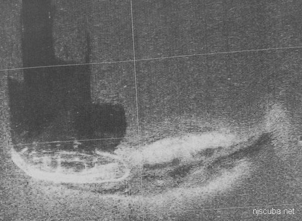
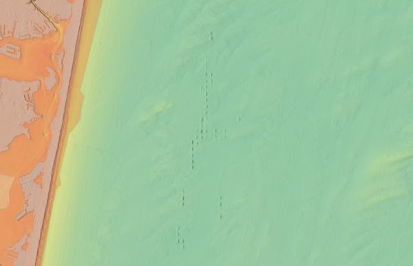
The Axel Carlson reef is situated in a trough next to an underwater hill known as the Manasquan Ridge. This is an area of silty mud bottom and usually has relatively poor visibility. Axel Carlson reef is sometimes referred to as the Mantoloking reef. It also contains a number of sunken army tanks ( not shown. ) Minimum clearance at mean low water is 40 feet.
The pink areas on the chart are the "Full Access Zones", approximately 0.6 square miles. These are the areas where commercial fishermen will continue to be allowed to set their traps and lines as of 2015. For the rest of us, those are more like "No Access Zones," but some sort of fair compromise needed to be reached with the commercial fishermen, some of whom could legitimately claim to have fished those spots for generations.
The actual location of the Carrabassett is a secret.
NOAA
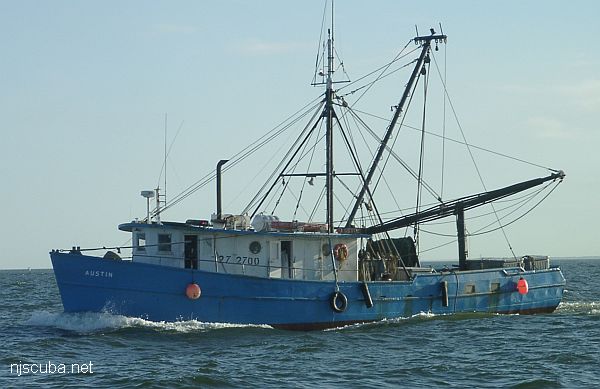
- Type:
- artificial reef, trawler
- Built:
- 1956, Tampa Marine, Tampa FL USA
- Specs:
- ( 65 ft ) 79 GT
- Sponsor:
- Grady family, Greater Point Pleasant Charter Boat Association, Ocean Reef Foundation of New Jersey
- Sunk:
- Wednesday Sept 21, 2016 - Axel Carlson Artificial Reef
- GPS:
- 40°02.900' -73°59.000'
- Depth:
- 80 ft
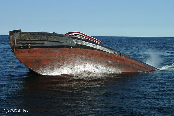
More: Austin ...
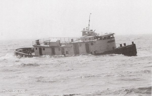
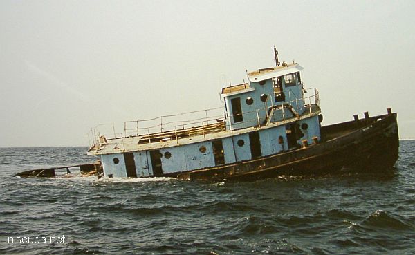
- Type:
- artificial reef, tugboat
- Built:
- 1951, Matton Shipyard, Cohoes NY USA as Edward Matton
- Specs:
- ( 85 x 23 ft )
- Sponsor:
- Ocean Wreck Divers
- Sunk:
- Tuesday September 12, 2000 - Axel Carlson Artificial Reef
- GPS:
- 40°02.473' -73°59.599'
- Depth:
- 80 ft, top at 60 ft
More: Patrick McHugh ...
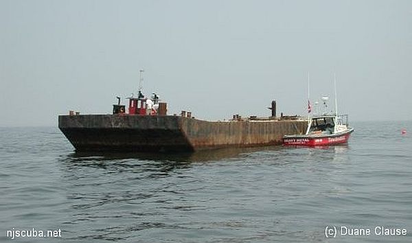
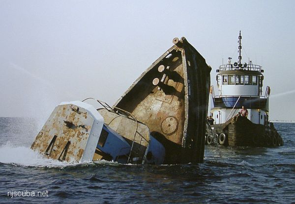
- Type:
- artificial reef, barge
- Specs:
- ( 75 x 28 ft )
- Sponsor:
- Capt Steve Nagiewicz
- Sunk:
- Friday June 27, 2003 - Axel Carlson Artificial Reef
- GPS:
- 40°03.560' -73°59.300'
- Depth:
- 80 ft
More: Barbara Ann ...
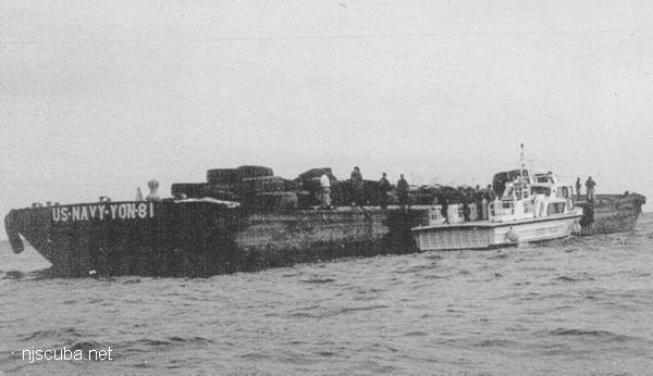
- Type:
- artificial reef, barge, tank, US Navy
- Built:
- 1942, Levingston Shipbuilding, Orange TX USA
- Specs:
- ( 174 x 40 ft ) 200 tons light
- Sponsor:
- Ocean Wreck Divers
- Sunk:
- Wednesday October 8, 1997 - Axel Carlson Artificial Reef
- GPS:
- 40°00.587' -73°59.391'
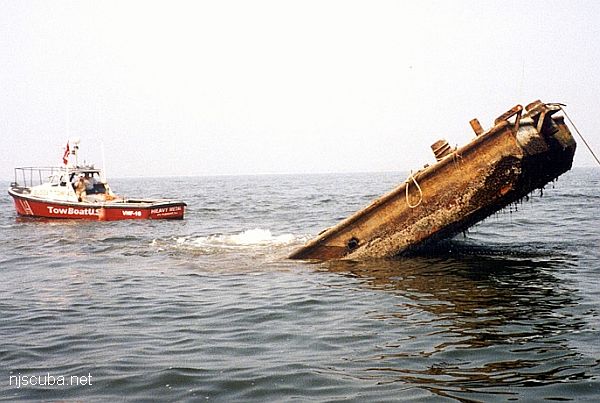
More: Ed Schmidiger YON-81 ...
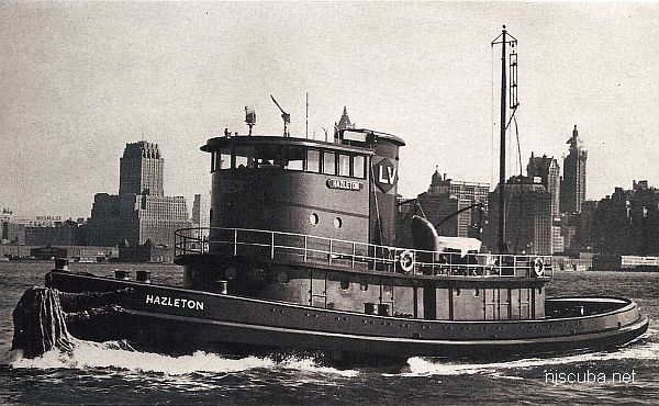
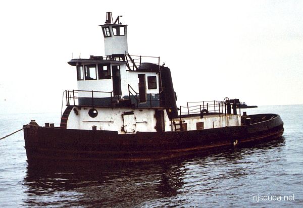
- Type:
- artificial reef, tugboat, McAllister Towing (Boston)
- Built:
- 1950, Jakobson Shipyard, Oyster Bay, NY as Hazleton
- Specs:
- ( 110 x 27 ft ) 199 gross tons
- Sponsor:
- Herb & Veronica Segars
- Sunk:
- Wednesday November 10, 2004 - Axel Carlson Artificial Reef
- GPS:
- 40°03.104' -73°59.283'
- Depth:
- 75 ft
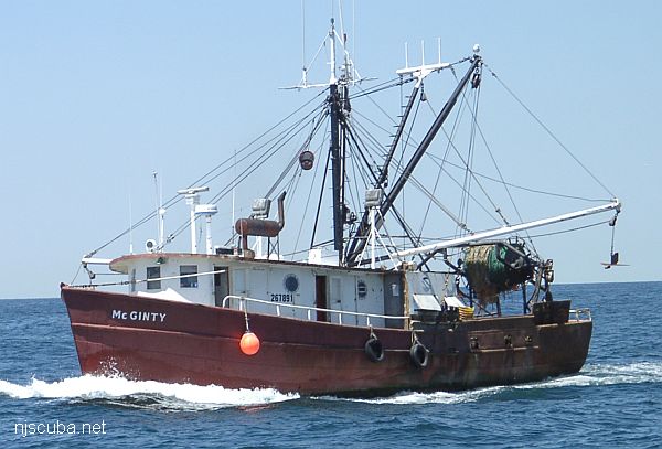
More: Captain Bill ...
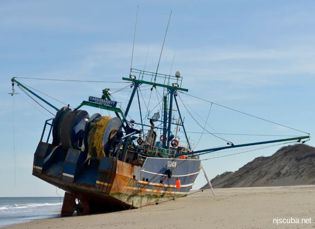
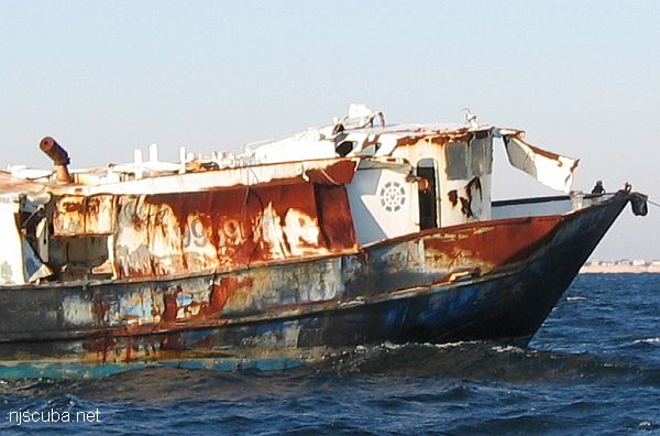
- Type:
- artificial reef, trawler
- Built:
- 1979, Gulf Coast Marine Builders, Bayou La Batre AL, as Cowboy
- Specs:
- ( 90 ft ) 159 tons
- Sunk:
- April 2024 - Axel Carlson Artificial Reef
- GPS:
- NJDEP Private Fishing Hole
More: Carrabassett ...