Cape May Artificial Reef
Cape May Artificial Reef
8.5 Nautical Miles off Cape May, 5.34 sq miles
Depth: 50-75 ft [download]


Cape May reef also contains large numbers of tire units and Army tanks (not shown) concentrated in the center area that appears here to be empty. This reef also received 50 redbird subways cars, which are not plotted. The Onondaga drifted slightly out of the reef boundaries, and the state does not list it, but it is there.
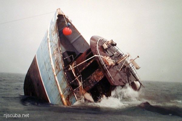
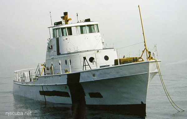
- Type:
- artificial reef, tugboat, USA
- Built:
- 1956, Equitable Equipment Company, Madisonville LA USA
- Specs:
- ( 100 x 27 ft ) 264 tons
- Sponsor:
- Ann E Clark Foundation, South Jersey Fishing Center
- Sunk:
- Friday March 26, 2004 - Cape May Artificial Reef
- GPS:
- 38°51.475' -74°42.029'
- Depth:
- 70 ft
More: King's Point ...
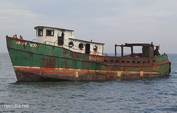
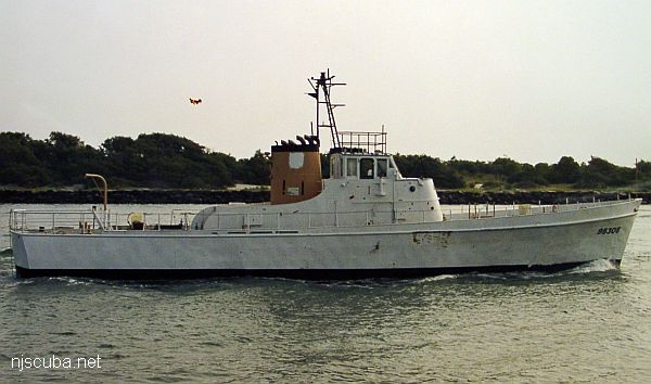
- Type:
- artificial reef, trawler, USA
- Specs:
- ( 133 x 30 ft )
- Built:
- 1945, American Bridge, Ambridge PA, as YF-879
- Sponsor:
- Cape May County Party & Charter Boat Association, Atlantic Cape Fisheries, Artificial Reef Association
- Sunk:
- Friday August 21, 1992 - Cape May Artificial Reef
- GPS:
- 38°53.118' -74°40.190'
- Depth:
- 70 ft
More: Sea Transporter YF-879 ...
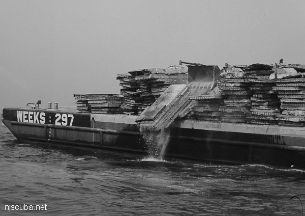
- Type:
- 4700 concrete slabs ( must be quite a pile )
- Sponsor:
- Delaware River Port Authority
- Sunk:
- 1988 - Cape May Artificial Reef
More: concrete ...
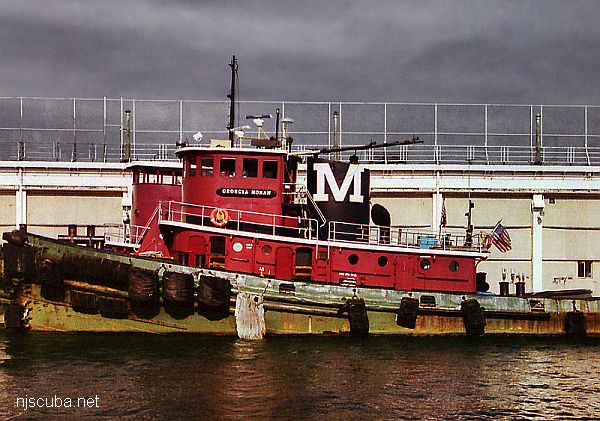
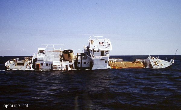
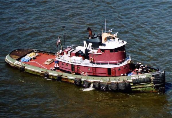
- Type:
- artificial reef, tugboat, USA
- Built:
- 1949, Levingston Shipbuilding, Orange TX as Barbara Moran
- Specs:
- ( 100 x 27 ft ) 238 tons
- Sponsor:
- Ann E Clark Foundation, South Jersey Fishing Center
- Sunk:
- Friday March 26, 2004 - Cape May Artificial Reef
- GPS:
- 38°51.465' -74°42.016'
- Depth:
- 70 ft
More: Georgia Moran ...
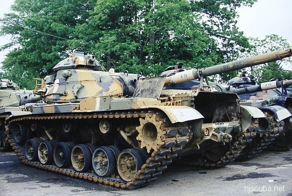
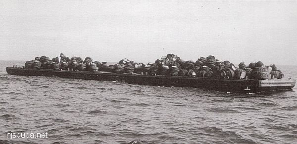
The Artificial Reef Program used four types of obsolete Army armored vehicles as artificial reef materials off the New Jersey coast. These were cleaned at local military bases, loaded onto barges for transport, and pushed off at their final destination. Once the Army had disposed of its excess inventory, the program ceased, around 1999. The Artificial Reef Program has sunk almost 400 tanks altogether, far too many to list them here in this website.
More: Army Tanks ...
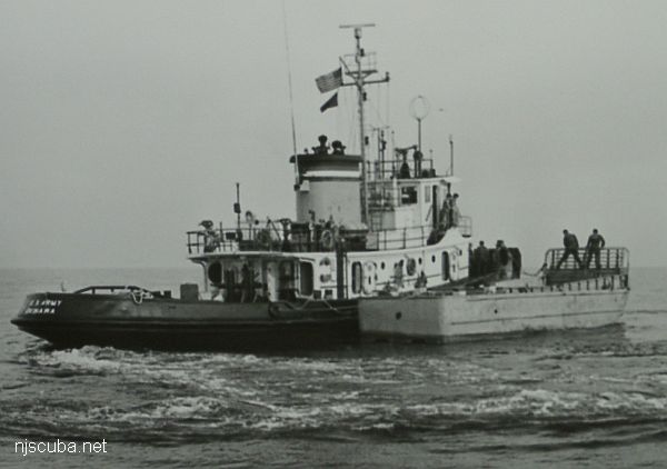
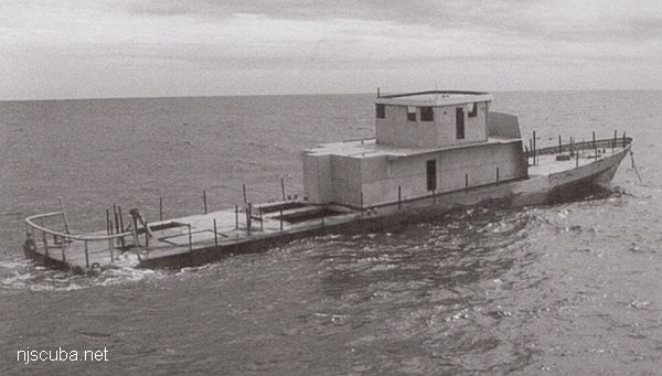
- Type:
- artificial reef, LCM-6 (Landing Craft-Mechanized, see "Captain Henry")
- Specs:
- ( 56 x 14 ft ) 64 tons
- Sponsor:
- Army Transportation Corps
- Sunk:
- Saturday November 14, 1987 - Cape May Artificial Reef
- GPS:
- 38°50.830' -74°42.510'
More: Peggy Diana LCM-6 ...