Delaware Bay Artificial Reef
Delaware Bay Artificial Reef
1.13 sq miles
Depth: 22-27 ft [download]
The NJDEP Division of Fish and Wildlife Artificial Reef Program is scheduled to begin deploying material on the new Delaware Bay Reef site beginning the second week of December 2017. The minimum vertical clearance is 15 feet below mean low water for all material placed on this site. A recent bathymetric survey was performed of the site and found depths ranging from 19 feet on the southwest corner to 35 feet midway between the northeast and southeast corners. This will result in material rising off the bottom from 4 feet to 20 feet respectively.
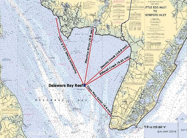
The reef site is approximately 1.13 square miles in area and is located approximately 9.2 nautical miles southwest of the Maurice River, bearing 188 degrees off Cumberland County, NJ.
Delaware Bay Reef Corner Coordinates:
NW  39 03.309' x 075 04.595'
NE  39 03.295' x 075 03.506'
SE  39 02.288' x 075 03.520'
SW  39 02.297' x 075 04.606'
The new reef will have a base of rock dynamited from a dredge site upriver near the Commodore Barry Bridge. Then concrete culverts and other material will be added on top. The rock varies from basketball size to the size of a car. The water is too shallow to use something larger, like a ship. The 1.3-square-mile area has a minimum depth of 19 feet deep and a maximum of 35 feet.
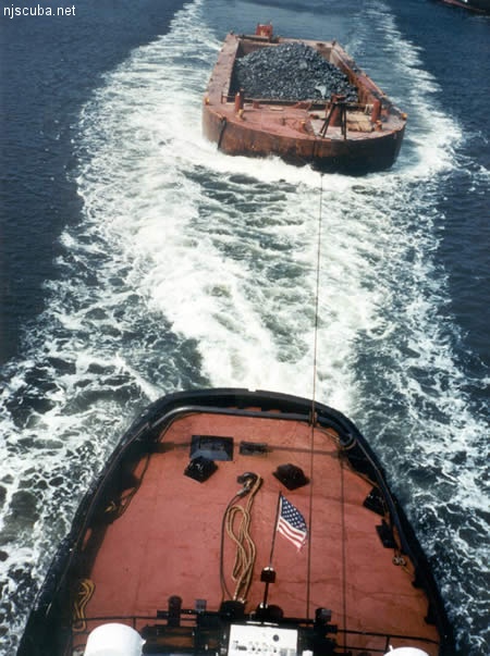
All manner of concrete, steel, and stone rubble from dredging, demolition projects, and other construction is used as artificial reef materials. This material is generally available at very low cost or free from construction companies who are more than happy to get rid of it. Transportation costs determine where this material is used by the Reef Program.
More: Rock & Rubble ...
Questions or Inquiries?
Just want to say Hello? Sign the .