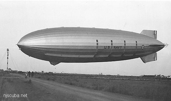
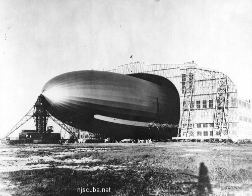
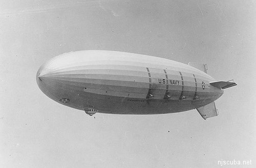
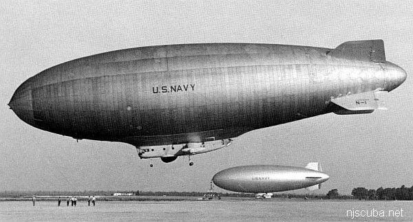
USS Akron ZRS-4
- Type:
- shipwreck, dirigible ( rigid airship ) , U.S. Navy
- Built:
- 1931, Akron OH USA
- Specs:
- ( 785 ft ) 200 tons, 76 passengers & crew
- Sunk:
- Tuesday April 4, 1933
atmospheric storm - 3 survivors - Depth:
- 105 ft
The Akron, like many other large dirigibles, was overcome by a wind shear too powerful for its relatively weak maneuvering controls and crashed. This is a problem inherent in this sort of craft that has never been solved.
The Akron and her sister the Macon were actually built as aircraft carriers. Each carried 5 small fighter planes, which were launched and recovered from a trapeze in the belly of the airship. The idea was that they would act as advance scouts for the fleet, but they were shown to be too vulnerable to attack from carrier-based aircraft. In any case, both ships were lost in accidents, and the airship program folded.
I don't know what kind of a dive this would be - much of the lightweight structure has probably dissolved completely by now. This is, however, one of the more unusual things sunk off the New Jersey coast. There are reports of a debris field of twisted girders.
For size comparison, see Andrea Doria.
Deep Sea Dive Sites, Dive Sites, Warships,
Deep Sea Chart (pan right for more)
- Four Daughters
- USS Akron
- Andrea Doria
- Atlantic Princess
- Azua
- USS Baldwin
- Bidevind
- Brian C
- Carolina
- Catamount
- Cayru
- Champion
- USS Cherokee
- Coimbra
- Corvallis
- Deepwater Dump
- Durley Chine
- Edward H Cole
- Galimore's Cayru
- Lady Gertrude
- Herbert Parker
- Thomas Hebert
- Hvoslef
- Isabel B Wiley
- India Arrow
- USS Jacob Jones
- Jacob M Haskell
- Lady Mary
- Lillian
- Maiden Creek
- Miraflores
- Misty Blue
- Montgomery
- USS Moonstone
- USS Murphy
- Northern Pacific
- Norness
- Pan Pennsylvania
- Republic
- Rio Tercero
- RP Resor
- Southern Lillian
- USS S-5
- USS Salmon
- SC-209
- Sebastian
- Shookus
- Sommerstad
- USS Spikefish
- Suffolk
- Texas Tower
- Texel
- U-550
- U-869
- Varanger
- West Wreck
- Wily Fox
- Winneconne
More: Deep Sea Dive Sites ...
- Type:
- shipwreck, blimp, U.S. Navy
- Built:
- 1958, Akron OH USA
- Specs:
- ( 403 x 85 ft ) 40 tons, 21 crew
- Sunk:
- Wednesday July 6, 1960
unknown cause - 18 casualties - Depth:
- 60 ft
More: ZPG-3W Reliance ...
Warships
- USS Akron
- USS Algol
- USS Baldwin
- Bronx Queen
- Capt Henry
- Catamount
- USS Cherokee
- HMS Culloden
- Great Isaac
- HMS Hussar
- Ida K
- Intrepid
- USS Jacob Jones
- Massachusetts
- R.C. Mohawk
- USS Moonstone
- USS Murphy
- New Jersey
- USS Ohio
- Olympia
- Peggy Diana
- USS Radford (main)
- USS San Diego
- SC-209
- SC-60
- USS Tarantula
- Texas Tower
- USS Turner
- ZPG-3W
A number of warships are sunk in New Jersey and New York waters:
More: Warships ...
Questions or Inquiries?
Just want to say Hello? Sign the .