Sea Girt Artificial Reef
Sea Girt Artificial Reef
- Boy Scout Reef
- car float
- Carlson II
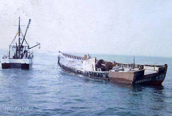
- Cinderella
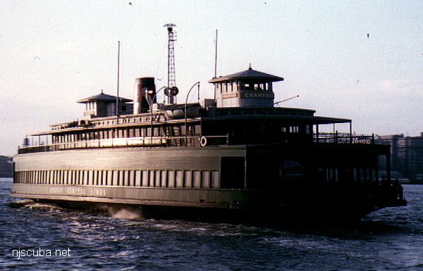
- Cranford
- drydock
- DVD Barge
- Dykes
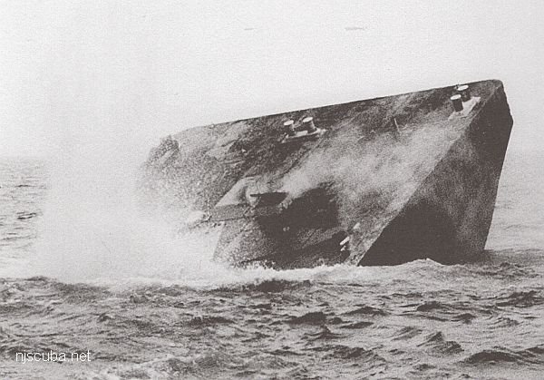
- Captain Etzel
- Fisherman Barge
- Golden Eagle
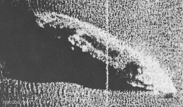
- Horseshoe Wrecks
- Kiley B
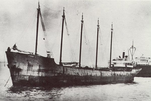
- Lewis F Boyer (Travis)
- Liberty Barge 1
- Liberty Barge 2
- Liberty Barge 3
- Liberty Barge 4
- Manasquan Inlet
- Marion
- Matt Turecamo
- Morania 180
- OWD IV
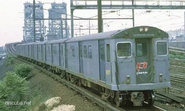
- PATH subway cars
- Railroad barge
- Response
- Restorer
- Rockland County
- Ronde Joyce
- Shark River Inlet
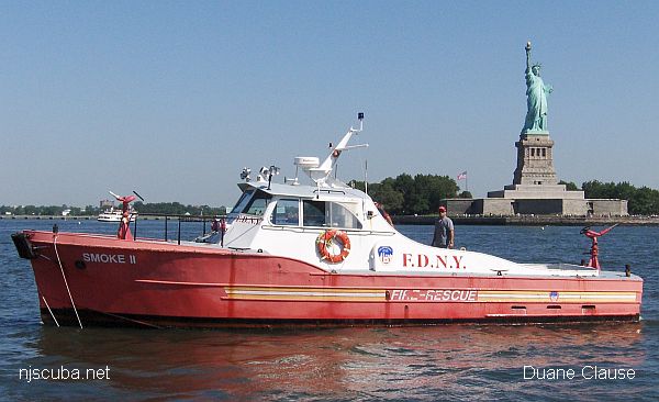
- Smoke II
- Spartan
- Swenson I
- Swenson II
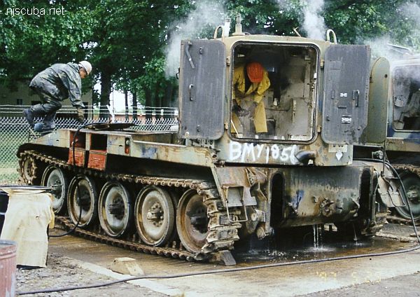
- army tanks
- Wedding Barge
3.6 Nautical Miles off Sea Girt, 1.33 sq miles
Depth: 60-75 ft [download]
The Sea Girt reef is located atop an underwater ridge known as the "Klondike". This is an area of clean sandy bottom and usually has relatively good visibility. Fish life abounds on all sites in this reef, although lobstering is slim. There are many more Army tanks than shown here, as well as quite a bit of concrete rubble scattered throughout the reef. The Sea Girt Reef is one of the oldest artificial reef sites in New Jersey. Reef-building activities at this site date back to 1937. Minimum clearance at mean low water is 50 feet.
If you look at the state's official record, linked above, the four older sites that are outside the official reef boundaries are not listed.
- Type:
- artificial reef, barge, US Navy
- Built:
- 1968, Philadelphia Naval Shipyard, as YC-1504
- Specs:
- ( 110 x 32 ft )
- Sponsor:
- US Navy, Clark's Landing Marina
- Sunk:
- Wednesday July 6, 1994 - Sea Girt Artificial Reef
- GPS:
- 40°07.910' -73°56.168'
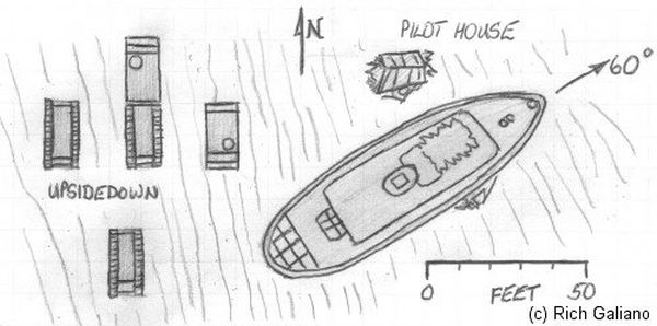
More: Captain Etzel ...
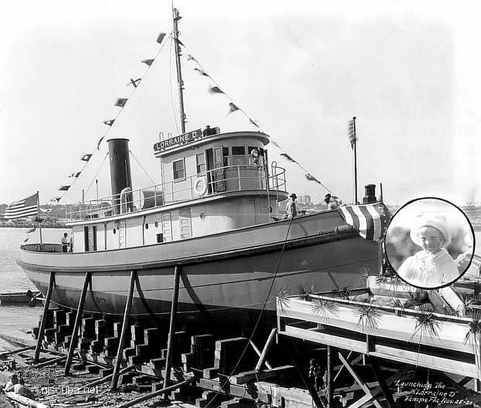
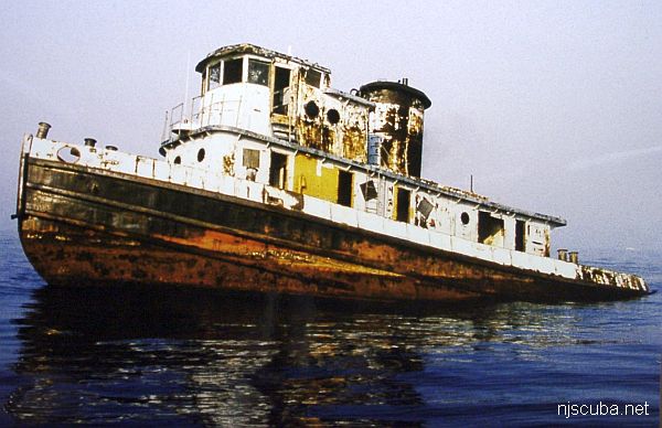
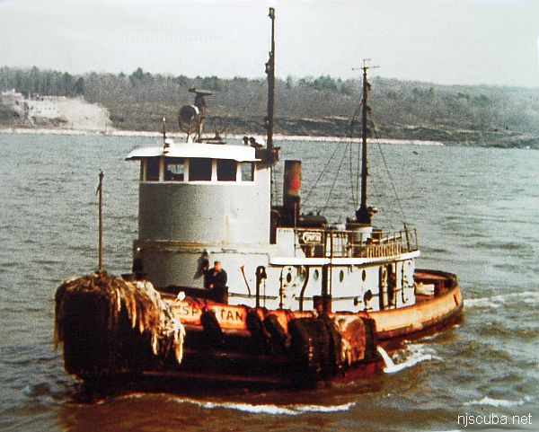
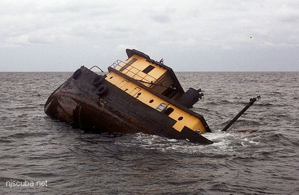
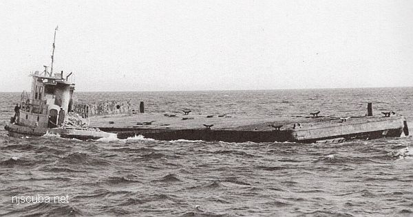
- Type:
- artificial reef, tugboat
- Built:
- 1922, Oscar Daniels, Tampa FL, as Lorraine D
- Name:
- named ( now ) for Travis Nagiewicz, Capt. Steve's son.
- Specs:
- ( 95 x 20 ft ) 125 gross tons
- Sponsor:
- Captains Steve Nagiewicz & Dan Crowell
- Sunk:
- Wednesday October 31, 2001 - Sea Girt Artificial Reef
- GPS:
- 40°08.179' -73°55.824'
- Depth:
- 75 ft
More: Lewis F Boyer ...
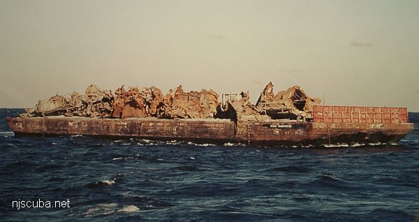
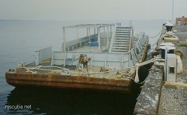
- Type:
- artificial reef, barges, tugboat
- Specs:
- ( huge junk pile )
- Sunk:
- Sunday December 23, 2012 - Sea Girt Artificial Reef
- GPS:
- 40°08.203' -73°55.779'
- Depth:
- 80 ft
More: Horseshoe Wrecks ...
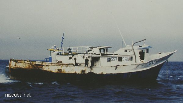
- Type:
- artificial reef, trawler
- Built:
- 1974, S & R Boat Builders, Bayou La Batre AL, as Brenda Jean
- Specs:
- ( 80 x 23 ft ) 114 gross tons
- Sponsor:
- Eagle Pharo Memorial
- Sunk:
- Friday December 19, 1997 - Sea Girt Artificial Reef
- GPS:
- 40°08.190' -73°56.100'
More: Golden Eagle ...
- Type:
- artificial reef, barge
- Specs:
- ( 109 x 34 ft )
- Sponsor:
- Friends of Craig and Pat Thoman
- Sunk:
- Tuesday January 15 2002 - Sea Girt Artificial Reef
- GPS:
- 40°07.370' -73°56.765'
More: Wedding barge ...
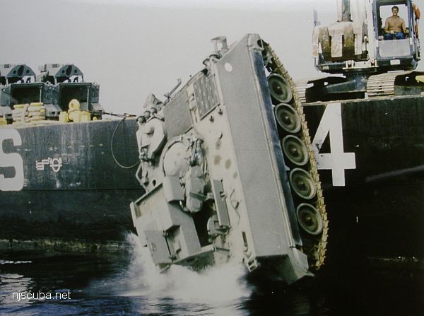
- Type:
- various types of Army tanks and other vehicles, 15 in all
- Sponsor:
- Friends of Clifford Lipke, NJ National Guard
- Sunk:
- 1998 - Sea Girt Artificial Reef
- GPS:
- 40°07.608' -73°56.650'
More: Tanks / Clifford Lipke Reef ...