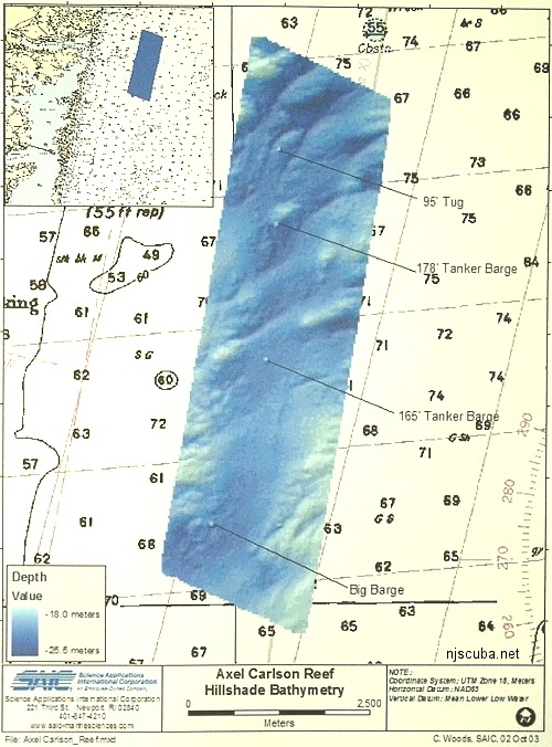
Axel Carlson Artificial Reef
Axel Carlson Artificial Reef
- "small old wreck"
- Austin
- Barbara Ann
- Bay King
- big barge
- Brooklyn
- Manasquan Inlet Buoy
- Captain Bill
- Carrabassett
- Caterina.D
- Colleen
- crab barge
- Delaware
- Ed Schmidiger
- Glory Wreck
- Hail Mary
- Harbor Charlie
- Hillman III
- Jim Lynch
- Manasquan Inlet
- McGinty
- Megan Sue
- Middle Barge
- MRMTC 8
- MRMTC 9
- OWD III
- Patrick McHugh
- Riggy
- Rump
- Shark River Inlet
- Snug Harbor
- Swensen
2.0 Nautical Miles off Mantoloking, 5.19 sq miles
Depth: 65-80 ft [download]
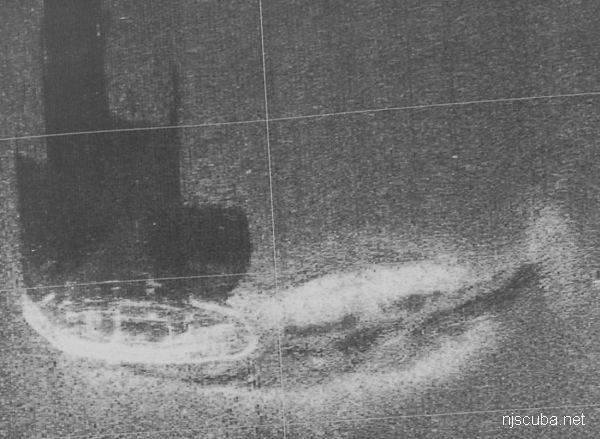
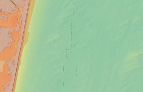
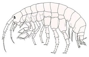
The Axel Carlson reef is situated in a trough next to an underwater hill known as the Manasquan Ridge. This is an area of silty mud bottom and usually has relatively poor visibility. Axel Carlson reef is sometimes referred to as the Mantoloking reef. It also contains a number of sunken army tanks ( not shown. ) Minimum clearance at mean low water is 40 feet.
The pink areas on the chart are the "Full Access Zones", approximately 0.6 square miles. These are the areas where commercial fishermen will continue to be allowed to set their traps and lines as of 2015. For the rest of us, those are more like "No Access Zones," but some sort of fair compromise needed to be reached with the commercial fishermen, some of whom could legitimately claim to have fished those spots for generations.
The actual location of the Carrabassett is a secret.
NOAA
All manner of concrete, steel, and stone rubble from dredging, demolition projects, and other construction is used as artificial reef materials. This material is generally available at very low cost or free from construction companies who are more than happy to get rid of it. Transportation costs determine where this material is used by the Reef Program.
More: Rock & Rubble ...

The Artificial Reef Program used four types of obsolete Army armored vehicles as artificial reef materials off the New Jersey coast. These were cleaned at local military bases, loaded onto barges for transport, and pushed off at their final destination. Once the Army had disposed of its excess inventory, the program ceased, around 1999. The Artificial Reef Program has sunk almost 400 tanks altogether, far too many to list them here in this website.
More: Army Tanks ...
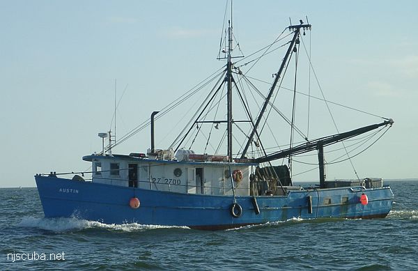
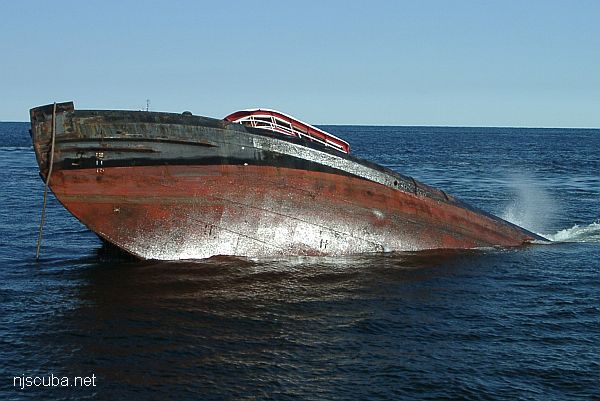
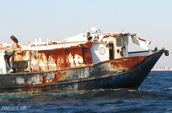
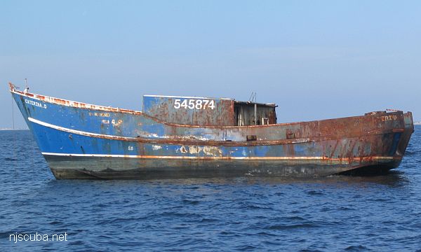
- Type:
- artificial reef, trawler
- Built:
- 1956, Tampa Marine, Tampa FL USA
- Specs:
- ( 65 ft ) 79 GT
- Sponsor:
- Grady family, Greater Point Pleasant Charter Boat Association, Ocean Reef Foundation of New Jersey
- Sunk:
- Wednesday Sept 21, 2016 - Axel Carlson Artificial Reef
- GPS:
- 40°02.900' -73°59.000'
- Depth:
- 80 ft
More: Austin ...
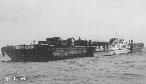
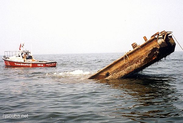
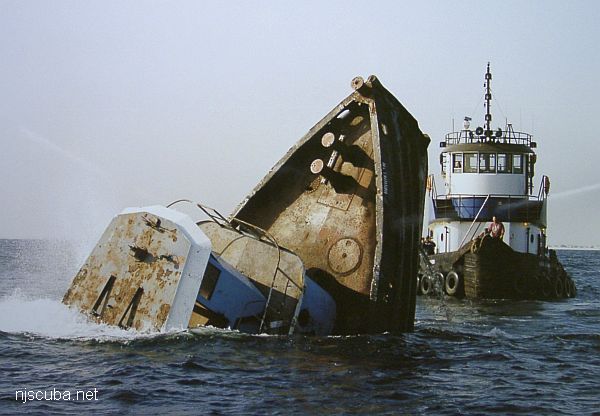
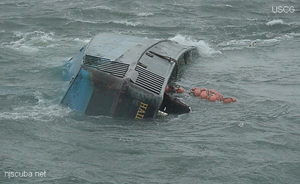
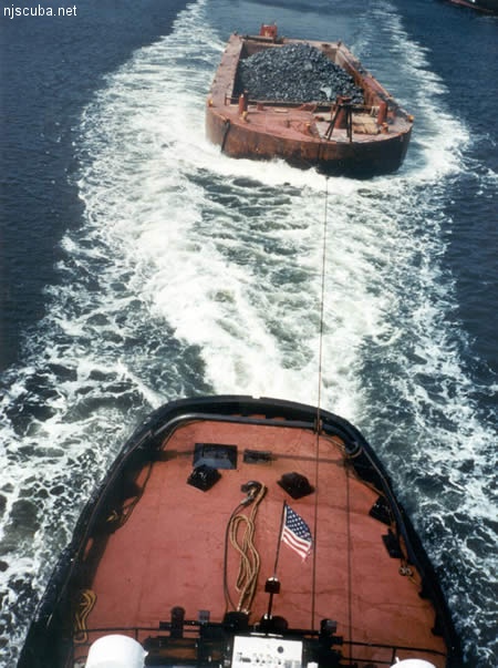
- Type:
- artificial reef, barge, tank, US Navy
- Built:
- 1942, Levingston Shipbuilding, Orange TX USA
- Specs:
- ( 174 x 40 ft ) 200 tons light
- Sponsor:
- Ocean Wreck Divers
- Sunk:
- Wednesday October 8, 1997 - Axel Carlson Artificial Reef
- GPS:
- 40°00.587' -73°59.391'
More: Ed Schmidiger YON-81 ...
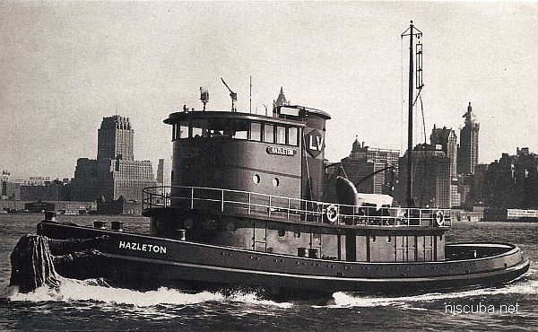
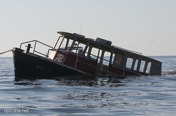
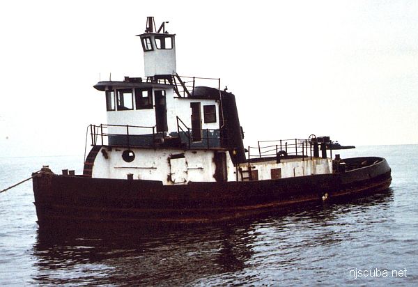
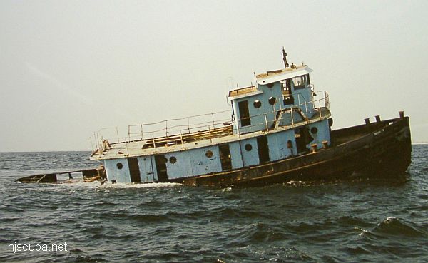
- Type:
- artificial reef, tugboat, McAllister Towing (Boston)
- Built:
- 1950, Jakobson Shipyard, Oyster Bay, NY as Hazleton
- Specs:
- ( 110 x 27 ft ) 199 gross tons
- Sponsor:
- Herb & Veronica Segars
- Sunk:
- Wednesday November 10, 2004 - Axel Carlson Artificial Reef
- GPS:
- 40°03.104' -73°59.283'
- Depth:
- 75 ft
More: Captain Bill ...
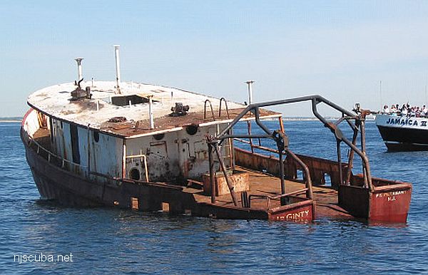
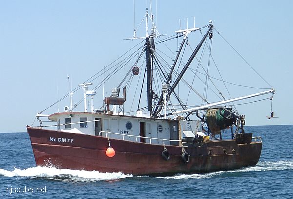
- Type:
- artificial reef, trawler
- Built:
- 1954, Tampa Marine, Tampa FL USA
- Specs:
- ( 65 ft ) 79 GT
- Sponsor:
- Ocean Wreck Divers
- Sunk:
- Friday May 7, 2010 - Axel Carlson Artificial Reef
- GPS:
- 40°03.486' -73°59.344'
- Depth:
- 80 ft
More: McGinty ...