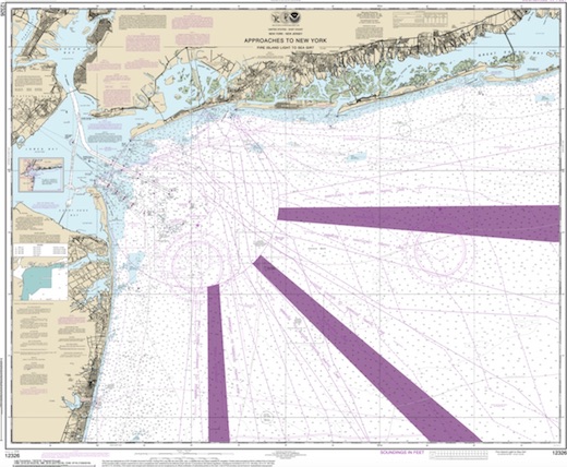
Long Island West Dive Sites Chart
Sandy Hook / Rockaway Inlet Chart
- Barge #10
- 3 Sisters
- Ambrose Buoy
- A Street - Shark River
- Acara
- Across
- Ajace
- Allenhurst Jetty
- Arnoff
- Arundo
- Asfalto
- Aurora
- Ayuruoca
- BA Wreck
- Shark River - Back Bay
- Balaena
- Bald Eagle
- BD1738
- USS Benson
- Beth Dee Bob
- Blue Boy
- Bronx Queen
- Bug Light
- Charles Dunlap
- Cecilia M Dunlap
- Chauncy Jerome
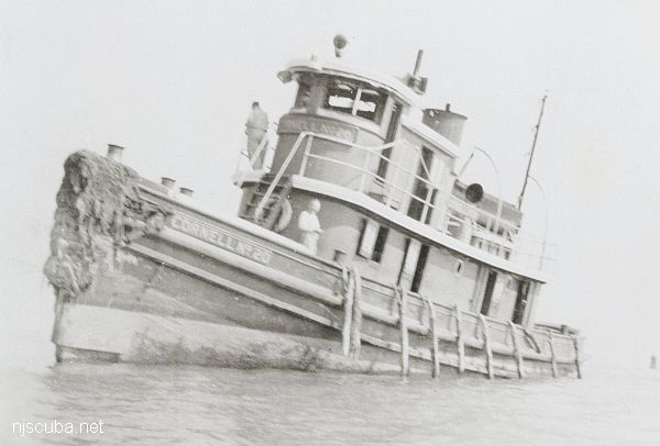
- Cornelia Soule
- Choapa
- coal (Lido)
- Continent
- crane barge
- Daghestan
- Dragger
- drydock
- Dryland
- Edwin Duke / Stone Barge
- dump
- Edmund Phinney
- East Rockaway Inlet
- Ed's Schooner
- Elberon Rocks
- Eureka
- Finance
- Fort Victoria
- German
- GL78
- Glen II
- I.P. Goulandris
- Gypsy
- Horseshoe Cove
- Alexander Hamilton
- Happy Days
- Howard
- Iberia
- Immaculata
- Inshore Schooner
- Jack I
- Jones Inlet
- Jones Tug
- Klondike Rocks
- Larsen
- Lizzie D
- Long Branch locomotives
- H.W. Long
- Macedonia
- Malta
- Margaret
- Mistletoe
- R.C. Mohawk
- Nautilus
- Navesink River
- Northeast Sailor
- New Reef
- New Deal
- New Era
- HMS Pentland Firth
- Long Branch Pier Rubble
- Pinta
- Pipe Barge
- Pliny
- Plymouth
- Pocopson
- Princess Anne
- Ruth Shaw
- Robert A Snow
- Ramos
- Ranger
- Relief Lightship
- Rickseckers
- Rjukan
- Rockaway Inlet
- Rockaway Belle
- Roda
- Rudder Wreck - Pocono
- Rusland / Adonis
- Scotland Buoy
- Sandy Hook Pilot Boat
- SC-60
- Shark River Inlet
- Shrewsbury Rocks
- Spring Lake Sailor
- Steel Wreck
- Stolt Dagali
- Sylvanus
- Tampa III
- USS Turner
- AWOIS 8087
- AWOIS 8097
- u11
- AWOIS 7509
- AWOIS 7932
- AWOIS 9768
- AWOIS 12966/11422
- AWOIS 1609
- AWOIS 8084
- AWOIS 7940
- AWOIS 7938
- AWOIS 8076
- AWOIS 4600
- AWOIS 8075
- Valerie E
- Vega
- Warrior
- Edward W Winslow
- Across Wreck
- Alexander Hamilton
- Allenhurst Jetty
- Arnoff
- Arundo
- Asfalto
- Atlantic Beach Reef ...
- Aurora
- Ayuruoca
- BA Wreck
- Balaena
- Bald Eagle
- BD 1738
- Beach Jetties
- Benson
- Black Warrior
- Bronx Queen
- Cecilia M. Dunlap
- Charles Dunlap
- Chauncey Jerome
- Choapa
- Continent
- Cornelia Soule
- Cornelius Grinnell
- crane barge
- Daghestan
- Delaware Water Gap
- drydock barge
- Dryland
- Dual Wrecks
- Dutch Springs (Lake Hydra) ...
- Edmund Phinney
- Elberon Rocks
- Eureka
- Fort Victoria
- G.L. 78
- German
- Glen II
- Goulandris
- Gypsy
- H.W. Long
- Hudson/East Rivers
- Iberia
- Immaculata
- Jack-I
- Larsen
- Lido (Coal Wreck)
- Lizzie D
- Locomotives
- Long Branch Pier
- Macedonia
- Malta
- McAllister Reef ...
- Mistletoe
- Mud Hole
- Nautilus
- Navesink River
- New Deal
- New Era
- New Jersey Aquarium
- Pentland Firth
- Pinta
- Pipe Barge
- Pliny
- Plymouth
- Pocopson
- Princess Anne
- R.C. Mohawk
- Ramos
- Raritan Bay
- Raritan River
- Relief Lightship
- Rickseckers
- Robert A Snow
- Rockaway Reef ...
- Round Valley
- Rudder Wreck
- Ruth Shaw
- Sandy Hook
- Sandy Hook Pilot
- Sandy Hook Reef ...
- SC-60
- Scotland
- Shark River
- Shark River - A Street
- Shark River - Back Bay
- Shark River Inlet
- Shrewsbury Rocks
- Steel Wreck
- Sylvanus
- Tampa III
- Three Sisters
- Triangle Wrecks
- u01 - AWOIS 8087
- u02 - AWOIS 12966/11422
- u03 - AWOIS 1609
- u04 - AWOIS 8084
- u05 - AWOIS 7940
- u06 - AWOIS 7938
- u07 - AWOIS 8076
- u08 - AWOIS 4600
- u09 - AWOIS 8075
- u10 - AWOIS 8097
- u11
- u12 - AWOIS 7509
- u13 - AWOIS 7932
- u14 - AWOIS 9768
- USS Turner
- Valerie E
- Vega
Volunteer divers at the aquarium assist with food preparation, cleaning and maintaining work area and exhibits, perform dive demonstrations, and assist aquarists when necessary. Volunteer must be a certified diver age 18 years and older with at least 25 logged dives; 5 in the last 2 years and 2 in the last 12 months. Volunteer must be able to commit to 2 eight-hour work shifts per month ( same day every other week. ) Volunteer applications are available at the information desk.
More: New Jersey Aquarium ...
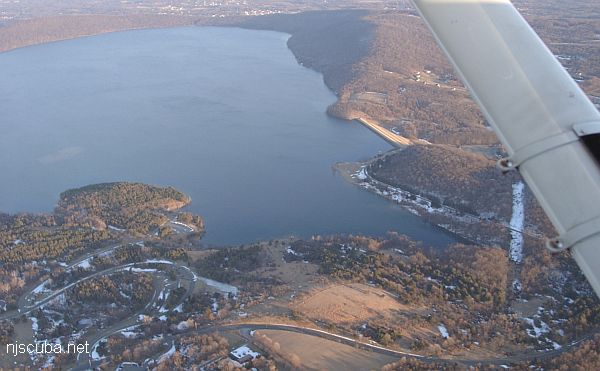
- Type:
- freshwater artificial reservoir
- Depth:
180 ft , but less than 60 ft in the usual area
More: Round Valley ...
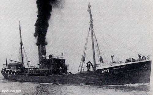
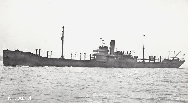
- Type:
- shipwreck, trawler, Royal Navy
- Name:
- Pentland Firth is the channel between the northern tip of Scotland and the Islands that form Scapa Flow, the great British naval base, and today one of the best wreck diving locales in the world.
- Built:
- 1934, England
- Specs:
- ( 164 x 27 ft ) 485 gross tons
- Sunk:
- Saturday September 19, 1942
collision with minesweeper trawler USS Chaffinch (400 tons) - ? casualties - GPS:
- 40°25.433' -73°52.204' (AWOIS 1991)
- Depth:
- 70 ft
More: HMS Pentland Firth ...
H10224/86 -- OPR-C121-WH-86; WHILE INVESTIGATING ITEM 751, AN AREA WITH NUMEROUS SIDE-SCAN SONAR CONTACT WAS FOUND AND DEVELOPED USING SIDE-SCAN AND ECHO SOUNDER; DIVER INVESTIGATION DETERMINED LIMITS OF SITE, NATURE OF WRECKAGE, AND LOCATION OF THE LEAST DEPTH; SITE WAS ORIENTED NORTHEAST-SOUTHWEST; CONSISTS MOSTLY OF SHIPYARD DEBRIS IN THE FORM OF HEAT EXCHANGERS, BUCKLED DECK PLATING, TWISTED ANGLE IRON, WOODEN RIBS, AND PIPING OF VARIOUS LENGTHS AND SIZES; THE NORTHEAST END OF THE SITE CONSISTED OF A BARGE LYING IN A NORTHWEST-SOUTHEAST DIRECTION WITH THE BOW OF THE BARGE DEFINING THE SOUTHEAST WALL OF THE SITE; THE NORTHWEST END OF THE BARGE, THE STERN, WAS COVERED WITH METAL DEBRIS, HAWSER LINES, AND TRAWLER NETTING; DIVERS CONCLUDED THAT THIS SITE IS THE WRECK OF A BARGE THAT WAS FILLED WITH SHIPYARD SCRAP IRON AND DEBRIS; PNEUMATIC DEPTH GAUGE LEAST DEPTH OF 50 FT. (ENTERED MSD 4/91)
More: u13 - AWOIS 7932 ...