
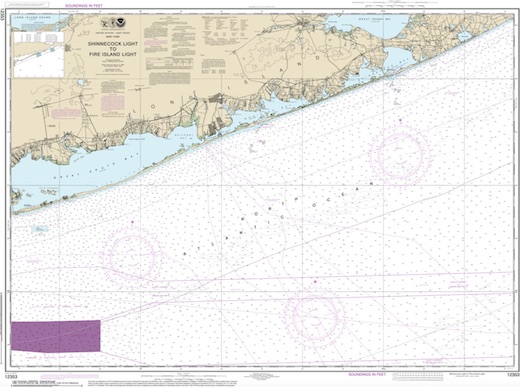
Long Island East Dive Sites Chart
Long Island - East Chart
- 3/4 Tug
- Amsterdam
- Andrea Doria
- Atlantic
- USS Baldwin
- Barataria
- USS Bass
- Black Point
- Burnside
- Coastwise
- Coimbra
- HMS Culloden
- Defender
- Dodger
- John A. Downs
- Essex
- USS G-1
- USS G-2
- Gate City
- Gluckauf
- Grecian
- Horton's Point / Commodore
- Hylton Castle
- John C. Fitzpatrick
- Kenosha
- Kismet Artificial Reef
- USS L-8
- Larchmont
- Lexington
- Lightburne
- Linda
- Maiden Creek
- Malden
- Mattituck Inlet
- Mattituck Artificial Reef
- Montauk Inlet
- Moriches Inlet
- Mount Sinai Harbor
- Myronus
- Norness
- USS Ohio
- Old Yankee
- Olinda
- Oregon
- Panther
- Pinnacle
- Ponquogue Bridge
- Port Jefferson Artificial Reef
- Port Jefferson Inlet
- Puszta
- Reggie
- Republic
- USS San Diego
- Sea Wolf
- Sebastian
- Shinnecock Inlet
- Shoreham Nuclear Power Plant
- Smithtown Artificial Reef
- Snug Harbor
- USS Spikefish
- Suffolk
- USS Tarantula
- Tennyson
- Thames
- Thelma Phoebe
- U-853
- Volund
- Block Island Wind Farm
- Wolcott
- Type:
- shipwreck, steamer
- Specs:
- 2388 tons
- Sunk:
- Friday August 20, 1920
collision with barge Pottsville - no casualties - Depth:
- 60 ft
More: Snug Harbor ...
- Type:
- shipwreck, tugboat, USA
- Built:
- 1937, Bethlehem Beaumont, Beaumont TX USA
- Specs:
- ( 68 ft ) 4 crew
- Sunk:
- Tuesday November 25, 1971
structural failure during storm due to improper modifications - 2 casualties - Depth:
- 136 ft
More: Barataria ...
- Type:
- shipwreck, schooner barge, USA ( formerly a clipper )
- Built:
- 1864, Goss & Sawyer, Bath ME USA, as Ocean Signal
- Specs:
- ( 187 x 38 ft ) 1265 gross tons, 4 crew
- Sunk:
- Wednesday January 26, 1898
foundered in storm - no survivors - Depth:
- 110 ft
More: Tennyson ...
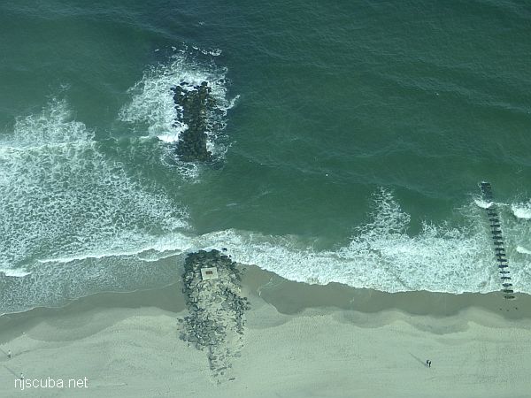
Dozens of jetties up and down the coast have been cut-though at the base like this one, making them inaccessible to fishermen, but not divers !
More: Beach Jetties ...
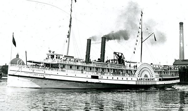
- Type:
- shipwreck, steamer, USA
- Built:
- 1885, Goss & Sawyer, Bath ME USA
- Specs:
- ( 252 x 37 ft ) 1605 tons, 351 passengers & crew
- Sunk:
- Monday February 11, 1907
collision with schooner Harry Knowlton - 334 casualties - Depth:
- 140 ft
huge paddlewheels; wooden hull draped with fishing nets; hazardous currents & poor viz.
More: Larchmont ...