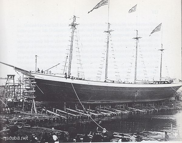
Long Island Sound Dive Sites Chart
Long Island Sound - West Chart
- Amsterdam
- Atlantic
- Barataria
- USS Bass
- Bayville barge
- Black Point
- Celtic/Cape Race
- Condor
- HMS Culloden
- Defender
- John A. Downs
- Essex
- Gwendoline Steers
- USS G-1
- USS G-2
- Grecian
- Horton's Point / Commodore
- Huntington Artificial Reef
- HMS Hussar
- USS L-8
- Larchmont
- Lexington
- Lightburne
- Malden
- Matinecock Artificial Reef
- Mattituck Inlet
- Mattituck Artificial Reef
- Montauk Inlet
- Mount Sinai Harbor
- Myronus
- USS Ohio
- Olinda
- Pinnacle
- Poling Bros #2
- Port Jefferson Artificial Reef
- Port Jefferson Inlet
- Puszta
- Shoreham Nuclear Power Plant
- Smithtown Artificial Reef
- Snug Harbor
- Thames
- Thelma Phoebe
- U-853
- Volund
- Delaware River Water Gap
- Block Island Wind Farm
Long Island Sound - East Chart
- Amsterdam
- Atlantic
- Barataria
- USS Bass
- Bayville barge
- Black Point
- Celtic/Cape Race
- Condor
- HMS Culloden
- Defender
- John A. Downs
- Essex
- Gwendoline Steers
- USS G-1
- USS G-2
- Grecian
- Horton's Point / Commodore
- Huntington Artificial Reef
- USS L-8
- Larchmont
- Lexington
- Lightburne
- Malden
- Matinecock Artificial Reef
- Mattituck Inlet
- Mattituck Artificial Reef
- Montauk Inlet
- Mount Sinai Harbor
- Myronus
- USS Ohio
- Olinda
- Pinnacle
- Poling Bros #2
- Port Jefferson Artificial Reef
- Port Jefferson Inlet
- Puszta
- Shoreham Nuclear Power Plant
- Smithtown Artificial Reef
- Snug Harbor
- Thames
- Thelma Phoebe
- U-853
- Volund
- Delaware River Water Gap
- Block Island Wind Farm
Long Island Sound averages 60 ft in depth, with the greatest depth of over 300 ft at the eastern end. Tidal effects are strongest at the narrow western end, where all the inrushing water flow piles up and makes tidal variations of up to 7 ft. Strong tidal currents are also prevalent, and visibility tends to be poorer than the open ocean, especially at depth.
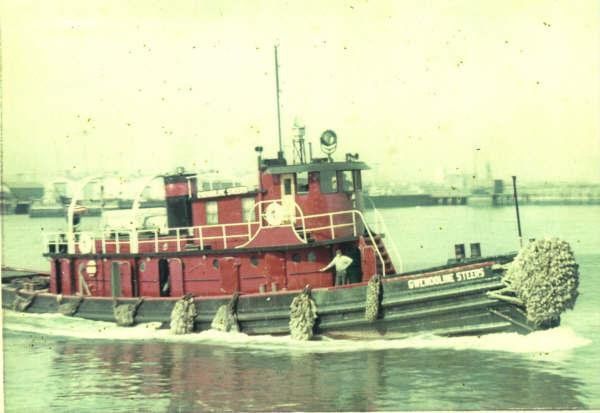
- Type:
- shipwreck, tugboat, USA
- Built:
- 1888, John H. Dialogue & Son, Camden NJ USA, as Douglas H. Thomas
- Specs:
- ( 97 x 21 ft ) 148 tons, 9 crew
- Sunk:
- Sunday December 30, 1962
cause unknown - no survivors - Depth:
- 40 ft, starts at 20 ft
More: Gwendoline Steers ...
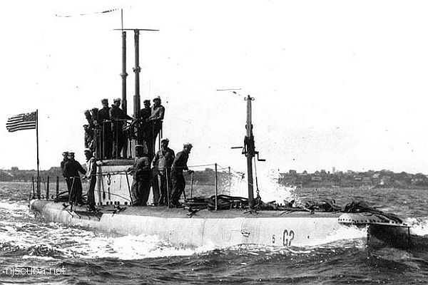
- Type:
- shipwreck, submarine, U.S. Navy
- Built:
- 1912, Lake Torpedo Boat Company, Newport News, VA USA
- Specs:
- ( 161 x 13 ft ) 400 tons, no crew
- Sunk:
- Wednesday July 30, 1919
foundered after weapons tests - 3 casualties (inspection crew) - Depth:
- 81 ft
More: USS G-2 SS-27 ...
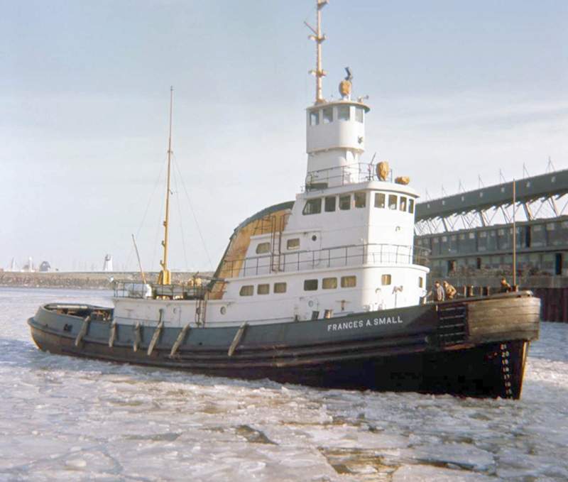
- Type:
- shipwreck, tugboat, USA
- Type:
- Fraser Shipyards, Superior, WI as Frances A. Small
- Specs:
- ( 113 x 31 ft, 850 tons ) 8 crew
- Sunk:
- Sunday March 3, 1985
collision with one of its own barges - no casualties - Depth:
- 230 ft
More: John A. Downs ...
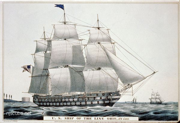
- Type:
- shipwreck, 74 gun ship-of-the-line, U.S. Navy
- Name:
- that place next to Indiana
- Built:
- 1820, New York Naval Shipyard, Brooklyn NY USA
- Specs:
- ( 208 x 54 ft ) 2757 gross tons
- Sunk:
- April 1884
set adrift and grounded by storm while being dismantled, later deliberately burned - Depth:
- 20 ft
More: USS Ohio ...
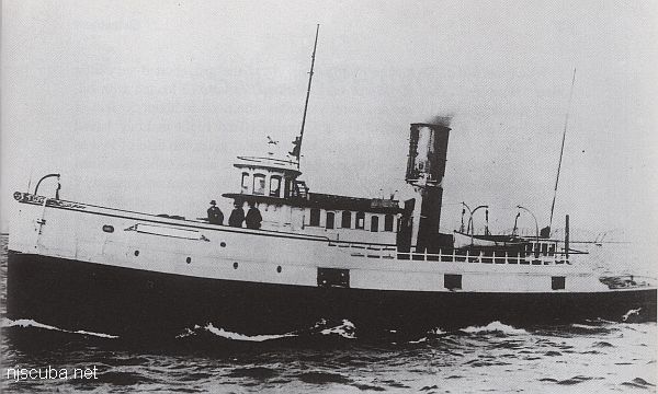
- Type:
- shipwreck, tanker, USA
- Built:
- 1863, USA
- Specs:
- ( 116 x 23 ft ) 159 tons
- Sunk:
- Wednesday February 7, 1940
struck pack ice - no casualties - Depth:
- 65 ft
More: Poling Brothers #2 ...