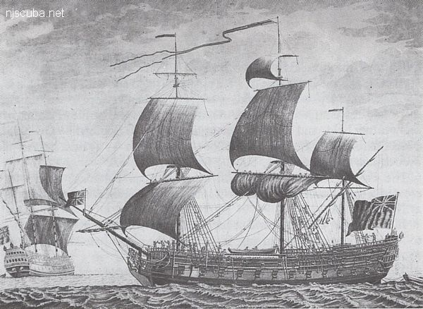
HMS Culloden
- Type:
- shipwreck, frigate, British Royal Navy
- Name:
- The Battle of Culloden, where in 1745 the English army massacred the last of the Scottish resistance ( and much of the civilian population ), completing the English conquest of Scotland.
- Built:
- 1776, England
- Specs:
- ( 170 x 47 ft ) 1658 gross tons, 650 crew
- Sunk:
- Monday January 24, 1781
ran aground in storm - no casualties - Depth:
- 20 ft
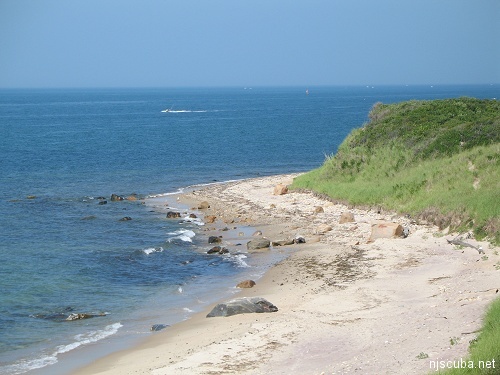
The HMS Culloden was a British warship that ran aground during the revolutionary war. The British recovered most of her supplies and guns before they burned her to the waterline. Today she sits in 20-25fsw. Several of her large cannons and timbers can still be seen. The wreck is spread out over a sandy bottom. Most of her artifacts have been recovered over the years but on occasion, a persistent diver will find something. To find the wreck take a compass heading of 330 degrees from the large boulder on the beach. Navigate the wreck beneath the surface due to the surface currents. There is a large bluff to walk down to get to the beach.
Directions:
Take the LIE ( 495 ) to exit 70 ( south ) proceed to Sunrise Hwy. ( Rt27 ). Travel east on Sunrise to the end, this turns into Montauk Hwy. (Rt.27A). Continue east to the town of Montauk. Turn left onto Edgemere St. which will turn onto Flamingo Ave. Turn left onto Duryea Ave. Take this to the end and turn right onto Soundview Drive. Take Soundview Dr. until it turns into a dirt road and continue about a 1/4 mile and turn right onto another dirt road ( no name ) take it to the end and park.
The Culloden is now a marine park, and scavenging, er ... salvaging, is strictly prohibited.
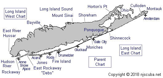
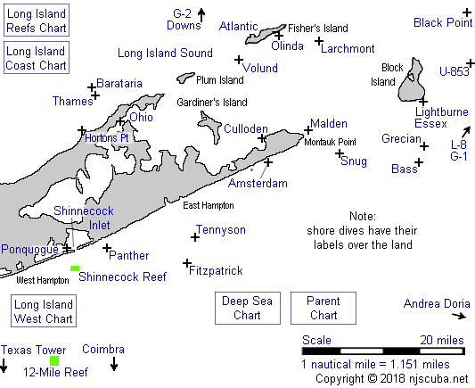
Dive Sites, Long Island Coast Dive Sites, Long Island East Dive Sites, Long Island Sound Dive Sites, New York Dive Sites, Sailing Ships, Warships,

Questions or Inquiries?
Just want to say Hello? Sign the .