
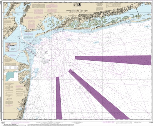
Sandy Hook Dive Sites Chart
Sandy Hook / Rockaway Inlet Chart
- Barge #10
- 120 Wreck
- 3 Sisters
- Ambrose Buoy
- A Street - Shark River
- Acara
- Across
- Adele
- Ajace
- Alex Mac
- Allenhurst Jetty
- Antioch
- Arnoff
- Arundo
- Asfalto
- Aurora
- Ayuruoca
- BA Wreck
- Shark River - Back Bay
- Balaena
- Bald Eagle
- BD1738
- USS Benson
- Beth Dee Bob
- Blue Boy
- Bronx Queen
- Bug Light
- Charles Dunlap
- Cecilia M Dunlap
- Catherine Jackson
- Chauncy Jerome
- Cornelia Soule
- Choapa
- coal (Lido)
- Continent
- crane barge
- Daghestan
- Dragger
- drydock
- Dryland
- Edwin Duke / Stone Barge
- dump
- Dutch Springs
- Edmund Phinney
- East Rockaway Inlet
- Ed's Schooner
- Elberon Rocks
- Eureka
- Finance
- Fort Victoria
- German
- GL78
- Glen II
- I.P. Goulandris
- Gypsy
- Horseshoe Cove
- Alexander Hamilton
- Howard
- Iberia
- Immaculata
- Inshore Schooner
- Jack I
- Joan La Rie III
- Jones Inlet
- Jones Tug
- Klondike Rocks
- Larsen
- Lizzie D
- Long Branch locomotives
- Logwood
- H.W. Long
- Macedonia
- Mahogany
- Malta
- Manasquan Inlet
- Margaret
- Marion
- Mistletoe
- R.C. Mohawk
- Manasquan Wreck
- Nautilus
- Navesink River
- Northeast Sailor
- New Reef
- New Deal
- New Era
- HMS Pentland Firth
- Long Branch Pier Rubble
- Pinta
- Pipe Barge
- Pliny
- Plymouth
- Pocopson
- Princess Anne
- Ruth Shaw
- Robert A Snow
- Ramos
- Ranger
- Relief Lightship
- Rickseckers
- Rjukan
- Rockaway Inlet
- Rockaway Belle
- Round Valley
- Roy's barge
- Rudder Wreck - Pocono
- Rusland / Adonis
- Scotland Buoy
- Sandy Hook Pilot Boat
- SC-60
- Sea Girt Inlet
- Sea Girt Wreck
- Shark River Inlet
- Shrewsbury Rocks
- Spring Lake Sailor
- Steel Wreck
- Stolt Dagali
- Sylvanus
- Tampa III
- USS Turner
- AWOIS 8087
- AWOIS 8097
- u11
- AWOIS 7509
- AWOIS 7932
- AWOIS 9768
- AWOIS 12966/11422
- AWOIS 1609
- AWOIS 8084
- AWOIS 7940
- AWOIS 7938
- AWOIS 8076
- AWOIS 4600
- AWOIS 8075
- Valerie E
- Vega
- Warrior
- Delaware River Water Gap
- Western World
- Edward W Winslow
- Across Wreck
- Alexander Hamilton
- Allenhurst Jetty
- Arnoff
- Arundo
- Asfalto
- Atlantic Beach Reef ...
- Aurora
- Ayuruoca
- BA Wreck
- Balaena
- Bald Eagle
- BD 1738
- Beach Jetties
- Benson
- Black Warrior
- Bronx Queen
- Cecilia M. Dunlap
- Charles Dunlap
- Chauncey Jerome
- Choapa
- Continent
- Cornelia Soule
- Cornelius Grinnell
- crane barge
- Daghestan
- Delaware Water Gap
- drydock barge
- Dryland
- Dual Wrecks
- Dutch Springs (Lake Hydra) ...
- Edmund Phinney
- Elberon Rocks
- Eureka
- Fort Victoria
- G.L. 78
- German
- Glen II
- Goulandris
- Gypsy
- H.W. Long
- Hudson/East Rivers
- Iberia
- Immaculata
- Jack-I
- Larsen
- Lido (Coal Wreck)
- Lizzie D
- Locomotives
- Long Branch Pier
- Macedonia
- Malta
- McAllister Reef ...
- Mistletoe
- Mud Hole
- Nautilus
- Navesink River
- New Deal
- New Era
- New Jersey Aquarium
- Pentland Firth
- Pinta
- Pipe Barge
- Pliny
- Plymouth
- Pocopson
- Princess Anne
- R.C. Mohawk
- Ramos
- Raritan Bay
- Raritan River
- Relief Lightship
- Rickseckers
- Robert A Snow
- Rockaway Reef ...
- Round Valley
- Rudder Wreck
- Ruth Shaw
- Sandy Hook
- Sandy Hook Pilot
- Sandy Hook Reef ...
- SC-60
- Scotland
- Shark River
- Shark River - A Street
- Shark River - Back Bay
- Shark River Inlet
- Shrewsbury Rocks
- Steel Wreck
- Sylvanus
- Tampa III
- Three Sisters
- Triangle Wrecks
- u01 - AWOIS 8087
- u02 - AWOIS 12966/11422
- u03 - AWOIS 1609
- u04 - AWOIS 8084
- u05 - AWOIS 7940
- u06 - AWOIS 7938
- u07 - AWOIS 8076
- u08 - AWOIS 4600
- u09 - AWOIS 8075
- u10 - AWOIS 8097
- u11
- u12 - AWOIS 7509
- u13 - AWOIS 7932
- u14 - AWOIS 9768
- USS Turner
- Valerie E
- Vega
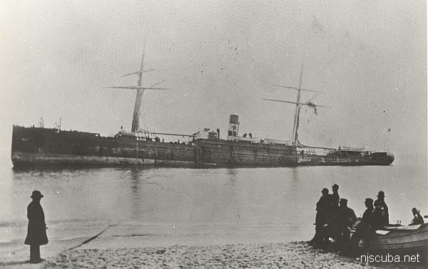
- Type:
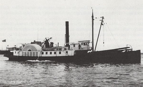
- Adonis - shipwreck, wood-hulled bark
Rusland - shipwreck, iron-hulled steamer, England - Built:
- Adonis - 1853, Germany
Rusland - 1872, Scotland, as Kenilworth - Specs:
- Adonis - 550 tons, 12 crew
Rusland - ( 345 x 37 ft ) 2538 gross tons, ~200 passengers & crew - Depth:
- 25 ft
- Sunk:
- Adonis - Tuesday March 8, 1859 - ran aground in bad weather, no casualties
Rusland - Saturday March 17, 1877 - ran aground in bad weather, no casualties
More: Dual Wrecks ...
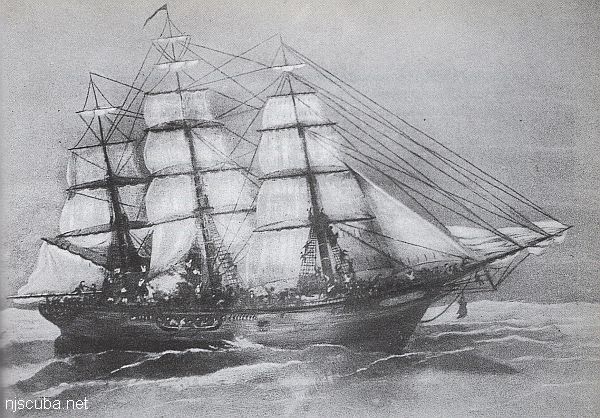
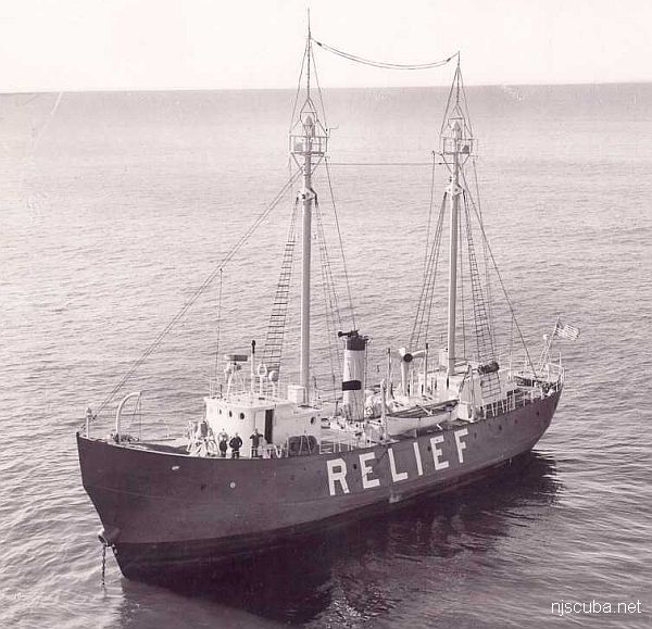
- Type:
- shipwreck, lightship, USCG
- Name:
- Named for its job - as the "relief ship" for the other regular lightships along the eastern seaboard.
- Built:
- 1904, New York Shipbuilding, Camden NJ USA
- Specs:
- ( 129 x 28 ft ) 631 gross tons, 9 crew
- Sunk:
- Friday June 24, 1960
collision with freighter Green Bay - no casualties - GPS:
- 40°27.144' -73°49.070' (AWOIS 2003)
- Depth:
- 105 ft, main deck at 90
More: Relief Lightship WAL-505 ...
- Type:
- shipwreck, tanker
- Specs:
- ( 120 ft )
- Depth:
- 115 ft
This is erroneously called a tug, but its shape and size indicate that she was once might have been a small oiler or tanker. The wreck lies upright in the muddy bottom at 120 feet. She comes up 15 feet off the bottom in many places and is mostly intact. I have little idea of age, but her conditions suggest she's been there for 30-40 years or more.
More: Larsen ...