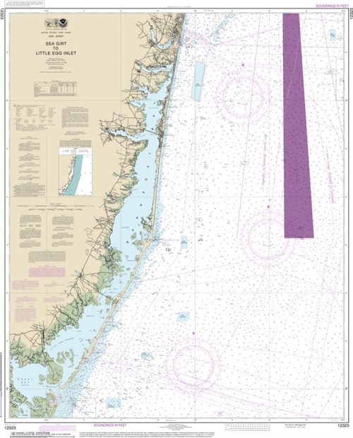
Barnegat Dive Sites Chart
- Absecon Inlet
- Adriatic
- USS Akron
- Almirante
- Anastasia
- Astra
- Barnegat Inlet
- Brigantine Beach Wreck
- boiler wreck
- Bonanza
- Brick barge
- Brigantine Inlet
- Cornelius Grinnell
- Caddo
- Capt Smitty
- Cassandra
- Charlemagne Tower
- Chaparra
- Chesapeake
- clam boat
- Creole
- Delaware
- dredge
- Duncan
- Emerald / USS Hibiscus
- Francis A Perkins
- William R Farrell
- FF Clain
- Gassoon
- Gory Wreck
- Glory Wreck
- Granite Wreck
- Great Isaac
- Gulftrade (stern)
- Gulftrade (bow)
- Hankins (Big)
- Hankins (Offshore)
- Hankins 3
- Cornelius Hargraves
- Harry Rush
- Hornet
- Ida K
- Inshore barge/tug
- Irene/Truro
- John Minturn
- John Marvin
- Kennebec
- Lake Frampton
- Lake Allure
- Lana Carol
- Lavallette Wreck
- Leon Walter
- Lillian
- Manhattan
- Maurice Tracy
- Mediator
- Meta
- Middle Barge
- Mohawk
- EF Moran
- Mullica River Wrecks
- NJ Aquarium
- Northern 29
- NW Barges
- Offshore Tug
- Oklahoma
- Patrice McAllister
- Park City
- Peerless
- Persephone
- Remedios Pascual
- Reliable
- Ridge Schooner
- Riggy
- RP Resor
- Rump
- Southern Lillian
- Sachem
- Salem
- San Saba
- Sea Hag
- Seaside Crane Barge
- Shookus
- Simala
- Sumner
- Southwest Mohawk
- Thurmond
- Tolten
- Troop Carrier
- Vivian
- Vizcaya
- Yellow Flag
- ZPG-3W
- Adriatic
- Barnegat Bay
- Barnegat Inlet
- Barnegat Light Reef ...
- Beach Jetties
- Bonanza
- Brick barge
- Caddo
- Chaparra
- Charlemagne Tower
- Chesapeake
- clam boat
- Cornelius Hargraves
- F.F. Clain
- Francis A Perkins
- Garden State N Reef ...
- Garden State S Reef ...
- Gassoon
- Great Isaac
- Gulf Trade
- Hankins Wrecks
- Harry Rush
- Inshore Barge/Tug
- Irene/Truro
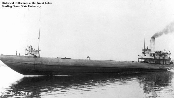
- Type:
- shipwreck, "whale-back" steamer, USA
- Built:
- 1890, AmShip Superior, Duluth MN USA, as Colgate Hoyt
- Specs:
- ( 276 x 36 ft ) 1253 displacement tons
- Sunk:
- Saturday December 25, 1909
ran aground in thick fog - 10 casualties - Depth:
- 14 ft
More: Thurmond ...
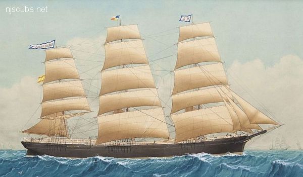
- Type:
- shipwreck, sailing ship, Spain
- Built:
- 1885, J. Urquhart, Canada, as Stalwart
- Specs:
- ( 216 x 40 ft ) 1605 gross tons, 21 crew
- Sunk:
- Saturday January 3, 1903
ran aground in bad weather - no casualties - Depth:
- 25 ft
More: Remedios Pascual ...
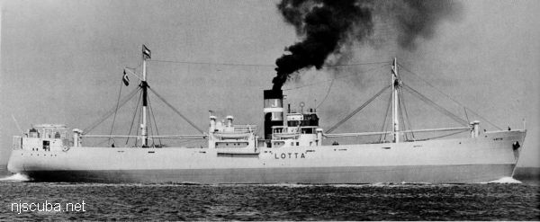
- Type:
- shipwreck, tanker, USA ( Gulf Oil )
- Name:
- One of a series of ships owned by Gulf Oil company, all named "Gulf ____"
- Built:
- 1920, Sun Shipbuilding, Chester PA USA
- Specs:
- ( 430 x 59 ft ) 6776 gross tons, 34 crew
- Sunk:
- Tuesday March 10, 1942
torpedoed by U-588 - 18 casualties - Depth:
- bow - 60 ft ; stern - 90 ft
More: Gulf Trade ...
- Type:
- shipwreck, tanker, USA
- Name:
- Named for R P Resor, Treasurer of Standard Oil.
- Built:
- 1936, Federal Shipbuilding, Kearny NJ USA
- Specs:
- ( 435 x 66 ft ) 7451 gross tons, 49 crew
- Sunk:
- Friday February 28, 1942
torpedoed by U-578 - 2 survivors - Depth:
- 125 ft
More: RP Resor ...
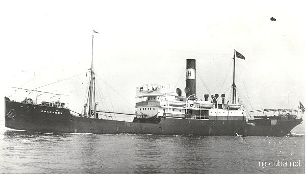
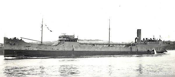
- Type:
- shipwreck, freighter, Cuba
- Name:
- a seaport in northeastern Cuba
also Spanish for "cowboy" or slang for "shorty" - Built:
- 1906, Scotland, as Tinhow
- Specs:
- ( 249 x 38 ft ) 1510 gross tons, 29 crew
- Sunk:
- Sunday October 27, 1918
struck mine laid by U-117 - 6 casualties - Depth:
- 80 ft
More: Chaparra ...