
Klondike Rocks
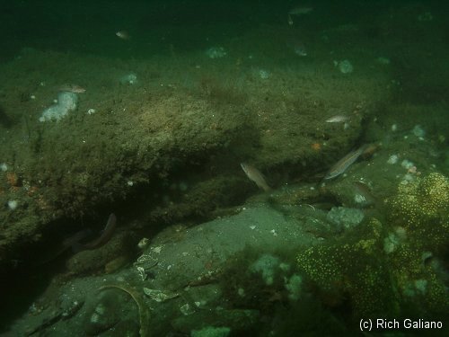
more than two feet above the bottom. Cunners
These low outcroppings appear in small to large patches over a two-mile area called the Klondike, and elsewhere, at depths ranging from 60 to 90 feet. The overhangs, crags, and holes afforded by the piles of rocks and boulders provide excellent homes for fish and lobsters. Visibility can be great here at times, but it is usually 10-20 ft, with a silty bottom in most places. The larger areas extend for many hundreds of feet, and an incautious diver can easily get lost. The stone itself is a type of sandstone known as Greensand, which occurs along the northern part of the New Jersey coast, and parts of Long Island, most famously as the Shrewsbury Rocks.
Captain Henry Beebe named this bank of high bottom off the central Jersey coast during the time of gold fever in the West. He ferried people from the Jersey beaches in small boats to drift from the pilot boat B Jordan, which he captained. He'd bring them to the Klondike Bank, thus named because of its rich treasure trove of fish. Many of the individual outcroppings are named after the fishing boat or captain that found the spot.

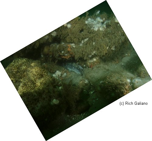
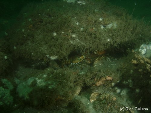
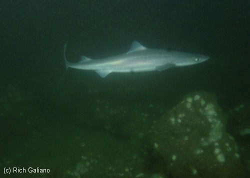
There are hundreds of small lumps and ridges such as this, stretching the entire length of the Jersey coast. The Manasquan Ridge and its East Lump is another example of these spots, as is the Harvey Cedar Lump, although there are many that show up on nautical charts as just small spots.
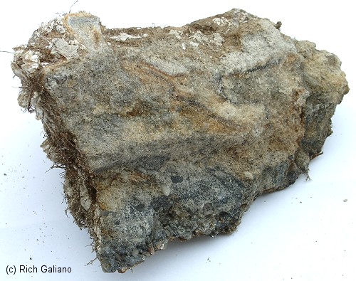
Facing is the broken-off interior edge. ( Approx. 7" )
Dive Sites, Manasquan Dive Sites, New Jersey Dive Sites,
Manasquan Chart
- Barge #10
- 120 Wreck
- 3 Sisters
- Ambrose Buoy
- A Street - Shark River
- Across
- Adele
- Ajace
- Alex Mac
- Allenhurst Jetty
- Anastasia
- Antioch
- Arnoff
- Arundo
- Asfalto
- Aurora
- Ayuruoca
- BA Wreck
- Shark River - Back Bay
- Balaena
- Bald Eagle
- Barnegat Inlet
- BD1738
- USS Benson
- Beth Dee Bob
- Blue Boy
- Bonanza
- Brick barge
- Bronx Queen
- Brunette
- Cecilia M Dunlap
- Cornelius Grinnell
- Catherine Jackson
- Chauncy Jerome
- Caddo
- Cadet
- Capt Smitty
- Catamount
- Charlemagne Tower
- Chaparra
- Chesapeake
- Choapa
- clam boat
- Continent
- crane barge
- Creole
- Daghestan
- Delaware
- drydock
- Dryland
- dump
- Duncan
- Edmund Phinney
- Elberon Rocks
- Emerald / USS Hibiscus
- Eureka
- Francis A Perkins
- William R Farrell
- FF Clain
- Finance
- Fort Victoria
- Gassoon
- German
- Lady Gertrude
- GL78
- Glen II
- Glory Wreck
- I.P. Goulandris
- Granite Wreck
- Great Isaac
- Gulftrade (stern)
- Gulftrade (bow)
- Gypsy
- Horseshoe Cove
- Alexander Hamilton
- Hankins (Big)
- Hankins (Offshore)
- Hankins 3
- Happy Days
- Cornelius Hargraves
- Harry Rush
- Harvey's Schooner
- Thomas Hebert
- Ida K
- Immaculata
- Inshore barge/tug
- Irene/Truro
- Irma C
- John Minturn
- Jack I
- Joan La Rie III
- Klondike Rocks
- Lizzie H. Brayton
- Lana Carol
- Larsen
- Lavallette Wreck
- Leon Walter
- Lillian
- Lizzie D
- Long Branch locomotives
- Logwood
- H.W. Long
- Macedonia
- Mahogany
- Malta
- Manasquan Inlet
- Marion
- Maurice Tracy
- Mediator
- Meta
- Middle Barge
- Mistletoe
- R.C. Mohawk
- Mohawk
- Manasquan Wreck
- Nautilus
- Navesink River
- Northeast Sailor
- New Reef
- New Deal
- New Era
- NW Barges
- Olsen
- HMS Pentland Firth
- Park City
- Peerless
- Persephone
- Long Branch Pier Rubble
- Pinta
- Pliny
- Plymouth
- Pocopson
- Remedios Pascual
- Ruth Shaw
- Ramos
- Ranger
- Reliable
- Relief Lightship
- Rickseckers
- Ridge Schooner
- Riggy
- Rjukan
- Rockaway Belle
- Roy's barge
- RP Resor
- Manasquan River Railroad Bridge
- Rudder Wreck - Pocono
- Rump
- Rusland / Adonis
- Scotland Buoy
- San Saba
- Sandy Hook Pilot Boat
- SC-60
- Sea Girt Inlet
- Sea Girt Wreck
- Sea Hag
- Seaside Crane Barge
- Shark River Inlet
- Shrewsbury Rocks
- Simala
- Spring Lake Sailor
- Steel Wreck
- Stolt Dagali
- Sumner
- Southwest Mohawk
- Sylvanus
- Tampa III
- Thurmond
- Tolten
- Train Wheel
- Troop Carrier
- USS Turner
- AWOIS 8087
- AWOIS 8097
- u11
- AWOIS 7509
- AWOIS 7932
- AWOIS 9768
- AWOIS 12966/11422
- AWOIS 1609
- AWOIS 8084
- AWOIS 7940
- AWOIS 7938
- AWOIS 8076
- AWOIS 4600
- AWOIS 8075
- Valerie E
- Vega
- Vivian
- Vizcaya
- Warrior
- Western World
- Edward W Winslow
- Yankee (G+D)
- Yellow Flag
- ZPG-3W
More: Manasquan Dive Sites Chart ...
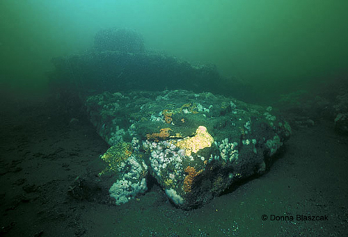
The Shrewsbury Rocks are a wide area of rocky bottom that stretches from fourteen feet of water out to the fifty-foot mark off of Monmouth Beach. Some of the formations are twenty feet tall or more and can be very pretty under good conditions, which are unfortunately seldom this far north. The stone itself is a type of sandstone known as Greensand.
More: Shrewsbury Rocks ...
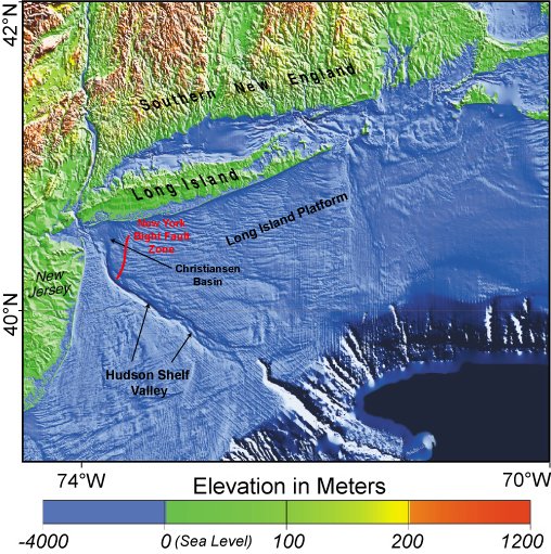
With rare exceptions, scuba diving is a bottom-fixated activity. In the region covered in this website, one may encounter many different bottom types, from rocky pinnacles around Block Island to white sands off Cape May to mud and oyster beds in any estuary. This variation is far greater and more interesting than is found in the tropics. Here is some explanation of what bottom compositions are found where and why:
More: Bottom Composition ...
Questions or Inquiries?
Just want to say Hello? Sign the .