Ships (25/49)

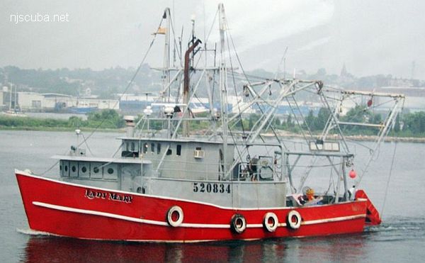
A ship is a large watercraft that travels the world's oceans and other sufficiently deep waterways, carrying goods or passengers, or in support of specialized missions, such as defense, research, and fishing. Ships are generally distinguished from boats, based on size, shape, load capacity, and tradition.
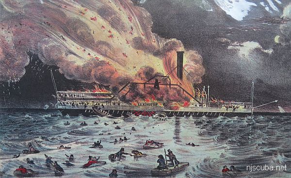
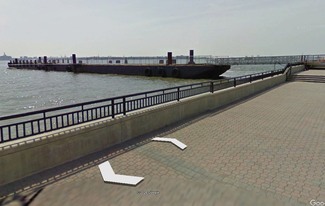
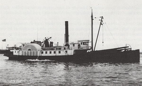
 1  24 25 26  49  

Shipwreck Larchmont
Type:
shipwreck, steamer, USA
Built:
1885, Goss & Sawyer, Bath ME USA
Specs:
( 252 x 37 ft ) 1605 tons, 351 passengers & crew
Sunk:
Monday February 11, 1907
collision with schooner Harry Knowlton - 334 casualties
Depth:
140 ft

huge paddlewheels; wooden hull draped with fishing nets; hazardous currents & poor viz.


Lewis F. Boyer reef
At launching, with namesake (inset)
Type:
artificial reef, tugboat
Built:
1922, Oscar Daniels, Tampa FL, as Lorraine D
Name:
named ( now ) for Travis Nagiewicz, Capt. Steve's son.
Specs:
( 95 x 20 ft ) 125 gross tons
Sponsor:
Captains Steve Nagiewicz & Dan Crowell
Sunk:
Wednesday October 31, 2001 - Sea Girt Artificial Reef
GPS:
40°08.179' -73°55.824'
Depth:
75 ft

Shipwreck Lexington
Type:
steamer, USA
Built:
1835, Jeremiah Simonson, New York NY USA
Specs:
( 207 x 21 ft ) 488 gross tons, 165 passengers & crew
Sunk:
Monday January 13, 1840
fire - 4 survivors
Depth:
125 ft - 150 ft

Libra reef
Type:
artificial reef, barge, gravel
Specs:
( 195 ft )
Sponsor:
Hay's Tug & Launch
Sunk:
Thursday June 12, 1997 - Ocean City Artificial Reef
GPS:
39°10.801' -74°32.741'


Shipwreck Lightburne
Type:
shipwreck, tanker, USA (Texaco)
Built:
1919, Texas Steamship Company, Bath ME USA
Specs:
( 432 x 56 ft ) 6429 tons, 37 crew + dog
Sunk:
Friday February 10, 1939
ran aground on Block Island - no casualties
Depth:
30 ft

Freighter Lillian
Type:
shipwreck, freighter, USA
Built:
1920, Bethlehem Wilmington, Wilmington DE USA, as Maddequet
Specs:
( 327 x 46 ft ) 3482 gross tons, 32 crew
Sunk:
Sunday February 26, 1939
collision with freighter Wiegand ( 6568 tons) - no casualties
Depth:
150 ft

Lisa Michelle reef
Type:
artificial reef, barge
Specs:
( 110 x 30 ft )
Sponsor:
McNeil's Marina, Cape May County Party & Charter Boat Association
Sunk:
Wednesday August 8, 1990 - Cape May Artificial Reef
GPS:
38°53.505' -74°40.075'


THIS FILE INCLUDES ALL REGULATIONS ADOPTED AND PUBLISHED THROUGH THE
NEW JERSEY REGISTER, VOL. 47, NO. 3, February 2, 2015
TITLE 13. LAW AND PUBLIC SAFETY
CHAPTER 82. BOATING REGULATIONS
SUBCHAPTER 3. OPERATIONAL REGULATIONS

§ 13:82-3.17 Diving and swimming

(a) General provisions with respect to diving and swimming are as follows:

Printed from njscuba.net