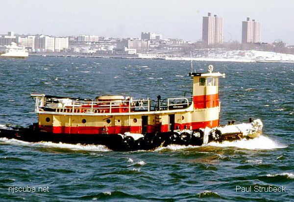
- Type:
- artificial reef, trawler, USA
- Built:
- 1947, Bath Iron Works, Bath Maine USA
- Specs:
- ( 144x27 ft ) 393 tons
- Sunk:
- Wednesday April 17, 2002 - Moriches Artificial Reef
- Depth:
- GPS:
- 40°43.402' -72°46.659
More: Bad Bob's Big Boat ...
A ship is a large watercraft that travels the world's oceans and other sufficiently deep waterways, carrying goods or passengers, or in support of specialized missions, such as defense, research, and fishing. Ships are generally distinguished from boats, based on size, shape, load capacity, and tradition.
More: Gallery of Ships ...
More: Bad Bob's Big Boat ...
shipwreck, wooden hull full of coal
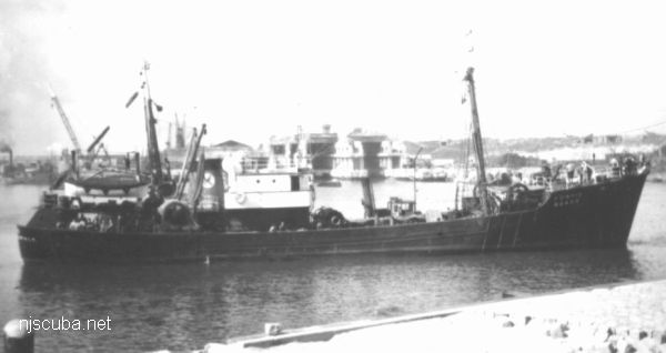
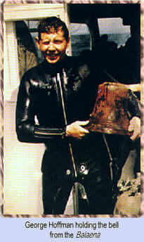
A wood sailing ship in the Mud Hole at a depth of 170 feet. She was a collier or ore carrier. She is still largely intact, coal in what's left of her holds. Divers tell tales of finding lots of deadeyes, but I haven't seen or heard of one coming from this wreck in many years. Her bell was found to identify her name, but not much else has been discovered about her history. A dive for the very experienced diver. Limited visibility, deep and dark. For those with the technical dive skill, it is a very nice dive.
More: Balaena ...
More: Barataria ...
More: Barbara Ann ...
More: Barge 199 ...
| Name | Description | Sunk | GPS |
| 80 ft steel | 40°31.884' -73°43.297' |
||
| 85 ft steel | 40°31.942' -73°42.894' |
||
| 100 ft steel | 40°31.631' -73°43.029' |
||
| 140 ft steel | 40°31.736' -73°42.736' |
||
| 150 ft steel | 40°31.903' -73°43.166' |
||
| 150 ft wood | 40°31.762' -73°43.306' |
||
| 75 ft steel | Thursday Nov 14, 2019 |
40°31.604' -73°43.611' |
More: barges - Atlantic Beach Artificial Reef ...
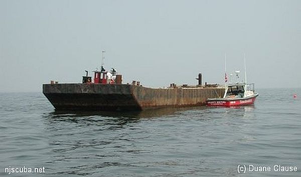
The "Ocean Prince" drydock (above) was sunk in 1986 and is well-attested. New York has photos of a clearly different drydock which they place here, but I believe is actually at Shinnecock, and I have placed it there.
| Name | Description | Sunk | GPS |
| 110 ft steel | Thursday Sept 9, 1999 |
40°35.973' -73°13.242' |
|
| Air Force Scow |
110 ft steel | Sunday Oct 14, 2018 |
40°35.914' -73°11.986' |
| Dump Scow DS-24 |
100 ft steel | Sunday Oct 14, 2018 |
40°35.838' -73°12.015' |
| Irvington | 60 ft steel | 2024 | 40°35.949' -73°12.308' |
| Piano Scow | 30 ft steel | Sunday Oct 14, 2018 |
40°35.872' -73°12.022' |
| "Ocean Prince" Drydock #4 |
200 ft steel drydock |
Saturday Nov 29, 1986 |
40°35.704' -73°11.968' |
More: barges - Fire Island Artificial Reef ...
| Name | Description | Sunk | GPS |
| 115 ft steel | 40°31.145' -73°31.736' |
||
| 100 ft wood drydock |
1990 | 40°31.504' -73°31.914' |
|
| Navy | 110 ft steel | 1993 | 40°31.077' -73°31.476' |
| 40 ft steel dredge |
Wednesday Oct 4, 2000 |
40°31.010' -73°32.501' |
|
| 40 ft steel dredge |
Wednesday Oct 4, 2000 |
40°31.010' -73°32.501' |
|
| DB-1 | 75 ft steel derrick |
Friday Aug 10, 2018 |
40°30.971' -73°32.971' |
More: barges - Hempstead Artificial Reef ...
More: JJ DPC-19 ...