
Spring Lake Sailor
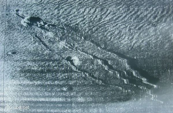
- Type:
- shipwreck, schooner barge
- Depth:
- 75 ft
A large sailing ship, just north of the Sea Girt Reef in 73 feet. Very low-lying. Wreckage consists of three sets of wood walls with some decking. Deep holes for lobsters. Very hard to find and hook. A nice spot for six lobster divers or a small cadre of artifact hunters. Probably over 100 years old. Some brass odds and ends over the years have been found, with some bottles and china, but I suspect she was largely stripped and sank.
-- Capt Steve Nagiewicz
aka: NW Sailor, AWOIS 7778
AWOIS 7778
LAT: 40.147547 / LON: -73.930514 / HIGH
Wreck - Submerged, dangerous to surface navigation
58 Feet and tenths
333SS/89 - OPR-C147-HE-89;
CONTACT NO. 16;
50M SIDE SCAN SONAR COVERAGE OVER CONTACT PROVIDED BY WHITING IN H10290/88;
DIVER INVESTIGATION LOCATED A BADLY DETERIORATED WOODEN WRECK WHICH WAS SUNK INTO A FLAT SANDY BOTTOM;
HIGHEST OBJECT WAS A LARGE CORAL-COVERED ROCK OR PIECE OF WRECKAGE;
DIVERS UNABLE TO DETERMINE THE EXACT NATURE OF THIS CORAL-COVERED OBJECT;
POSITIVE IDENTIFICATION OF WRECKAGE COULD NOT BE MADE;
LAT 40-08-51.166N, LONG 73-55-49.845W;
LORAN C RATES: 9960-W 15503.1, 9960-X 26907.3, 9960-Y 43517.6, 9960-Z 59778.2;
EVALUATOR RECOMMENDED CHARTED A DANGEROUS WRECK COVERED 58 FT. MLLW AT SURVEY POSITION.
(ENTERED MSM 5/90)

Questions or Inquiries?
Just want to say Hello? Sign the .