Logwood

- Type:
- shipwreck, sailing ship
- Built:
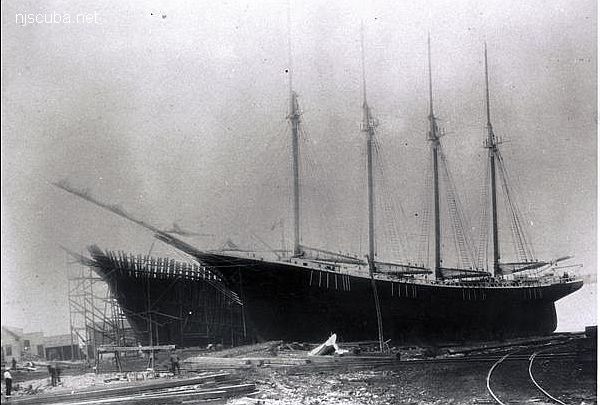
- 1906, Rockland, Maine, USA, as John D. Colwell
- Specs:
- ( 192 x 39 ft ) 1,042 gross tons, 14 passengers & crew
- Sunk:
- Wednesday May 12, 1920
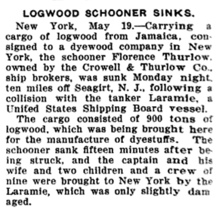
collision with tanker Laramie, no casualties - Depth:
- 95 ft

The Laramie was found to be solely at fault. The Florence Thurlow, buoyed up by her cargo of lumber, did not immediately sink, and was eventually removed as an obstruction to navigation by the Coast Guard, probably with dynamite.
Today the "Logwood" is a typical New Jersey lobster "snag". It consists of a pile of rusted chain surrounded by low timbers running off in several directions in the sand. This wreck is in an area that scallop boats frequent, and shows the signs of being dragged apart. Each year pieces of wreckage are missing or dragged far off the main wreck site. It is a good place to find scallops and, depending on how frequently she's dived, not a bad place for lobster.

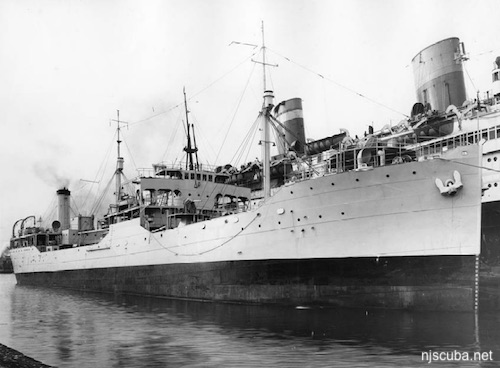
Laramie, later during World War II as USS Laramie; launched in 1919. At the time of the collision, the brand-new ship was owned by the United States Shipping Board, and the incident is expunged from her official Navy histories. At 446 feet and 14,950 tons fully loaded, even a glancing blow from Laramie would have been fatal to the schooner.
The wreck was identified by Dan Lieb of the New Jersey Historical Divers Association ( although it was always known as the "Logwood", which in hindsight was a dead giveaway. )

Questions or Inquiries?
Just want to say Hello? Sign the .