Sandy Hook Artificial Reef
Sandy Hook Artificial Reef
1.6 nautical miles off Sea Bright, 1.76 sq miles
Depth: 40-60 ft [download]
The pink area on the chart is the "Full Access Zone", approximately 0.25 square miles. This is the area where commercial fishermen will continue to be allowed to set their traps and lines as of 2015.
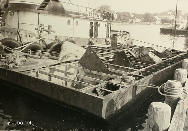
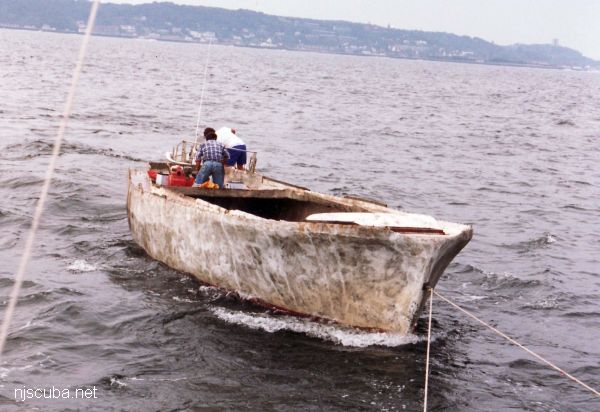
The Sandy Hook reef has only a few small vessels sunk on it, although it does encompass several interesting shipwrecks. Instead, the northernmost of New Jersey's Artificial Reefs is composed of thousands of tons of construction debris and dredge spoils from New York City - far too much of it to plot! Minimum clearance at mean low water is 30 feet.
Concrete rubble is concentrated in the north. The southern part of the reef is mostly dumped dredge rock, sort of an extension to the Shrewsbury Rocks. There is so much rock and rubble in the Sandy Hook Reef that I could not even begin to put it all on the chart - the bottom is practically paved.
Visibility is usually poor on the way down but can get better near the bottom, where it is dark and cold. See the Macedonia for a more detailed description of diving conditions here. The Sandy Hook Reef is one of the oldest artificial reef sites in New Jersey. Reef-building activities at this site date back to 1937.

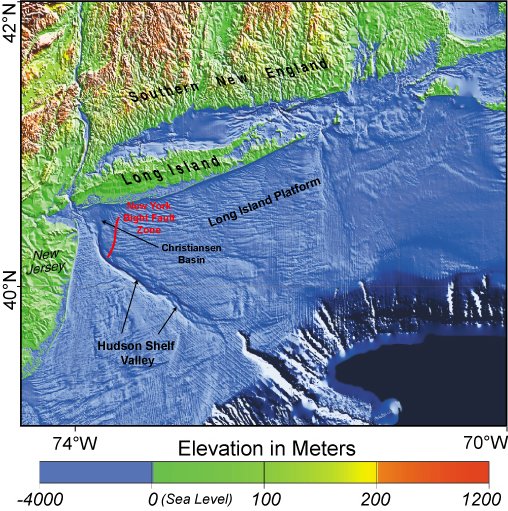
This is a shot of some bathymetric imaging released by NOAA. At left are the Highlands and twin lights. North from there is Sandy Hook, with two World War II gun batteries clearly visible. Offshore of Sandy Hook appears to be a big borrow pit for beach replenishment. South of that are the Shrewsbury rocks. In the center is the Sandy Hook Reef. The outline of the reef is perfectly clear - it is paved with dredge rock. At the lower right is a similar feature - another rock ridge that is clearly man-made. This is in the vicinity of the Mud Dump, it is dredged material from New York Harbor. They probably had the dump zone marked by buoys in the age before GPS - that is why it is so precise.
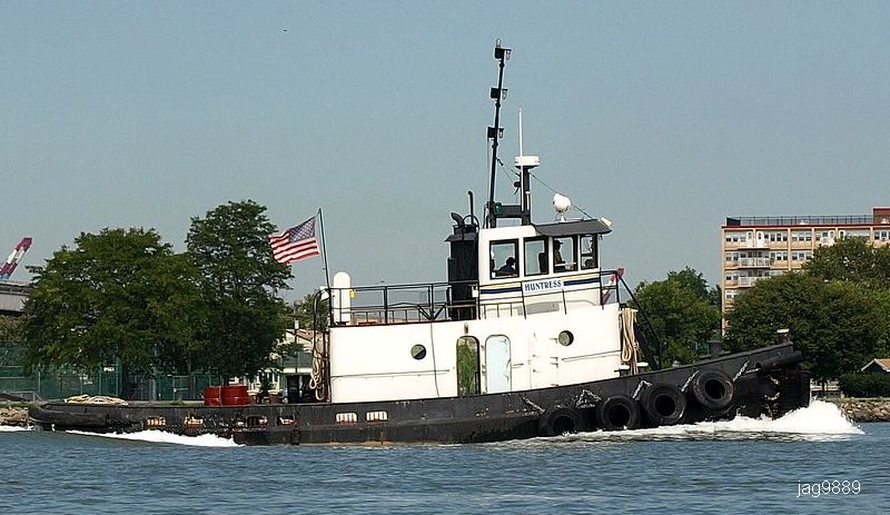
- Type:
- artificial reef, tugboat
- Built:
- 1955, Wiley Manufacturing, Port Deposit MD USA, as Deborah
- Specs:
- ( 56 ft ) 42 GT
- Sponsor:
- Vinik Marine
- Sunk:
- Saturday June 9, 2020 - Sandy Hook Artificial Reef
- GPS:
- 40°21.541' -73°56.006'
- Depth:
- 60 ft
More: Huntress ...
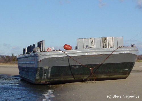
- Type:
- artificial reef, barge
- Specs:
- ( 45 x 20 ft )
- Sponsor:
- Coleman Construction Company
- Sunk:
- Tuesday June 27, 1989 - Sandy Hook Artificial Reef
- GPS:
- 40°21.060' -73°56.125'
- Depth:
- 50 ft
More: Coleman I ...
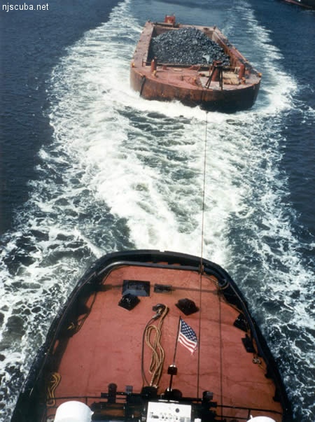
All manner of concrete, steel, and stone rubble from dredging, demolition projects, and other construction is used as artificial reef materials. This material is generally available at very low cost or free from construction companies who are more than happy to get rid of it. Transportation costs determine where this material is used by the Reef Program.
More: Rock & Rubble ...
- Type:
- artificial reef, sailboat
- Specs:
- ( 45 x 20 ft )
- Sponsor:
- Lockwood Marina
- Sunk:
- circa 1991 - Sandy Hook Artificial Reef
- GPS:
- gone
- Depth:
- 50 ft
More: Lockwood ...
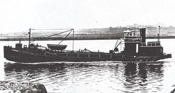
- Type:
- artificial reef, tanker - Spentonbush Company, USA (Hess Oil)
- Built:
- 1932, Ira S. Bushey & Sons, Brooklyn NY USA
- Specs:
- ( 110 ft )
- Sponsor:
- Spectra Services
- Sunk:
- Saturday June 3, 1989 - Sandy Hook Artificial Reef
- GPS:
- 40°21.525' -73°56.110'
- Depth:
- 60 ft
More: V.L. Keegan YO-166 ...
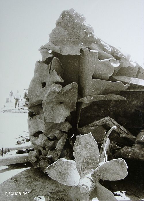
- Type:
- artificial reef, tugboat (cut into pieces)
- Specs:
- ( 65 ft )
- Sponsor:
- Spectra Services
- Sunk:
- Saturday June 3, 1989 - Sandy Hook Artificial Reef
- GPS:
- 40°21.555' -73°56.103'
- Depth:
- 60 ft
More: Dorothy ...
Artificial Reef Charts, Charts, Dive Sites, Long Island West Dive Sites, New Jersey Artificial Reef Charts, New Jersey Dive Sites, Sandy Hook Dive Sites,
New Jersey Artificial Reefs
More: New Jersey Artificial Reefs ...
Sandy Hook / Rockaway Inlet Chart
- Barge #10
- 120 Wreck
- 3 Sisters
- Ambrose Buoy
- A Street - Shark River
- Acara
- Across
- Adele
- Ajace
- Alex Mac
- Allenhurst Jetty
- Antioch
- Arnoff
- Arundo
- Asfalto
- Aurora
- Ayuruoca
- BA Wreck
- Shark River - Back Bay
- Balaena
- Bald Eagle
- BD1738
- USS Benson
- Beth Dee Bob
- Blue Boy
- Bronx Queen
- Bug Light
- Charles Dunlap
- Cecilia M Dunlap
- Catherine Jackson
- Chauncy Jerome
- Cornelia Soule
- Choapa
- coal (Lido)
- Continent
- crane barge
- Daghestan
- Dragger
- drydock
- Dryland
- Edwin Duke / Stone Barge
- dump
- Dutch Springs
- Edmund Phinney
- East Rockaway Inlet
- Ed's Schooner
- Elberon Rocks
- Eureka
- Finance
- Fort Victoria
- German
- GL78
- Glen II
- I.P. Goulandris
- Gypsy
- Horseshoe Cove
- Alexander Hamilton
- Howard
- Iberia
- Immaculata
- Inshore Schooner
- Jack I
- Joan La Rie III
- Jones Inlet
- Jones Tug
- Klondike Rocks
- Larsen
- Lizzie D
- Long Branch locomotives
- Logwood
- H.W. Long
- Macedonia
- Mahogany
- Malta
- Manasquan Inlet
- Margaret
- Marion
- Mistletoe
- R.C. Mohawk
- Manasquan Wreck
- Nautilus
- Navesink River
- Northeast Sailor
- New Reef
- New Deal
- New Era
- HMS Pentland Firth
- Long Branch Pier Rubble
- Pinta
- Pipe Barge
- Pliny
- Plymouth
- Pocopson
- Princess Anne
- Ruth Shaw
- Robert A Snow
- Ramos
- Ranger
- Relief Lightship
- Rickseckers
- Rjukan
- Rockaway Inlet
- Rockaway Belle
- Round Valley
- Roy's barge
- Rudder Wreck - Pocono
- Rusland / Adonis
- Scotland Buoy
- Sandy Hook Pilot Boat
- SC-60
- Sea Girt Inlet
- Sea Girt Wreck
- Shark River Inlet
- Shrewsbury Rocks
- Spring Lake Sailor
- Steel Wreck
- Stolt Dagali
- Sylvanus
- Tampa III
- USS Turner
- AWOIS 8087
- AWOIS 8097
- u11
- AWOIS 7509
- AWOIS 7932
- AWOIS 9768
- AWOIS 12966/11422
- AWOIS 1609
- AWOIS 8084
- AWOIS 7940
- AWOIS 7938
- AWOIS 8076
- AWOIS 4600
- AWOIS 8075
- Valerie E
- Vega
- Warrior
- Delaware River Water Gap
- Western World
- Edward W Winslow
More: Sandy Hook Dive Sites Chart ...
With rare exceptions, scuba diving is a bottom-fixated activity. In the region covered in this website, one may encounter many different bottom types, from rocky pinnacles around Block Island to white sands off Cape May to mud and oyster beds in any estuary. This variation is far greater and more interesting than is found in the tropics. Here is some explanation of what bottom compositions are found where and why:
More: Bottom Composition ...