Northeast Sailor

Shipwreck Northeast Sailor
Type:
shipwreck, sailing ship
Depth:
75 ft

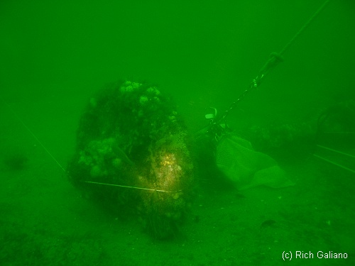
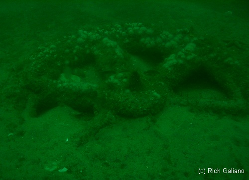
The "Northeast Sailor" is the remains of a large sailing ship. The absence of towing bits is an indicator that this was probably not a schooner barge, while the presence of a boiler and steam machinery place the vessel in the mid to late nineteenth century.

compass

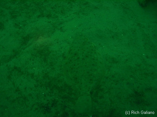
The lay of the wreck is typical. The Bow faces east, probably into the storm that sank her. Low wooden remains lie in lines emanating from a sizable chain-pile and anchor. Some machinery can also be found, including the aforementioned boiler and steam winches. Although the wreckage is scattered, navigation is not difficult. The bottom is clean coarse sand, and there are lobster holes dug beneath the wooden ribs. Many of these are very deep, and even a long stick will not reach the bottom, so lobstering on this wreck is a challenge, but doable. The last time I was there, I grabbed half a dozen nice-sized lobsters, and not one keeper in the lot! All females.

Shipwreck Northeast Sailor
Tied in to a winch near the chain pile
Shipwreck Northeast Sailor
Northeast Sailor
Lots of machinery around the bow
Shipwreck Northeast Sailor
I have no idea what this is
Shipwreck Northeast Sailor
See the flounder?

Drawing courtesy of Aaron Hirsh


Comments on Northeast Sailor

Questions or Inquiries?

Just want to say Hello? Sign the .

Submit a Comment

Your email address will not be published. Required fields are marked *


Click image to replace if unable to read.

Enter the digits from the image above, except for the last one:

This site uses Akismet to reduce spam. Learn how your comment data is processed.


NM22/46 -- DERRICK BARGE WRECK LIGHTED BUOY 3, BLACK, QK FL GREEN, ESTABLISHED IN 62 FT., 1.75 MILES, 63 DEG. FROM SCOTLAND LIGHT VESSEL. BUOY LOCATED 200 FEET EAST OF SUNKEN WRECK WHICH LIES IN A SE-NW DIRECTION.

H10224/86 -- OPR-C121-WH-86; MAIN SCHEME HYDROGRAPHY AND SIDE-SCAN SONAR INVESTIGATION REVEALED WHAT APPEARED TO BE A WRECK IN FOUR PIECES 447M SW OF WRECK; FOUR DIVES WERE PERFORMED IN 1987; FOUND A BARGE, APPROXIMATELY 50 X 120 FT WITH A PNEUMATIC DEPTH GAUGE LEAST DEPTH OF 63 FT; 0-5 FT VISIBILITY; A STRUCTURE SIMILAR TO A DERRICK CRANE WAS FOUND; HYDROGRAPHER AND EVALUATOR RECOMMENDED DELETING CHARTED SYMBOL AND ADDING 63 WK AS SHOWN ON PRESENT SURVEY. (UPDATED MSD 4/91)

24 NO. 1350; BARGE, SUNK 5/30/46; POS. ACCURACY WITHIN 1 MILE;