Dive Sites (35/45)
More: Dive Sites ...

- Type:
- shipwreck, clam dredge, USA
- Built:
- 1949, RTC Shipbuilding, Camden NJ, USA
- Specs:
- ( 120 ft ) 177 GT
- Sunk:
- August 1990
- Depth:
- 65 ft
intact, upright, steel hull
More: Sea Girt ...
Sea Girt Inlet is reduced to an outflow pipe. The water it releases is often so contaminated with goose droppings that it causes beach closings for miles around.
More: Sea Girt Inlet ...
3.6 Nautical Miles off Sea Girt
Depth: 60-75 ft [download]
More: Sea Girt Artificial Reef ...
- Type:
- shipwreck, sailing ship
- Depth:
- 85 ft
A large wooden sailing ship, more intact than most. The hull is almost complete, 8-10 feet high, with a Navy-style stockless anchor in one side of the bow, and bowsprit lying in the sand below. The bowsprit indicates that this was a true sailing ship and not a schooner barge. I saw no sign of towing bits, bow, or stern. The stern is broken down.
More: Sea Hag ...
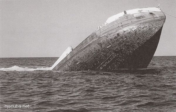
- Type:
- artificial reef, trawler, USA
- Specs:
- ( 135 x 32 ft )
- Built:
- 1945, American Bridge, Ambridge PA, as YF-879
- Sponsor:
- Cape May County Party & Charter Boat Association, Atlantic Cape Fisheries, Artificial Reef Association
- Sunk:
- Friday August 21, 1992 - Cape May Artificial Reef
- GPS:
- 38°53.118' -74°40.190'
- Depth:
- 70 ft
More: Sea Transporter YF-879 ...
- Type:
- shipwreck, barge
- Specs:
- ( 250 ft ? )
- Depth:
- 85 ft

A very large intact steel deck barge, lying upright, north-south. The southern end is partially collapsed and opened up, allowing easy access to at least part of the inside. Rust holes in the deck let light in throughout the rest of the interior, although they are too small to fit through. A great spearfishing site, and not bad for lobsters. The crane lies about 1/4 mile away.
More: Seaside Crane barge ...
- Type:
- shipwreck
- Depth:
- 95 ft
The "Seawolf", as she is called, is a large steel-hulled wreck that faces in an easterly direction. Her bow rises 14 ft or so off the bottom. Most of the wreck comes off the bottom only a few feet. She has a large fishing net draped over her midships.
More: Seawolf ...

