Dive Sites (36/46)
Dive Sites - pick your starting point
More: Dive Sites ...
- Type:
- shipwreck, sailing ship
- Depth:
- 85 ft
A large wooden sailing ship, more intact than most. The hull is almost complete, 8-10 feet high, with a Navy-style stockless anchor in one side of the bow, and bowsprit lying in the sand below. The bowsprit indicates that this was a true sailing ship and not a schooner barge. I saw no sign of towing bits, bow, or stern. The stern is broken down.
More: Sea Hag ...
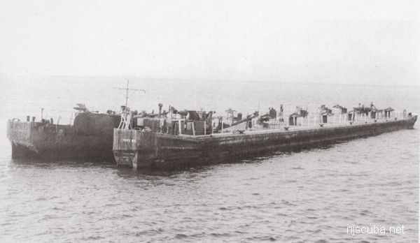
- Type:
- shipwreck, barge
- Specs:
- ( 250 ft ? )
- Depth:
- 85 ft

A very large intact steel deck barge, lying upright, north-south. The southern end is partially collapsed and opened up, allowing easy access to at least part of the inside. Rust holes in the deck let light in throughout the rest of the interior, although they are too small to fit through. A great spearfishing site, and not bad for lobsters. The crane lies about 1/4 mile away.
More: Seaside Crane barge ...
- Type:
- shipwreck
- Depth:
- 95 ft
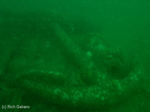
The "Seawolf", as she is called, is a large steel-hulled wreck that faces in an easterly direction. Her bow rises 14 ft or so off the bottom. Most of the wreck comes off the bottom only a few feet. She has a large fishing net draped over her midships.
More: Seawolf ...
- Type:
- smallish tidal river inlet with stone jetties or bulkheads on both sides
- Depth:
- 15 ft
The Shark River is your best bet for shore diving in the northern half of the New Jersey coastline, far better than the Manasquan River. Shark River offers at least four different locations to dive: either side of the inlet, with rock jetties to explore, slightly upstream at A Street in Belmar, and upriver in the back bay area at L Street, Belmar. The wreck of the Malta is also just a few blocks south on the beach, but hardly worth diving.
More: Shark River ...
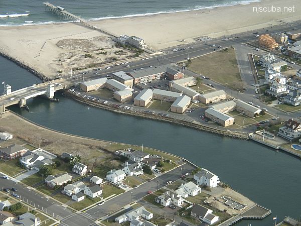
Yet another place to dive the Shark River is on the south side, near the intersection of 1st Avenue and A Street, behind the apartments. There is limited but very convenient free parking. A small cement stairway leads down to a concrete ledge above the water. Climb down between the big rock and the bulkhead, where you will find more steps underwater. ( Whoever B.M and M.M. are - thank you! )
More: Shark River - A Street ...
- Type:
- inland tidal bay
- Depth:
- 20 ft max, 15 ft in most places
This dive site, formerly known as 'L Street' has changed completely, and for the better. The town of Belmar has done something really nice for us divers and installed wide wooden steps down the bulkhead in Maclearie Park. This more than makes up for the loss of the boat ramp area, which is off-limits to all swimmers since it was rebuilt. I suppose the little cove by the ramp is still accessible from the beach, but the new site is much better, and far from all the dangerous boat traffic around the ramp and marina.
More: Shark River - Back Bay ...
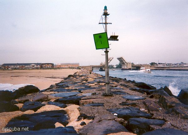
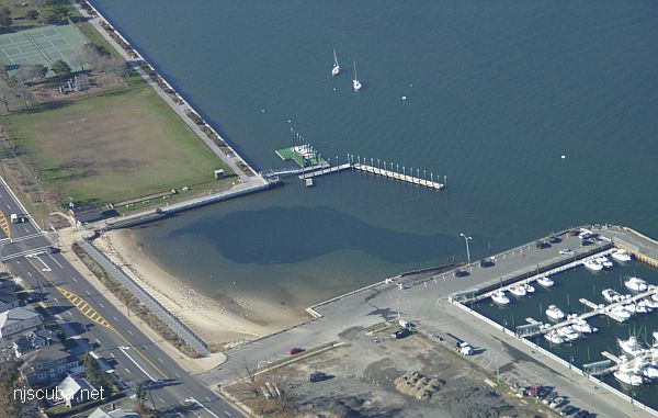
Shark River Inlet
- Type:
- smallish tidal river inlet with stone jetties or bulkheads on both sides
- Depth:
- 15 ft
This inlet has an L-shaped jetty on the north side and a longer straight jetty on the south side. Both jetties are made of loose stones - hardly any concrete - and the bottom is sandy and usually clean. You can walk over the bridge from one side of the inlet to the other in about five minutes.
More: Shark River Inlet ...
Shark River Artificial Reef
15.6 Nautical Miles off Manasquan, 0.83 sq miles
Depth: 120-140 ft [download]
More: Shark River Artificial Reef ...
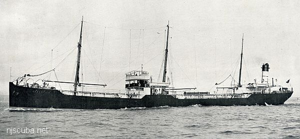
- Type:
- artificial reef, barge, tank
- Specs:
- ( 250 x 42 ft )
- Sponsor:
- Charlie Bobowicz
- Sunk:
- Monday August 17, 1987 - Garden State North Artificial Reef
- GPS:
- 39°37.498' -74°01.412'
- Depth:
- 80 ft
More: Molasses barge ...