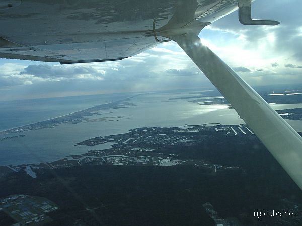
Dive Sites (5/46)
Dive Sites - pick your starting point
More: Dive Sites ...
- Type:
- major ocean inlet with strong current, surf, and heavy boat traffic
- Depth:
- 45 ft
More: Barnegat Inlet ...
3.1 Nautical Miles off Barnegat, 1.08 sq miles
Depth: 50-60 ft [download]
More: Barnegat Light Artificial Reef ...
Bayville barge
The visibility on this site varies. Average is 10-12ft. This site offers two wrecks which lie in 25 fsw. A British WWI two-man reconnaissance submarine and an old wooden barge. They are both within swimming distance from each other. The marine life is fair around these wrecks. There are a few car tires between the two wrecks and you may find an occasional lobster hiding inside them.
To locate the barge take a compass heading of 330 degrees from the pilings located on the east side of Greenwich Ave. It takes about 50 kick cycles to reach the wreck. To get to the submarine take a compass heading of 30 degrees from the same pilings. This can be reached in about 30 kick cycles. Both of the wrecks are not intact but make for a good dive.
More: Bayville barge ...
from AWOIS:
H10224/86 -- OPR-C121-WH-86; WRECKAGE WITH 52 FT PNEUMATIC DEPTH GAUGE LEAST DEPTH, WHICH IS BELIEVED TO BE THIS ITEM, APPROXIMATELY 100M SW OF AWOIS POSITION; DIVERS FOUND THE WRECK OF A BARGE, APPROXIMATELY 20 X 45 M; THREE BOILERS AND NUMEROUS OTHER TYPES OF SHIPYARD DEBRIS WERE FOUND STREWN OVER AN AREA OF 360 X 165 FT; IN THE NW CORNER OF THE SITE THE REMAINS OF ANOTHER WRECK WAS FOUND WITH ONLY THE SHELL PLATING AND FLOOR FRAMING REMAINING; APPROXIMATELY 200 FT LONG, 27 FT BEAM AND SHELL PLATING EXTENDING 5 FT ABOVE THE BOTTOM; BOTH ENDS OF THE WRECK TAPERED INTO THE SAND WITH NO BOW OR STERN VISIBLE; ONE OBJECT CONSISTING OF GUARD RAIL TYPE METAL, APPROXIMATELY 2 FT WIDE, 3/8 INCH THICK, AND 40 FT LONG, FORMING A 60 DEGREE ARCH WITH THE MIDDLE STANDING 10 FT OFF THE BOTTOM; SITE CONSISTED OF TWO WRECKS AND SHIPYARD DEBRIS, INCLUDING A BOOM CRANE; LEAST DEPTH TAKEN ON THE TOP OF THE BOILER LOCATED AT THE NORTHEAST SECTION OF SITE. (UPDATED MSD 4/91)
More: BD 1738 ...
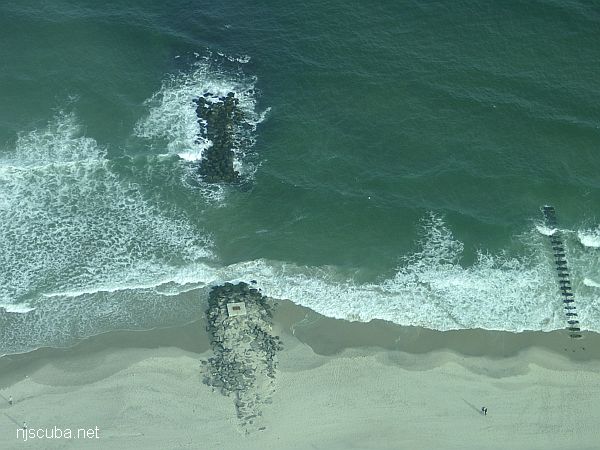
Dozens of jetties up and down the coast have been cut-though at the base like this one, making them inaccessible to fishermen, but not divers !
More: Beach Jetties ...
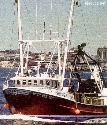
- Type:
- shipwreck, clam dredge, USA
- Built:
- 1990, Bock Marine, Beaufort NC USA
- Specs:
- ( 84 ft ) 96 tons, 4 crew
- Sunk:
- Wednesday January 6, 1999
foundered in rough seas - no survivors - Depth:
- 120 ft
More: Beth Dee Bob ...
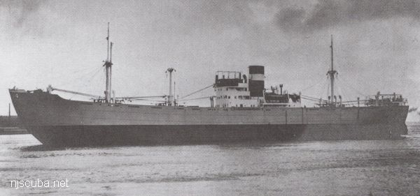
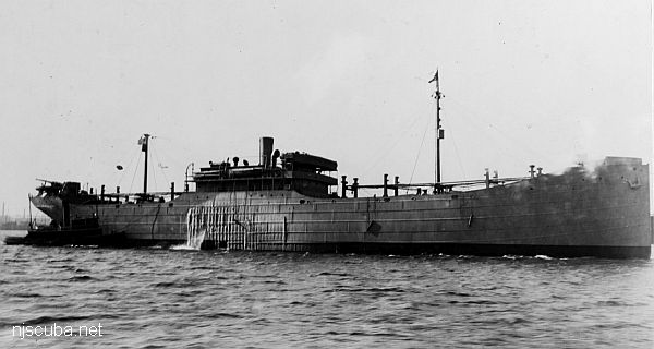
- Type:
- shipwreck, collier, USA
- Built:
- 1918, New York Shipbuilding, Camden NJ USA
- Specs:
- ( 369 x 55 ft ) 5353 displacement tons
- Sunk:
- Saturday May 5, 1945
torpedoed by U-853 - 12 casualties - Depth:
- 85 ft
More: Black Point ...