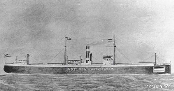
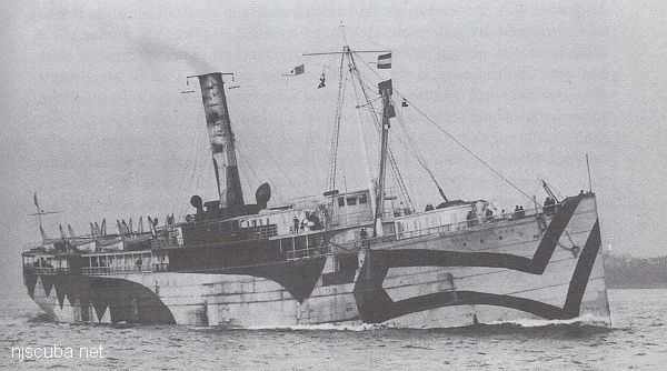
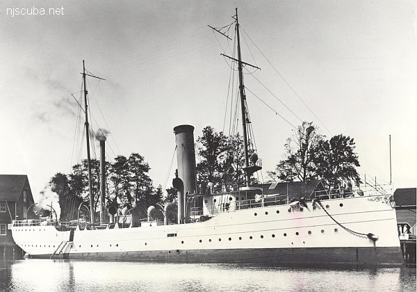
Dive Sites (31/45)

sandy hook manasquan barnegat  cape may  nj coast  li west   li east   li coast  deep sea  nj reefs  ny reefs
 1  30 31 32  45  

Port Jefferson Artificial Reef

Depth: 88 to 94 feet
1.79 nautical miles northeast of Port Jefferson Inlet


Shipwreck Poseidon
Type:
shipwreck, iron-hulled screw freighter, USA
Built:
1914, Scotland
Specs:
( 295 x 43 ft ) 1909 tons
Sunk:
Wednesday July 31, 1918
collision with freighter SS Somerset
Depth:
90 ft

Shipwreck Princess Anne
Type:
shipwreck, liner, USA
Built:
1897, Chester PA USA
Specs:
( 350 x 42 ft ) 3629 gross tons
Sunk:
February 6, 1920; ran aground in storm - no casualties
Depth:
20 ft

Shipwreck R.C. Mohawk
Not to be confused with the S.S. Mohawk or the other S.S. Mohawk.
Type:
shipwreck, revenue cutter, U.S. Revenue Service, on loan to U.S. Navy
Name:
A tribe of Iroquoian Indians of the eastern New York area.
Built:
1902, Richmond VA USA
Specs:
( 206 x 32 ft ) 980 gross tons, 77 crew
Sunk:
Monday October 1, 1917
collision with tanker Vennachar - no casualties
GPS:
40°25.025' -73°45.158' (AWOIS 2010)
Depth:
100 ft

Railroad Bridge
Viewed from the northwest, prior to reconstruction, winter, high tide. 7-11 store at upper right.
Type:
inland tidal river
Depth:
20 ft, mostly a lot shallower

This spot is upstream on the Manasquan River. The diving area is rather small and not very deep. Visibility tends to be poor, and this is worsened whenever an O/W training class is in session, which is often. Also, the current under the bridge becomes very strong, so slack water is essential. For a long time, a dredge barge has been anchored in the channel, but otherwise, there is no boat traffic.


Type:
shipwreck, schooner barge
Specs:
1208 tons
Sunk:
Friday June 30, 1933
GPS:
40°25.505' -73°54.071' (AWOIS 1990)
Depth:
80 ft

Nearby are the remains of several other barges.


Type:
shipwreck, iron-hulled screw steamer
Built:
1878, Scotland, as Clan Ranald
Specs:
( 305 x 34 ft ) 2008 gross tons
Sunk:
Tuesday June 4, 1901
foundered when cargo of asphalt melted and shifted - no casualties
Depth:
40 ft


Sandy Hook, Raritan Bay & Environs
Looking northeast: Port Monmouth, Belford, the Navy pier, Sandy Hook, and Long Island are visible faintly in the distance.

This bay is muddy and turbid, although some folks dive the several small wrecks around the inside of Sandy Hook. Bottle hunting around the old piers and pilings in Keyport harbor is also a possibility, but most of the structures along the bay shore are too small and shallow to be of interest. I have scouted the shoreline from Atlantic Highlands to Laurence Harbor, and nothing looks too promising. See also entries on Navesink River and Horseshoe Cove.


Shipwreck Dorothy B. Barrett
Type:
shipwreck, schooner, USA
Built:
1904, Bath ME USA
Specs:
( 259 x 45 ft ) 2088 gross tons, 10 crew
Sunk:
Wednesday August 14, 1918
shelled by U-117 - no casualties
Depth:
60 ft

low debris field mostly buried in the sand

Printed from njscuba.net