Delaware Bay
I doubt this is a good place to dive. Even without the river pollution, the bottom is muddy and the water is full of silt. If anyone knows anything different, let me know.
More: Delaware Bay ...
Cape May Chart
More: Cape May Dive Sites Chart ...
Delaware Bay
I doubt this is a good place to dive. Even without the river pollution, the bottom is muddy and the water is full of silt. If anyone knows anything different, let me know.
More: Delaware Bay ...
Delaware Bay Artificial Reef
1.13 sq miles
Depth: 22-27 ft [download]
More: Delaware Bay Artificial Reef ...
Delaware Artificial Reefs
Delaware has a string of artificial reef sites in the Delaware bay, but they are of little interest to divers. Most of the sites are quite shallow and perilously close to the shipping lanes, several of them were actually reduced for this reason. The conditions in the bay are hardly good for diving. The reefs consist mostly of concrete rubble from construction in Philadelphia and other cities on the river. Also shown is New Jersey's sole artificial reef in the bay.
More: Delaware Bay Reefs ...
DelJerseyLand Inshore Artificial Reef
26 Nautical Miles from Indian River Inlet, 1.51 sq miles
Depth: 120-140 ft [download]
More: DelJerseyLand Artificial Reefs ...
low debris field mostly buried in the sand
More: Dorothy B Barrett ...
aka "Southern Pet Wreck"
More: Elizabeth Warren ...
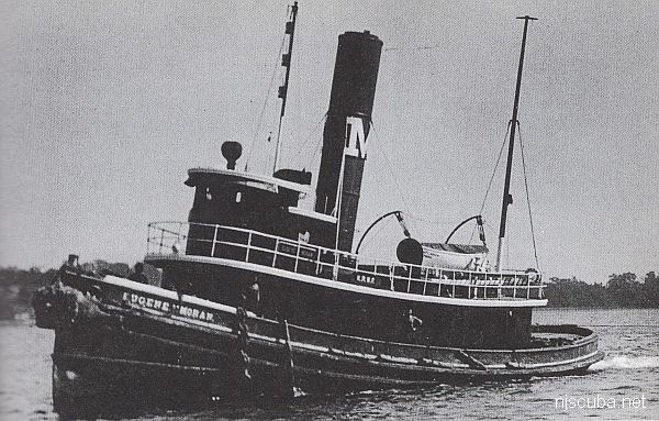
More: Eugene F Moran ...
The Evening Star or 'Pig Iron Wreck' appears to be the remains of a tanker that ran aground and broke up. The wreck sits in 40 ft of water and is scattered over a relatively large area.
More: Evening Star ...
Garden State South Artificial Reef
5.1 Nautical Miles off Spray Beach, 0.74 sq miles
Depth: 55-65 ft [download]
More: Garden State South Artificial Reef ...
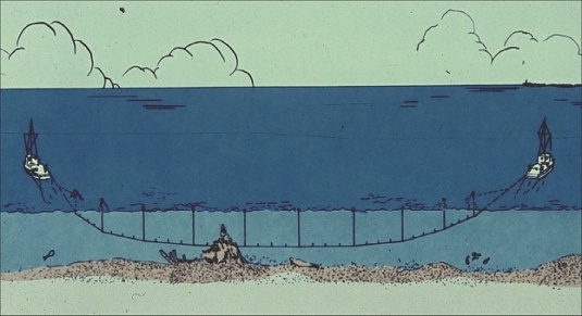
Wire dragging is an operation used to locate and/or reduce the navigational hazard of a sunken wreck, rock, or other obstruction.
More: Wire Drag ...