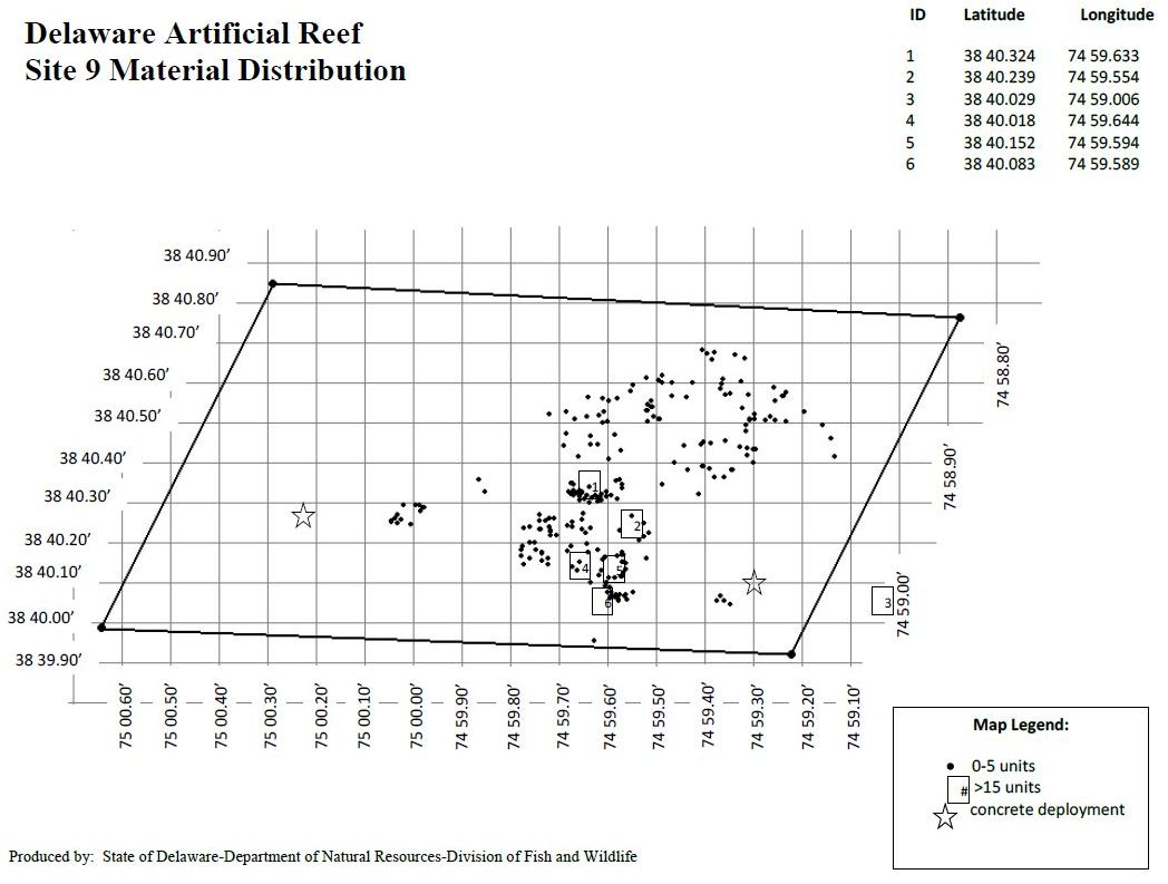
Delaware #09 Artificial Reef

Delaware #9 Artificial Reef

4.5 Nautical Miles from Indian River Inlet, 1.31 sq miles
Depth: 50-60 ft

Nothing really of interest in this reef - just a lot of concrete and tire units that have been sinking down into the mud for over twenty years. But someday ...
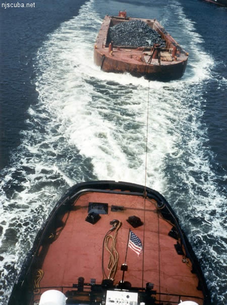
rock reef
A hopper barge full of rock

All manner of concrete, steel, and stone rubble from dredging, demolition projects, and other construction is used as artificial reef materials. This material is generally available at very low cost or free from construction companies who are more than happy to get rid of it. Transportation costs determine where this material is used by the Reef Program.


from AWOIS: 1607

NM47/66 -- DANGEROUS WRECK OF DREDGE DRYLAND, 62 FT. LONG. 22 FT. WIDE REPORTED SUNK IN ABOUT 90 FT. COVERED ABOUT 55 FT.

CL1540/78 -- MAR, OPR-C622-RU/HE-78; ITEM 4; INVESTIGATION BEGAN 30 AUGUST AND WAS COMPLETED ON 18 SEPTEMBER. EFFECTIVELY CLEARED TO MIN. OF 45.5 FT., (38.5 FT. ON A 40 FT. SHOAL), WITH NO HANGS ENCOUNTERED.

FE221/78-79 -- OPR-C622-RU/HE; ITEM 4; REQUIRED CLEARANCE TO 45 FT. DUE TO POSSIBLE HAZARDS ON THE BOTTOM. 1 MILE, RADIUS CIRCLE DRAGGED TO 45 FT. EXCEPT TO 38 FT. ON 40 FT. SHOAL (SEE AWOIS NO.00752) NW OF AMBROSE LIGHT TOWER. NO HANGS ENCOUNTERED. RECOMMENDED THAT CLEARED AREA BE CHARTED WITH GREEN TINT WITH 45 FT. CLEARANCE NOTE WHERE APPROPRIATE.

H10224/86-87 -- OPR-C121-WH-86-87; WRECK FOUND DURING MAIN SCHEME HYDROGRAPHY AND SIDE-SCAN SONAR OPERATION 850M EAST OF REPORTED POSITION; SIX DIVES PERFORMED; 2-15 FT VISIBILITY; PNEUMATIC DEPTH GAUGE LEAST DEPTH OF 86 FT TAKEN ON TOP OF A 20 FT LONG DREDGE PIPE FLOAT FOUND 841.6M EAST OF AWOIS POSITION; WRECK SITE REVEALED PIPES, FLOATS, AND DREDGING EQUIPMENT. (UPDATED MSD 4/91)