Delaware Artificial Reefs
Delaware Artificial Reefs (and a few New Jersey reefs)
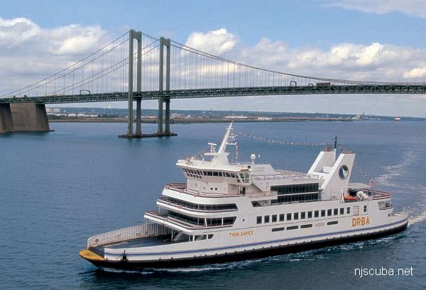
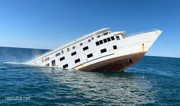
Coverage of Delaware is restricted to just those sites that are in the ocean and vessels in the bay. Siting reefs has been tricky for Delaware, as they must be kept clear of the shipping lanes. This doesn't leave a lot of places that are both located in usefully deep water and a convenient distance from shore. Cape May Reef belongs to New Jersey, but is within range of Delaware, and lately seems to have received material from Delaware. I have also included the USS Blenny, to the south - drag the chart.
Delaware Artificial Reef Charts
The 5 Delaware reefs shown here total approximately 7.2 square miles.
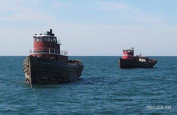
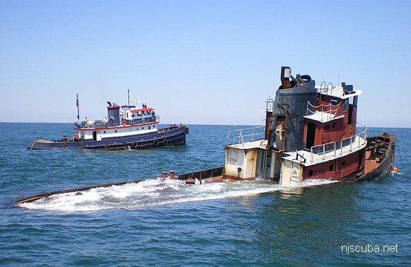
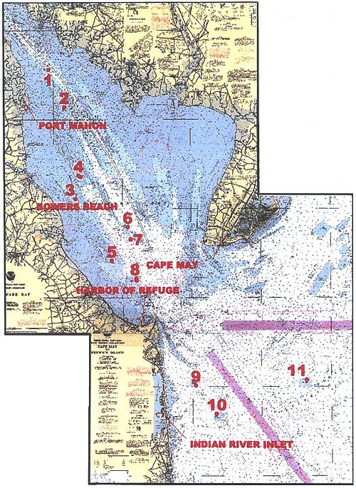
Site #8 has a 70' tugboat "Golden Eagle". Site #6 has a 120' barge. Site #1 has a 40' pilot boat. Other than that, the Delaware Bay reefs are all concrete rubble.
- Delaware 2015-2016 Reef Guide
- Delaware 2009-2010 Reef Guide
- Delaware 2005 Reef Guide
- Delaware Artificial Reef Program
- Youtube | Instagram | Farcebook
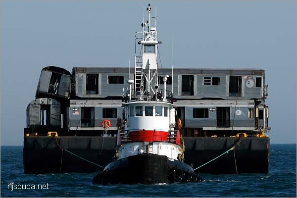
- Type:
- ~100 "Brightliner" subway cars - NYC Subway system
- Built:
- 1963-1964 - Budd Company - Model R32 # 3350-3949
1966-1967 - St. Louis Car - Model R38 # 3950-4149
1967-1969 - St. Louis Car - Model R40 # 4150-4349
1969-1970 - St. Louis Car - Model R42 # 4550-4949 - Specs:
- ( 60 x 10 ft ) 10 tons ( all, typical, body only )
- Sunk:
- 44 cars were sunk on Atlantic City Reef on April 3, 2008
more in Cape May reef and Delaware reefs - Sponsor:
- New York City Metropolitan Transportation Authority ( MTA )
- GPS:
- too many to list, and all gone anyway
- Depth:
- Depths vary by location
More: Brightliner Subway Cars ...
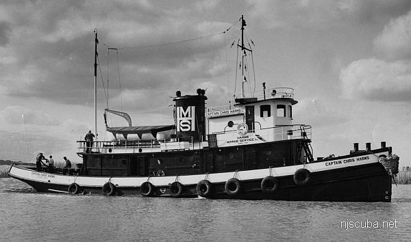
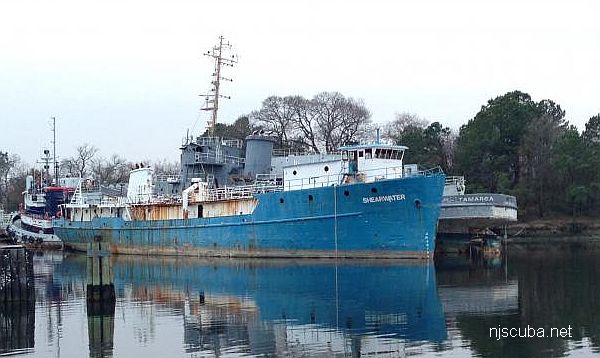
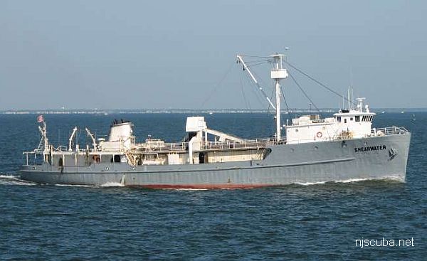
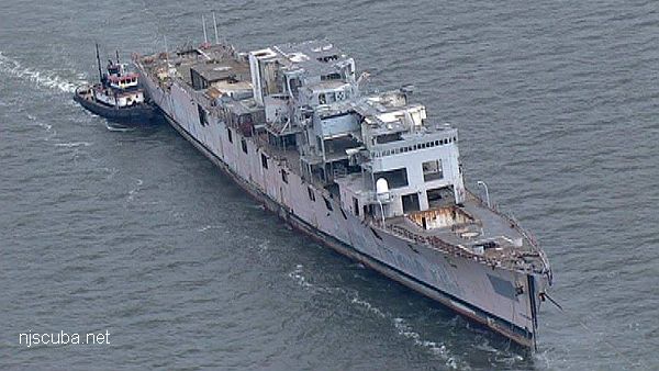
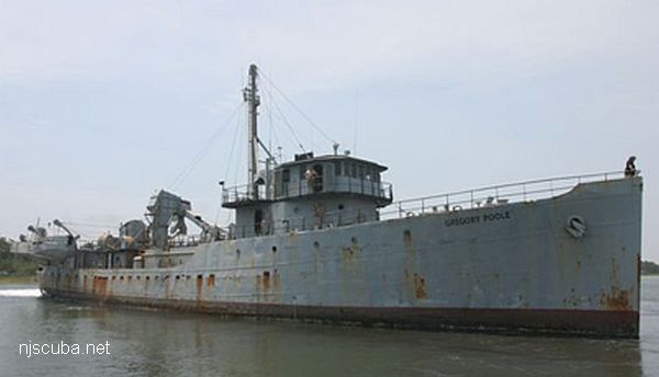
- Type:
- artificial reef, tugboat
- Built:
- 1947, Gulfport Shipbuilding, Port Arthur, TX, as Captain Chris Harms
- Specs:
- ( 85 ft )
- Sunk:
- Wednesday March 10, 2010 - Delaware #11 Artificial Reef
- GPS:
- 38°40.540' -74°43.957'
More: Sandy Point ...
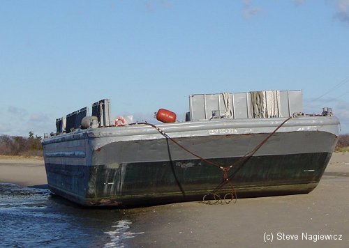
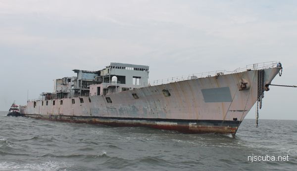
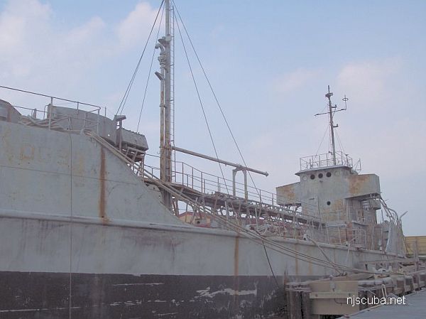
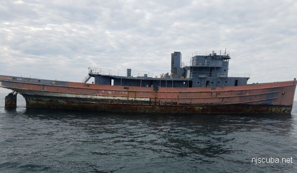
- Type:
- artificial reef, barge
- Built:
- 1953, Avondale Shipyards, New Orleans LA, as BCL-1103
- Specs:
- ( 110 x 34 ft ) 144 tons
- Sunk:
- Friday Oct 20, 2000 - Delaware #11 Artificial Reef
- GPS:
- 38°40.540' -74°43.957'
More: YC-1479 ...
Cape May Chart
- Absecon Inlet
- USS Akron
- Alex Gibson
- Alexander
- Almirante
- American
- Astra
- Atlantus
- Azua
- Dorothy B Barrett
- Brigantine Beach Wreck
- USS Blenny
- boiler wreck
- Brian C
- Brigantine Inlet
- Brigantine Buoy Wreck
- Charles Morand
- Cape May Inlet
- Cassandra
- Cayru
- Champion
- USS Cherokee
- China Wreck
- City of Athens
- City of Georgetown
- Clermont
- Corson’s Inlet
- William B Diggs
- dredge
- Admiral DuPont
- Elizabeth Warren
- Evening Star
- car float
- Florida
- Galimore's Cayru
- Gory Wreck
- Great Egg Inlet
- Gypsum Prince
- Hereford Inlet
- Hornet
- Hvoslef
- India Arrow
- Indian River Inlet
- USS Jacob Jones
- John Marvin
- China Junk Wreck
- Kennebec
- King Cobra
- Lemuel Burrows
- Lake Frampton
- Lady Mary
- Linda Snow II
- Marine Electric
- Miraflores
- Misty Blue
- Mohawk
- Montgomery
- USS Moonstone
- EF Moran
- Northern Pacific
- Nuphar
- Oklahoma
- Patrice McAllister
- Pet Wreck
- Poseidon
- Ranald
- RJ Walker
- Southern Lillian
- USS S-5
- Salem
- Salem
- San Jose
- Sea Girt
- Shookus
- Sindia
- Slabs
- General Slocum
- Southern Sword
- Townsend's Inlet
- Varanger
- Wayne
- Wily Fox
- YP-387
More: Cape May Dive Sites Chart ...
Delaware Bay
I doubt this is a good place to dive. Even without the river pollution, the bottom is muddy and the water is full of silt. If anyone knows anything different, let me know.
More: Delaware Bay ...
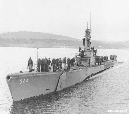
- Type:
- shipwreck, Balao ( modified Gato ) class submarine, U.S. Navy
- Built:
- 1944, Electric Boat Company, Groton, CT USA
- Specs:
- ( 312 x 27 ft ) 1810 tons, no crew
- Sunk:
- Wednesday June 7, 1989
"Africa Queen" artificial reef, Maryland - Depth:
- 70 ft
More: USS Blenny SS-324 ...