Cape May Dive Sites Chart
Cape May Chart
- 44009 Weather Buoy
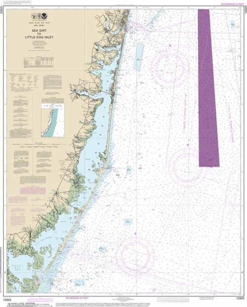
- Absecon Inlet
- USS Akron
- Alex Gibson
- Alexander
- Almirante
- American
- Astra
- Atlantus
- Azua
- Dorothy B Barrett
- Brigantine Beach Wreck
- USS Blenny
- boiler wreck
- Brian C
- Brigantine Inlet
- Brigantine Buoy Wreck
- Charles Morand
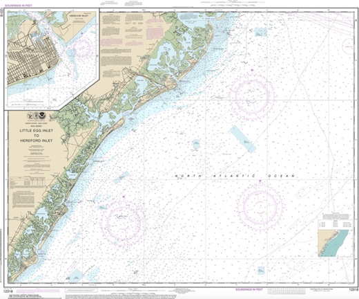
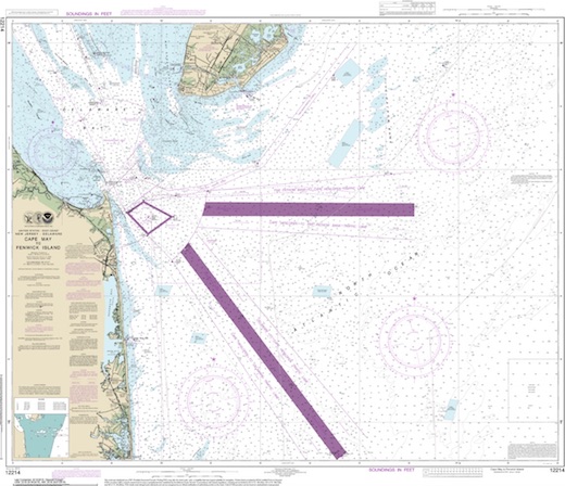
- Cape May Inlet
- Cassandra
- Cayru
- Champion
- USS Cherokee
- China Wreck
- City of Athens
- City of Georgetown
- Clermont
- Corson’s Inlet
- William B Diggs
- dredge
- Admiral DuPont
- Elizabeth Warren
- Evening Star
- car float
- Florida
- Galimore's Cayru
- Gory Wreck
- Great Egg Inlet
- Gypsum Prince
- Hereford Inlet
- Hornet
- Hvoslef
- India Arrow
- Indian River Inlet
- USS Jacob Jones
- John Marvin
- China Junk Wreck
- Kennebec
- King Cobra
- Lemuel Burrows
- Lake Frampton
- Lady Mary
- Linda Snow II
- Marine Electric
- Miraflores
- Misty Blue
- Mohawk
- Montgomery
- USS Moonstone
- EF Moran
- Northern Pacific
- Nuphar
- Oklahoma
- Patrice McAllister
- Pet Wreck
- Poseidon
- Ranald
- RJ Walker
- Southern Lillian
- USS S-5
- Salem
- Salem
- San Jose
- Sea Girt
- Shookus
- Sindia
- Slabs
- General Slocum
- Southern Sword
- Townsend's Inlet
- Varanger
- Wayne
- Wily Fox
- YP-387
- Absecon Inlet
- Admiral DuPont
- Alex Gibson
- Alexander
- Almirante
- American
- Astra
- Atlantic City Reef ...
- Atlantus
- Azua
- Beach Jetties
- Boiler Wreck
- Brian C
- Brigantine Beach Wreck
- Brigantine Buoy Wreck
- Brigantine Inlet
- Cape May Inlet
- Cape May Reef ...
- car float
- Cassandra
- Champion
- China Junk Wreck
- China Wreck
- City of Athens
- Clermont
- Corson's Inlet
- Deepwater Reef ...
- Delaware #09 Reef
- Delaware #10 Reef ...
- Delaware #11 Reef ...
- Delaware Bay
- Delaware Bay Reef
- Delaware Bay Reefs
- DelJerseyLand Reefs ...
- Dorothy B Barrett
- Elizabeth Warren
- Eugene F Moran
- Evening Star
- Florida
- Garden State S Reef ...
- General Slocum
- Georgetown
- Glory
- Great Egg Inlet
- Great Egg Reef ...
- Gypsum Prince
- Hereford Inlet
- Hornet
- John Marvin
- Kennebec
- King Cobra
- Lake Frampton
- Lemuel Burrows
- Linda Snow II
- Little Egg Reef ...
- Little Egg/Holgate Inlet
- Manhattan
- Misty Blue
- Mohawk (older)
- Montgomery
- Mullica River Wrecks
- New Jersey Aquarium
- Northern 29
- Northern Pacific
- Nuphar
- Ocean City Reef ...
- Oklahoma
- Patrice McAllister
- Pet Wreck
- Poseidon
- Ranald
- RJ Walker
- Salem
- Salem Wrecks
- San Jose
- Sea Girt
- Shookus
- Sindia
- Slabs
- Southern Lillian
- Townsend's Inlet
- Townsend's Inlet Reef ...
- USS Jacob Jones
- USS S-5
- Varanger
- Wayne
- Wildwood Reef ...
- William B. Diggs
- YP-387
- Type:
- shipwreck, steamer, USA
- Built:
- 1859, Harlan & Hollingsworth, Wilmington DE USA
- Specs:
- ( 234 x 31 ft ) 1419 gross tons, 55 passengers & crew
- Sunk:
- Friday November 7, 1879
collision with sailing ship Lady Octavia - 28 casualties - Depth:
- 105 ft
More: Champion ...
Delaware #11 Artificial Reef
15.5 Nautical Miles from Indian River Inlet, 1.52 sq miles
Depth: 70-90 ft
More: Delaware #11 Artificial Reef ...
Ocean City Artificial Reef
4.5 Nautical Miles off Ocean City, 1.35 sq miles
Depth: 55-70 ft [download]
More: Ocean City Artificial Reef ...
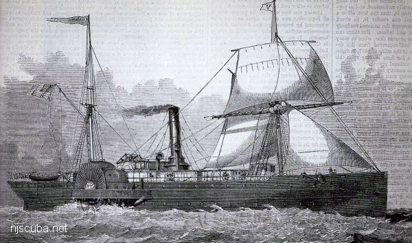
- Type:
- shipwreck, iron-hulled screw steamer
- Built:
- 1881, England
- Specs:
- ( 287 x 37 ft ) 1963 gross tons
- Sunk:
- Saturday September 23, 1882
ran aground - no casualties
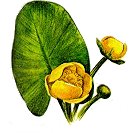
Coast Guard records denote this wreck as "disproved" - no longer there. It was removed as a hazard to navigation. Nuphar is the genus name for Water Lilies.
More: Nuphar ...