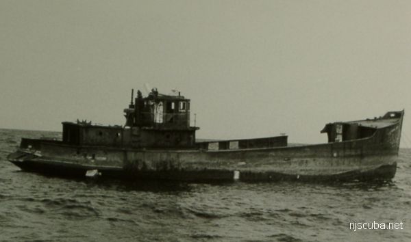
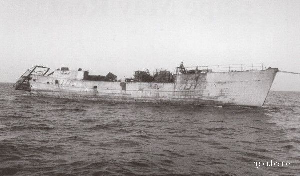
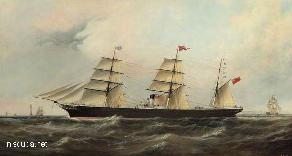
Winthrop
- Type:
- artificial reef, trawler, USA
- Built:
- 1948, Bath Iron Works, Bath, Maine, USA
- Specs:
- ( 117 x 24 ft ) 195 gross tons
- Sponsor:
- Eirek's Dock, Fish America Foundation
- Sunk:
- Wednesday July 12, 1989 - Cape May Artificial Reef
- GPS:
- 38°50.825' -74°43.312'
- Depth:
- 60 ft
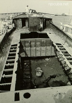
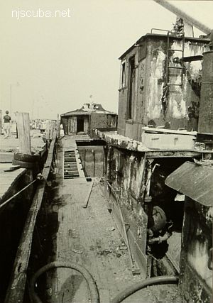
The Winthrop sank at its dock in Cape May and remained there for 5 years before being raised and re-sunk as a reef.
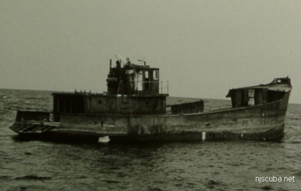
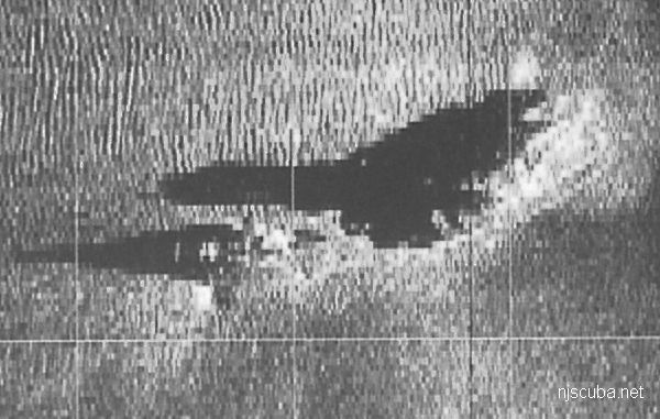
Winthrop was one of twenty sisters built at Bath Iron Works. They were given to the French government under the Marshal Plan to make up for losses to the fishing fleet in World War II. Winthrop is sister to Laita, cousin to Bad Bob's Big Boat.
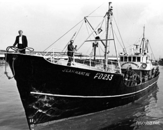
I have been unable to determine which of the original sisters ended up as the Winthrop:
- Charles Massot - 1948
- Gris Brumaire - 1948
- Jean-Pierre Robert - 1948
- Lucien Marie - 1948
- Lucien Gougy - 1948
- Marcel-Peyronnie - 1948
- Jean-Marthe - 1948
- Massabielle - 1948
- Kerolay - 1948
- Steyr - 1948
- St. Pierre Eglise - 1948
- Edouard Goughy - 1948
- Men Gwen - 1948
- Laita - 1948
- Pierre Descelliers - 1948
- Armand Crespin - 1948
- Ker-Ysa - 1949
- Saint Joachim - 1949
- Doux Frimaire - 1949
- Patron Roger Dupuy - 1949
At least I know which one it isn't.
Artificial Reef Sites, Artificial Reefs, Cape May Artificial Reef, New Jersey Artificial Reef Sites, New Jersey Artificial Reefs, Trawlers,
Cape May Artificial Reef
8.5 Nautical Miles off Cape May, 5.34 sq miles
Depth: 50-75 ft [download]
More: Cape May Artificial Reef ...
Cape May Chart
- Absecon Inlet
- USS Akron
- Alex Gibson
- Alexander
- Almirante
- American
- Astra
- Atlantus
- Azua
- Dorothy B Barrett
- Brigantine Beach Wreck
- USS Blenny
- boiler wreck
- Brian C
- Brigantine Inlet
- Brigantine Buoy Wreck
- Charles Morand
- Cape May Inlet
- Cassandra
- Cayru
- Champion
- USS Cherokee
- China Wreck
- City of Athens
- City of Georgetown
- Clermont
- Corson’s Inlet
- William B Diggs
- dredge
- Admiral DuPont
- Elizabeth Warren
- Evening Star
- car float
- Florida
- Galimore's Cayru
- Gory Wreck
- Great Egg Inlet
- Gypsum Prince
- Hereford Inlet
- Hornet
- Hvoslef
- India Arrow
- Indian River Inlet
- USS Jacob Jones
- John Marvin
- China Junk Wreck
- Kennebec
- King Cobra
- Lemuel Burrows
- Lake Frampton
- Lady Mary
- Linda Snow II
- Marine Electric
- Miraflores
- Misty Blue
- Mohawk
- Montgomery
- USS Moonstone
- EF Moran
- Northern Pacific
- Nuphar
- Oklahoma
- Patrice McAllister
- Pet Wreck
- Poseidon
- Ranald
- RJ Walker
- Southern Lillian
- USS S-5
- Salem
- Salem
- San Jose
- Sea Girt
- Shookus
- Sindia
- Slabs
- General Slocum
- Southern Sword
- Townsend's Inlet
- Varanger
- Wayne
- Wily Fox
- YP-387
More: Cape May Dive Sites Chart ...
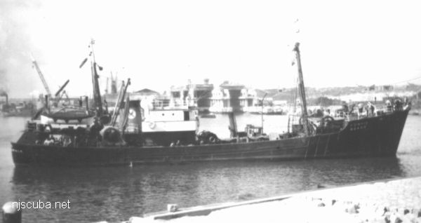
- Type:
- artificial reef, trawler, clam dredge, USA
- Built:
- 1948, Bath Iron Works, Bath, Maine, USA
- Specs:
- ( 117 x 24 ft ) 195 gross tons
- Sponsor:
- Eirek's Dock, Fisherman Magazine
- Sunk:
- Thursday October 16, 1986 - Cape May Artificial Reef
- GPS:
- 38°51.860' -74°42.965'
- Depth:
- 65 ft
More: Laita ...
- Type:
- artificial reef, trawler, USA
- Built:
- 1947, Bath Iron Works, Bath Maine USA
- Specs:
- ( 144x27 ft ) 393 tons
- Sunk:
- Wednesday April 17, 2002 - Moriches Artificial Reef
- Depth:
- GPS:
- 40°43.402' -72°46.659
More: Bad Bob's Big Boat ...
Questions or Inquiries?
Just want to say Hello? Sign the .