Townsend's Inlet Artificial Reef
3.8 nm offshore, 0.69 sq miles
Depth: 50-65 ft [download]
More: Townsend's Inlet Artificial Reef ...
Dive Sites - pick your starting point
More: Dive Sites ...
Townsend's Inlet Artificial Reef
3.8 nm offshore, 0.69 sq miles
Depth: 50-65 ft [download]
More: Townsend's Inlet Artificial Reef ...
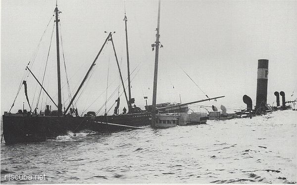
The Train Wheel Wreck is another unidentified wooden schooner. She is located in 120 feet of water only a few miles from the G&D Wreck. According to Jimmy Fazzolare divers will find a pile of train wheels and wooden debris. The Train Wheels must have been cargo. In the center of the wreck is a depression where divers can usually find big lobsters.
More: Train Wheel Wreck ...
More: Triangle Wrecks ...
This wreck is described only as a "Troop Carrier" from World War II. Given its location, I would guess that what is meant by this is most likely a landing craft; probably lost in an accident during an amphibious training exercise by the Army.
More: Troop Carrier ...
12-Mile Artificial Reef
12.0 nautical miles from Moriches and Shinnecock Inlets, 1.33 sq miles
Depth: 123 - 143 ft
More: Twelve-Mile Artificial Reef ...
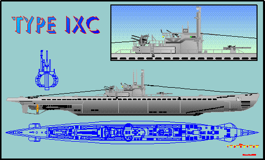
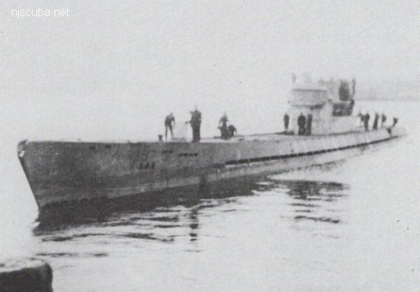
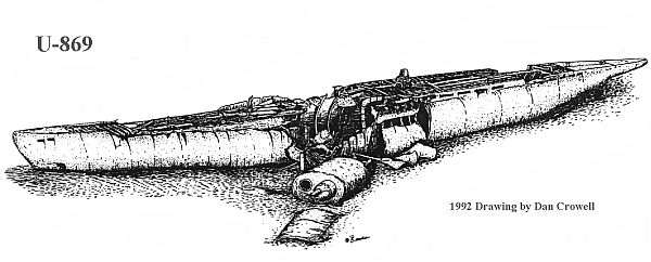
More: U-550 ...
FE327SS/89 -- OPR-C147-HE-89; CONTACT #22 ON SURVEY H-10284/88; DIVER INVESTIGATION FOUND THE REMAINS OF A LARGE WOODEN SHIP OR BARGE COMPLETELY COLLAPSED UPON ITSELF; A LARGE PILE OF BLOCKS, WHICH RESEMBLED BALLAST BLOCKS, REMAINS; DIVER PNEUMATIC DEPTH GAUGE LEAST DEPTH OF 47 FT TAKEN ON TOP OF PILE OF BLOCKS. (ENTERED MSD 7/91)
More: u01 - AWOIS 8087 ...
AWOIS 12966:
H10675/96-97 -- OPR-C399-RU; 200% SIDE-SCAN SONAR LOCATED A LARGE RECTANGULAR, UNCHARTED OBSTRUCTION. DIVERS DESCRIBE A BARGE WITH SURROUNDING SCOUR. BARGE RELIEF IN SCOUR IS 2.4 METERS (8 FEET) BUT NEARLY LEVEL WITH THE BOTTOM. LD OF 8.1 METERS (26 FEET) (ENT 12/23/04, SJV)
More: u02 - AWOIS 12966/11422 ...