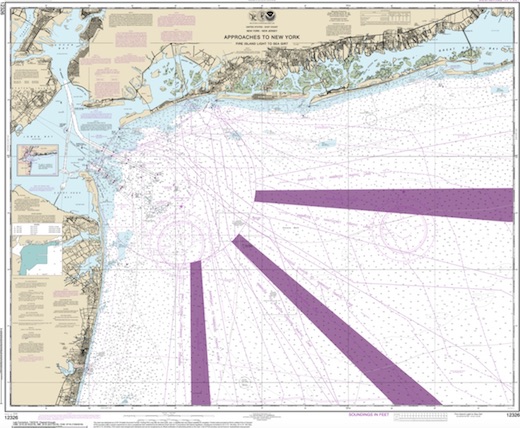
Long Island Central Dive Sites Chart
Long Island - Central Chart
- 3 Sisters
- 3/4 Tug
- 59-Pounder
- Acara
- Across
- Arnoff
- Arundo
- Asfalto
- Ayuruoca
- BA Wreck
- Balaena
- Bald Eagle
- USS Benson
- Beth Dee Bob
- Blue Boy
- Burnside
- Catamount
- Choapa
- coal (Lido)
- Coastwise
- Continent
- Dodger
- Dragger
- Drumelzier
- drydock
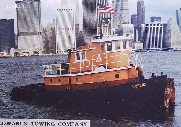
- Edwin Duke / Stone Barge
- dump
- East Rockaway Inlet
- Eureka
- Fire Island Inlet
- Gate City
- Gluckauf
- I.P. Goulandris
- Gypsy
- Happy Days
- Harvey's Schooner
- Howard
- Hylton Castle
- Iberia
- Immaculata
- Irma C
- Jones Inlet
- Jones Tug
- Kenosha
- Kismet Artificial Reef
- Larsen
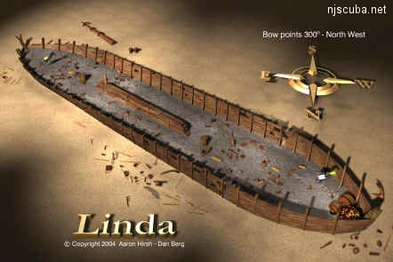
- Linda
- Lizzie D
- Margaret
- R.C. Mohawk
- Moriches Inlet
- Old Yankee
- Oregon
- Pipe Barge
- Ponquogue Bridge
- Ruth Shaw
- Reggie
- Rockaway Belle
- Roda
- USS San Diego
- SC-209
- Sea Wolf
- Shinnecock Inlet
- Sommerstad
- Steel Wreck
- Stolt Dagali
- USS Tarantula
- Train Wheel
- Valerie E
- Wolcott
- Yankee (G+D)
- Yellowbar Artificial Reef
- 3/4 Tug
- 59-Pounder
- Acara
- Ajace
- Arnoff
- Asfalto
- Atlantic Beach Reef ...
- Ayuruoca
- BA Wreck
- Bald Eagle
- Beach Jetties
- Black Warrior
- Bronx Queen
- Bug Light
- Burnside
- Celtic / Cape Race
- Charles Dunlap
- Choapa
- Coastwise
- Coimbra
- Condor
- Continent
- Cornelia Soule
- Dodger
- Dragger
- Drumelzier
- drydock barge
- E. Rockaway Inlet / 8th St
- Ed's Schooner
- Edwin Duke
- Eureka
- Fire Island Inlet
- Fire Island Reef ...
- Fort Victoria
- Glen Island
- Gluckauf
- Goulandris
- Gwendoline Steers
- Happy Days
- Harvey's Schooner
- Hempstead Reef ...
- Howard
- Hudson/East Rivers
- Hylton Castle
- Iberia
- Immaculata
- Inshore Schooner
- Irma C
- Jones Inlet / Wreck
- Kenosha
- Kismet Reef ...
- Lexington
- Lido (Coal Wreck)
- Linda
- Lizzie D
- Long Island Sound Chart ...
- Macedonia
- Maine
- Margaret
- McAllister Reef ...
- Mistletoe
- Moriches Reef ...
- Mud Hole
- Myronus
- New Deal
- Oregon
- Pinta
- Pipe Barge
- Poling Brothers #2
- Princess Anne
- R.C. Mohawk
- Reggie
- Relief Lightship
- Rickseckers
- Robert A Snow
- Rockaway Inlet
- Rockaway Reef ...
- Roda
- Ruth Shaw
- Sandy Hook Pilot
- Sandy Hook Reef ...
- Seawolf
- Shark River Reef ...
- Shrewsbury Rocks
- Steel Wreck
- Stolt Dagali
- Three Sisters
- Train Wheel Wreck
- USS Algol
- USS San Diego
- USS Tarantula
- USS Turner
- Valerie E
- Wolcott
- Yankee (G&D)
- Yankee (Old)
- Yellowbar Reef ...
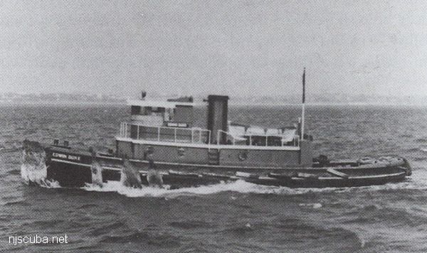
More: Edwin Duke ...
- Type:
- shipwreck, tugboat ?
- Depth:
- 40 ft
This unknown vessel is listed on the charts as "Margaret" and is speculated to be a tugboat. She may be the remains of the Margaret Olsen, a small steam-driven harbor boat, which collided with the tugboat Joseph A. Ginder on May 4, 1929. Visibility is usually pretty poor, 15 ft or less, and current can be a problem, due to the proximity to Deb's Inlet.
More: Margaret ...
- Type:
- shipwreck, schooner, USA
- Built:
- 1886, Rockland ME USA
- Specs:
- ( 225 x 37 ft ) 1556 tons
- Sunk:
- February 8, 1899; unknown
- Depth:
- 23 ft
aka "Derrick Barge"
More: Robert A Snow ...
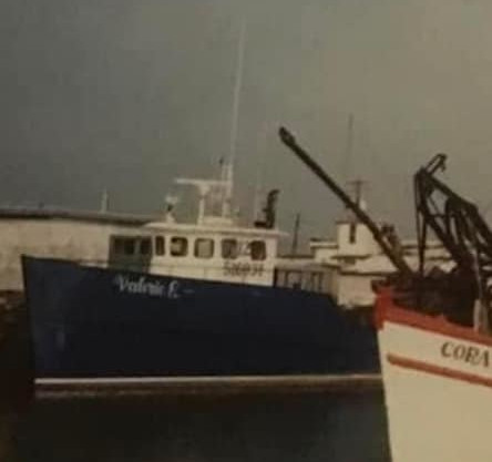
- Type:
- shipwreck, clam dredge
- Built:
- 1968, Kennedy Brown, Palatka FL
- Specs:
- ( 71 ft ) 116 gross tons, 3 crew
- Sunk:
- Thursday January 16, 1992; winter storm - no survivors
- Depth:
- 75 ft
More: Valerie E ...
- Type:
- shipwreck, schooner
- Built:
- 1894, Robert Palmer & Son, Noank CT USA
- Specs:
- 855 tons
- Sunk:
- Sunday April 20, 1913
More: Burnside ...