New Jersey Dive Sites (13/30)

 1  12 13 14  30  

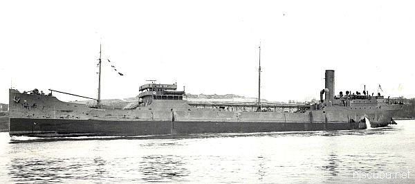
Shipwreck Gulf Trade
Type:
shipwreck, tanker, USA ( Gulf Oil )
Name:
One of a series of ships owned by Gulf Oil company, all named "Gulf ____"
Built:
1920, Chester PA USA
Specs:
( 430 x 59 ft ) 6776 gross tons, 34 crew
Sunk:
Tuesday March 10, 1942
torpedoed by U-588 - 18 casualties
Depth:
bow - 60 ft ; stern - 90 ft

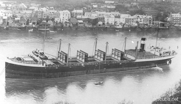
Shipwreck Gypsum Prince
Type:
shipwreck, freighter, England
Built:
1927, England
Specs:
( 347 x 52 ft ) 3915 gross tons, 26 crew
Sunk:
Sunday May 3, 1942
collision with freighter Voco ( 5090 tons) - 6 casualties
Depth:
70 ft

Type:
shipwreck, barge
Depth:


Location courtesy of Capt. Dan Berg


riveted iron hull
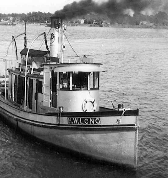
Type:
shipwreck, tugboat
Built:
Globe Shipbuilding, Buffalo NY USA
Specs:
( 53 ft )
Sunk:
circa 1973
GPS:
40°25.433' -73°52.204' (AWOIS 2008)
Depth:
70 ft

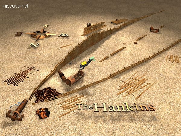
Shipwreck Hankins
The "Big Hankins, " to be precise. Typical of most any schooner barge wreck.
Type:
shipwreck, schooner barge(s)
Sunk:
late 1800s
Depth:
80 ft

Type:
shipwreck, sailing ship
Specs:
965 tons
Sunk:
Wednesday February 17, 1943
possibly collision with barge F.F. Clain
Depth:
80 ft

The Harry Rush is described as a freighter by Krotee, not always the most reliable source. The wreck commonly known as the Harry Rush is a sailing ship. The wreck is the typical three parallel wooden walls, very low-lying, with some steam machinery and chain pile at the west end. The orientation of the wreck is unusual, as if it sank while running for the shore, rather than riding out a storm. The absence of towing bits makes it likely this was a true sailing ship rather than a schooner barge.


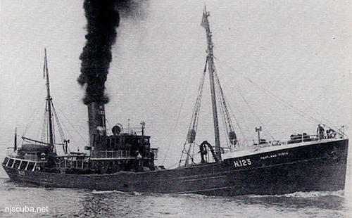
Shipwreck Pentland Firth
Type:
shipwreck, trawler, Royal Navy
Name:
Pentland Firth is the channel between the northern tip of Scotland and the Islands that form Scapa Flow, the great British naval base, and today one of the best wreck diving locales in the world.
Built:
1934, England
Specs:
( 164 x 27 ft ) 485 gross tons
Sunk:
Saturday September 19, 1942
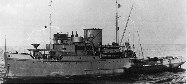
collision with minesweeper trawler USS Chaffinch (400 tons) - ? casualties
GPS:
40°25.433' -73°52.204' (AWOIS 1991)
Depth:
70 ft

Type:
shipwreck, barge
Specs:
( 70 ft )
Depth:
50 ft

intact, steel


Hudson & East Rivers
The Verrazano Narrows at the mouth of the Hudson River.

Looking roughly south: Sandy Hook is barely visible at upper-right, Rockaway inlet at the upper-left, Brooklyn at lower-left, Staten Island at lower-right. The shipping channel is also plainly obvious.


New Jersey Dive Sites

 1  12 13 14  30  

Humpback Whale

Megaptera novaeangliae

Size: to 50 ft

Habitat: oceanic

Notes:
These are most often seen from charter boats, and are certainly the most common large whales in the area. Occasionally one may even be spotted from shore. The popular notion of a whale song is actually the vocalization of these whales.

Printed from njscuba.net