
Townsend's Inlet Artificial Reef
Townsend's Inlet Artificial Reef
3.8 nm offshore, 0.69 sq miles
Depth: 50-65 ft [download]
DEP ADDING NEW REEF SITE OUTSIDE OF TOWNSENDS INLET
February 6, 2006
The New Jersey Department of Environmental Protection announced it would build a new reef site off the coast of Cape May County to enhance its nationally recognized network of 15 artificial reefs while strengthening marine resources, improving recreational opportunities, and boosting the state's economy.
Recently approved by the U.S. Army Corps of Engineers, construction of the reef, to be situated approximately 3.8 nautical miles southeast of Townsends Inlet in Cape May County, will be funded almost entirely through private donations. Some 800 reef-ball habitats are scheduled for deployment this summer on the Townsends Inlet reef site.
The reef site measures slightly more than one-half square mile with a depth between 49 feet and 66 feet. Its inshore portion will be used as a drift fishing area; the offshore portion will be reserved for vessels to accommodate diving. The new reef will become part of the state's Artificial Reef Program, administered by the DEP's Division of Fish and Wildlife.
Artificial reefs play a key role in supporting New Jersey's marine fishing and diving industries and contribute more than $50 million to the state's economy every year. These reefs also benefit the environment by providing new habitat for marine life. In fact, one out of every five fish reeled in by recreational anglers in New Jersey's salt waters during 2000 was caught on a reef site.

Approximately 1,100 tons of concrete castings, pipes and culverts were deployed in July 2006 to construct a "drift fishing" area on the reef site. 700 concrete reef balls were also placed on the reef.
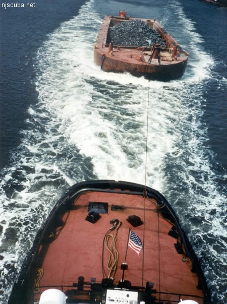
All manner of concrete, steel, and stone rubble from dredging, demolition projects, and other construction is used as artificial reef materials. This material is generally available at very low cost or free from construction companies who are more than happy to get rid of it. Transportation costs determine where this material is used by the Reef Program.
More: Rock & Rubble ...
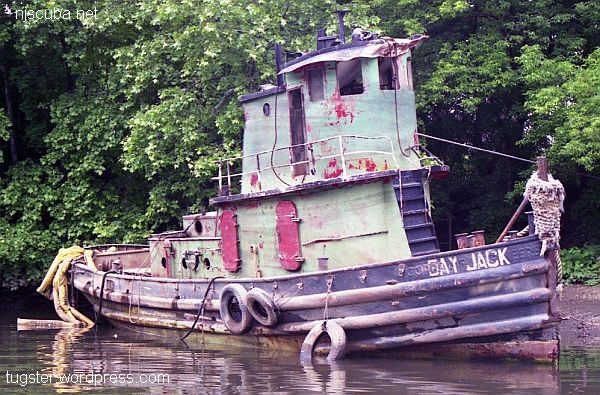
- Type:
- artificial reef, tugboat - USACE
- Built:
- 1941, Bay Shipbuilding, Sturgeon Bay, WI as Escort
- Specs:
- ( 56 x 14 ft ) 34 tons
- Sunk:
- November 2005 - Townsends Inlet Artificial Reef
- Sponsor:
- GPS:
- 39°06.450' -74°36.020'
- Depth:
- 60 ft
More: Bay Jack ...
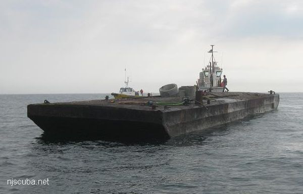
- Type:
- artificial reef, barge (2)
- Specs:
- ( 90 x 28 ft )
- Sunk:
- Saturday June 12, 2010 - Townsends Inlet Artificial Reef
- GPS:
- 39°06.543' -74°36.249'
More: Howard Bahnsen ...
- Type:
- artificial reef, barge (3)
- Specs:
- ( unknown )
- Sunk:
- Thursday May 16, 2019 - Townsends Inlet Artificial Reef
- GPS:
-
39°06.446' -74°36.429'
39°06.479' -74°36.316'
39°06.452' -74°36.455'
There was never any public notice of these sinkings, although they appeared later in lists.
More: Strathmere barges ...
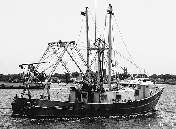
- Type:
- artificial reef, trawler
- Built:
- 1973, Seaman Shipbuilding, Bayou La Batre AL
- Specs:
- ( 77 ft ) 132 gross tons
- Sponsor:
- Mr. Nam Win, Cape May County Charter and Party Boat Association, Sportfishing Fund
- Sunk:
- Tuesday May 30, 2017 - Townsends Inlet Artificial Reef
- GPS:
- 39°06.500' -74°36.300'
- Depth:
- 60 ft
More: Fishermans Dream ...
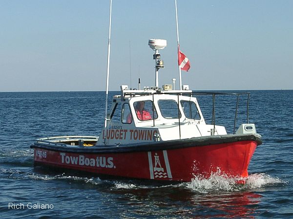
- Type:
- artificial reef, tow boat
- Built:
- 1956
- Specs:
- ( 30 ft )
- Sunk:
- Tuesday July 18, 2006 - Townsends Inlet Artificial Reef
- Sponsor:
- Budget Towing - Point Pleasant / TowBoatUS / Friends of Margie Starns
- GPS:
- 39°06.306' -74°36.471'
- Depth:
More: Heavy Metal ...