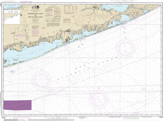
Long Island East Dive Sites Chart
Long Island - East Chart
- 3/4 Tug
- Amsterdam
- Andrea Doria
- Atlantic
- USS Baldwin
- Barataria
- USS Bass
- Black Point
- Burnside
- Coastwise
- Coimbra
- HMS Culloden
- Defender
- Dodger
- John A. Downs
- Essex
- USS G-1
- USS G-2
- Gate City
- Gluckauf
- Grecian
- Horton's Point / Commodore
- Hylton Castle
- John C. Fitzpatrick
- Kenosha
- Kismet Artificial Reef
- USS L-8
- Larchmont
- Lexington
- Lightburne
- Linda
- Maiden Creek
- Malden
- Mattituck Inlet
- Mattituck Artificial Reef
- Montauk Inlet
- Moriches Inlet
- Mount Sinai Harbor
- Myronus
- Norness
- USS Ohio
- Old Yankee
- Olinda
- Oregon
- Panther
- Pinnacle
- Ponquogue Bridge
- Port Jefferson Artificial Reef
- Port Jefferson Inlet
- Puszta
- Reggie
- Republic
- USS San Diego
- Sea Wolf
- Sebastian
- Shinnecock Inlet
- Shoreham Nuclear Power Plant
- Smithtown Artificial Reef
- Snug Harbor
- USS Spikefish
- Suffolk
- USS Tarantula
- Tennyson
- Thames
- Thelma Phoebe
- U-853
- Volund
- Block Island Wind Farm
- Wolcott
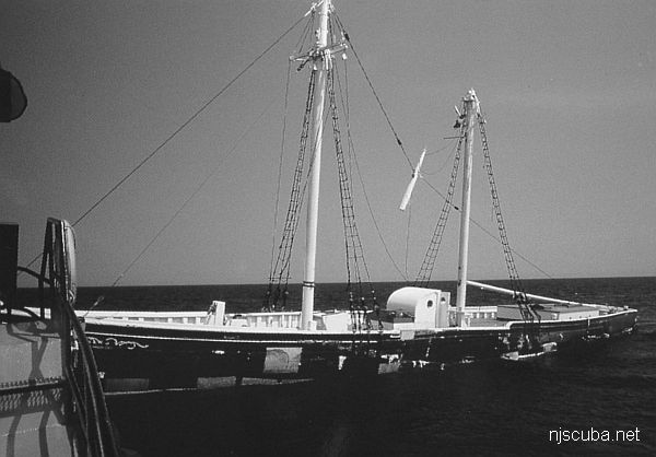
12-Mile Artificial Reef
12.0 nautical miles from Moriches and Shinnecock Inlets, 1.33 sq miles
Depth: 123 - 143 ft
More: Twelve-Mile Artificial Reef ...
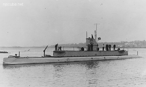
- Type:
- shipwreck, submarine, U.S. Navy
- Built:
- 1911, Lake Torpedo Boat Company, Newport News, VA USA
- Specs:
- ( 161 x 13 ft ) 400 tons, no crew
- Sunk:
- Tuesday June 21, 1921, deliberate - weapons test
More: USS G-1 SS-19 ...
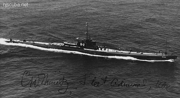
- Type:
- shipwreck, submarine, U.S. Navy
- Built:
- 1924, Portsmouth Navy Yard, NH USA
- Specs:
- ( 341 x 28 ft ) 2000 displacement tons, no crew
- Sunk:
- Monday March 12, 1945
deliberate - weapons test - Depth:
- 155 ft - sand ; 140 ft - deck ; 120 ft - conning tower
More: USS Bass V-2 / SS-64 ...
- Type:
- shipwreck, tugboat, USA
- Built:
- 1937, Bethlehem Beaumont, Beaumont TX USA
- Specs:
- ( 68 ft ) 4 crew
- Sunk:
- Tuesday November 25, 1971
structural failure during storm due to improper modifications - 2 casualties - Depth:
- 136 ft
More: Barataria ...
Shinnecock Inlet
The Shinnecock Inlet is located in the Hampton Bays on Long Island. The inlet is one of the only major inlets on the south shore and sees a great deal of boat traffic during the summer months. With that in mind, this inlet also sees a great deal of diver traffic as well.
More: Shinnecock Inlet ...