R.C. Mohawk (1/2)
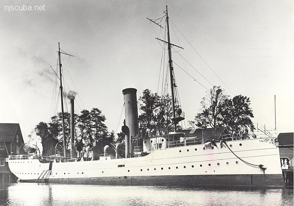
- Type:
- shipwreck, revenue cutter, U.S. Revenue Service, on loan to U.S. Navy
- Name:
- A tribe of Iroquoian Indians of the eastern New York area.
- Built:
- 1902, William R. Trigg, Richmond VA USA
- Specs:
- ( 206 x 32 ft ) 980 gross tons, 77 crew
- Sunk:
- Monday October 1, 1917
collision with tanker Vennachar - no casualties - GPS:
- 40°25.025' -73°45.158' (AWOIS 2010)
- Depth:
- 100 ft

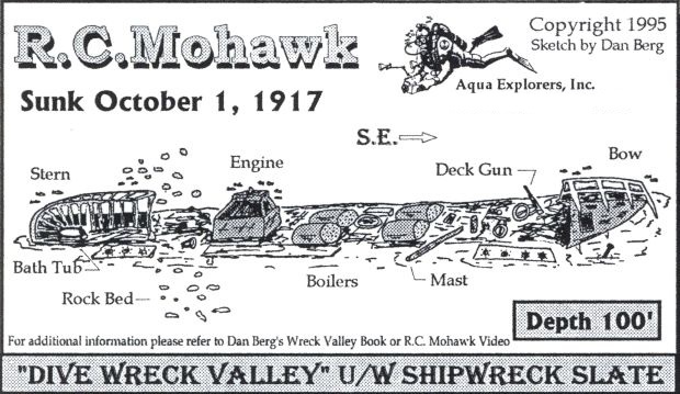
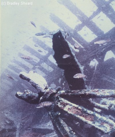
The U.S. Revenue Service later became the Coast Guard. The Revenue Cutter Mohawk was armed with several large guns for its law enforcement role. It also participated in many rescues at sea along the New Jersey and Long Island coastlines. The RC Mohawk today is a debris field. Unfortunately, the wreck site is located on the edge of the former 12 Mile Dumping Ground and is therefore not a recommended dive site. ( see Coney Island )
Mohawk, 1904
A Native American people formerly inhabiting northeast New York along the Mohawk and upper Hudson valleys north to the St. Lawrence River, with present-day populations chiefly in southern Ontario and extreme northern New York. The Mohawk were the easternmost member of the Iroquois confederacy.
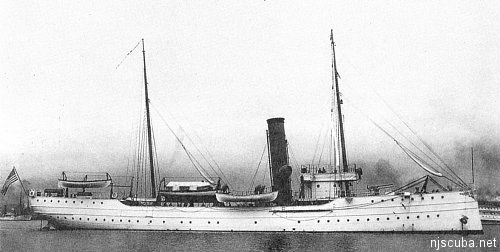
Builder: William R. Trigg, Richmond, Virginia
Length: 205' 6"
Beam: 32', Draft: 12' 7", Displacement: 980 (1905), Cost:
Commissioned: 10 May 1904
Decommissioned: Sank, 1 October 1917
Disposition: Sank after a collision off Sandy Hook, New Jersey
Machinery: Triple-expansion steam, 25", 37 1/2 ", and 56 1/4 " diameter x 30" stroke
Complement: 8 officers, 63 enlisted
Electronics: 1 x 2-kilowatt radio set
Armament: 2 x 6-pound rapid-fire guns (1907), 4 x 6-pound rapid-fire guns (1914)
Cutter History:
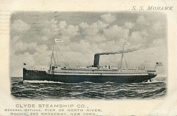
The Mohawk, a 205-foot steel-hulled "First Class Cruising Cutter, " was placed in commission at Arundel Cove, Maryland, on 10 May 1904, under the command of Captain Worth G. Ross. Her assigned signal letters were "G. V. F. T." On 17 May she was ordered to Jersey City, New Jersey. She set sail on 23 May, coaled at Norfolk, Virginia on 25 May, and arrived at Tompkinsville, New York, on 27 May. Tompkinsville was her "headquarters" or home port. She arrived at Jersey City on 28 May 1904 and was ordered to make a "trial trip" on 11 July 1904, arriving at Tompkinsville that day. On 13 July she sailed for the New England coast. The Mohawk returned to Tompkinsville on 28 July 1904 and was ordered to "proceed with command" to Newport and then to Portland.
The Mohawk's primary cruising grounds were off the coast between Nantucket Shoals and the Delaware breakwater. Her primary duties included "assisting vessels in distress and enforcing the various navigation laws, " including patrolling regattas. She destroyed or removed any derelicts or other hazards to navigation she located and undertook "winter cruises" as ordered each year.
She received her winter cruising orders on 30 November. On 18 January 1905, while conducting her winter cruise, her cruising grounds were extended to include the Capes of Virginia and Norfolk. On 9 February Mohawk was ordered to confine her operations to her regular cruising limits. On 1 April 1905 Captain Byron L. Reed took over command from Captain Ross, who had been appointed as the Chief of the Revenue Cutter Service. The Mohawk then underwent an overhaul at Woods Hole.
On 20 April 1905, she sailed for New London, Connecticut, and participated in the 6 May 1905 dedication of the Winthrop Monument. She sailed to Poughkeepsie, New York to enforce the rules and regulations in connection with a 28 June regatta. She was ordered to be in the vicinity of Flushing Bay, Long Island, to enforce the rules and regulations in connection with a 22 July 1905 regatta in that bay. On 27 July Mohawk was ordered to be at Whitestone, New York, by noon on 30 July, for the "purpose of receiving on board Captain Worth G. Ross, Chief of Division, R.C.S. Movement of vessel to be governed by such instructions as he may give."
On 25 August 1905 the steamer Barnes was reported ashore 1 3/4 miles from the Jones Beach Life-Saving Station and Mohawk was ordered to "proceed at once" to that area. On 4 October she was ordered to extend her cruise to the east as far as Provincetown, Massachusetts. On 19 October she was ordered to procure "at once sufficient dynamite or other explosives and proceed without delay to latitude 42d 17', longitude 62d 23', search for and destroy abandoned bark reported October 17 by steamer Teutonic, in the path of European vessels." However, on 21 October the Collector of Customs at Newport, Rhode Island, was ordered to notify Mohawk that the abandoned bark was in fact being towed by another ship to Halifax, Nova Scotia, and so was no longer a danger to navigation.
On 10 November Mohawk received orders to begin her winter cruise starting on 1 December 1905. Her cruising ground consisted of "New York, outside of Long Island to Vineyard Haven, and Nantucket Shoals and to southward to Delaware Breakwater." She sailed from Sandy Hook at noon on 1 December and proceeded to New London. The next year, in April, Mohawk was overhauled at Woods Hole. She patrolled the regatta at Poughkeepsie on 23 June 1906 and on 28 June she patrolled the Yale-Harvard regatta. She was then ordered to Flushing Bay, Long Island, to "assist" at the 30 June regatta.
She spent the next 15 years destroying derelicts, patrolling regattas, boarding merchant vessels, conducting search and rescue operations, and sailing on winter cruises. Some of her more unique operations included transporting President Howard Taft on 26 April 1912 from the "Recreation Pier" at West 50th Street, New York City, to Governors Island and back for the funeral of President Ulysses S. Grant's son, Major General Frederick Dent Grant. In September of that same year, she received on board Dr. George Styles of the Department of Agriculture and participated in a study of the bottom of the Potomac River. On 12 June 1914, she took aboard the Captain Commandant, Captain Commandant Ellsworth P. Bertholf, and a "Representative Adamson."
On 5 August 1914, she was assigned to enforce the country's neutrality laws and to board all foreign vessels leaving port. She was relieved of that duty on 19 March 1915 to resume a regular winter cruise. On 5 May 1915, she was assigned to the Pan American Financial Congress and President Woodrow Wilson's review of naval forces that took place on 8 May 1915. She grounded on Bartlett Reef, Long Island Sound, and underwent repairs.
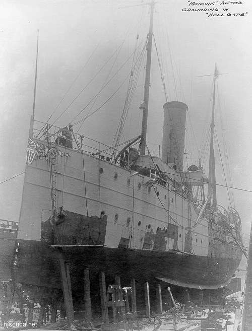
The Mohawk was "temporarily" transferred to the operational control of the US Navy after the US declared war on Germany on 6 April 1917. She retained her Coast Guard crew. The Mohawk was assigned to New York and patrolled the waters off the entrance to New York Harbor.
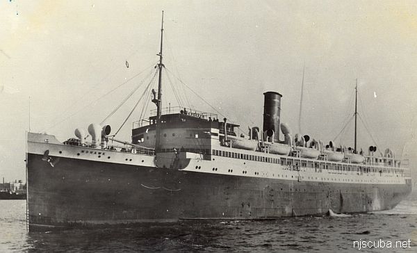
The cutter collided with the British tanker SS Vennacher (sic) off Sandy Hook, New Jersey on 1 October 1917. According to the Navy's report of the incident:
"The British vessel struck the Mohawk nearly at right angles, her stem cutting into the side amidships, abreast the engine room, between the launch davits, smashing the surf boat and cutting into the ship's side to such an extent that the use of a collision mat was out of the question ... Pumps were started at once, the general alarm sounded and all hands called to take stations for abandoning ship."
The cutter filled rapidly and began settling by the stern. Despite the severity of the collision all 77 of her crew were rescued by the USS Mohican (SP-117) and the USS Sabalo (SP-255). The USS Bridge (AF-1) arrived on the scene and attached a cable to Mohawk's bow bit. She then attempted to tow Mohawk into shallow water. Before rescuers were able to generate any forward movement, however, they noticed that Mohawk had begun to sink rapidly and list heavily to port. The commanding officer of the bridge was forced to cut the tow line and throw both engines into full speed ahead to get clear. " With her bow high in the air, the Mohawk settled slowly emitting quantities of smoke." She sank within one hour of the collision in 100 feet of water.
The salvage rights to her sunken wreck were sold to the H.L. Gotham Corporation, of 15 Park Row in New York City, on 7 February 1921 for $111.00.
Commanding Officers:
- Captain Byron L. Reed, 1 April 1905 - 19 October 1908
- Captain Stanley M. Landrey, 19 October 1908 - 1 November 1911
- First Lieutenant Joseph H. Crozier, 1 November 1911 - 26 August 1913
- Captain Francis S. Van Boskerck, 26 August 1913 - 2 October 1914
- Captain James. G. Ballinger, 2 October 1916 - 1 October 1917
from Coast Guard Records

Questions or Inquiries?
Just want to say Hello? Sign the .