Artificial Reefs
Artificial Reefs
- Home ...
- Dive Sites ...
- Artificial Reefs ...
- Marine Biology ...
- Artifacts ...
- Gear & Training ...
- Blog ...
- Cozumel ...
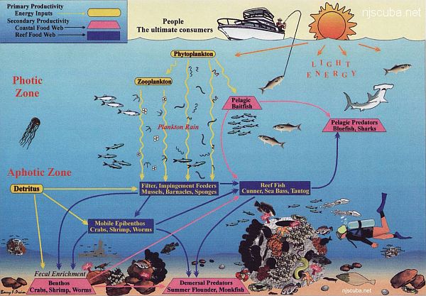
Throughout this website, you have probably found many references to artificial reefs. An artificial reef is any man-made object placed in the sea as a habitat for marine organisms. Sealife is drawn like a magnet to any large object in the otherwise featureless bottom sand. Almost anything will do, but objects that can withstand the corrosive effects of saltwater are best.
The objective of artificial reefs is to create hard structure habitat for mussels, Sea Bass, Blackfish, Porgy, lobster, and many other species of marine life. Once fish and shellfish establish themselves in their new homes - and it doesn't take long - the reefs produce excellent catches of fish for anglers and provide underwater attractions for scuba divers.
A Note on the "Numbers" Here
Artificial reef numbers are public record. That doesn't mean they are always easy to find. New York and Delaware are lackadaisical about publishing reef information, and often do so in ways that cannot be indexed by search engines. As of late, New Jersey keeps some reef sites secret for 'science'. * Reef numbers published in this site are accurate and precise as far as I know.
* Which I assume means private fishing
holes for politicians, staff and sponsors.
About the Charts
The thin red line is the state jurisdiction, nominally 3 nautical miles from shore. This is important for fishing and lobstering, as regulations vary from state to state. Outside the 3-mile limit Federal regulations apply. The thin blue line is 12 nautical miles from shore, which was once the Federal limit, now 200 miles. The pink bars are the shipping lanes. Contour depths are meters. 'Natural' shipwrecks are depicted with a wreck symbol.
Only vessels and large items of interest are shown. Not shown are all the rock and concrete drops that make up the vast bulk of reef material. Look at the states charts to see that, it would be much too messy here.
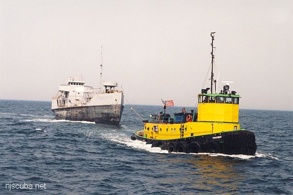
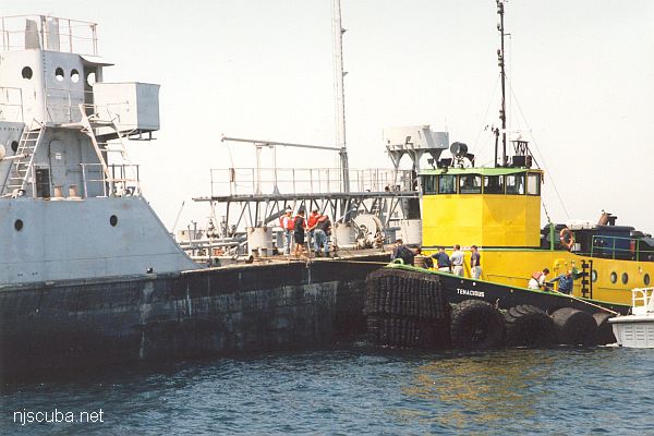
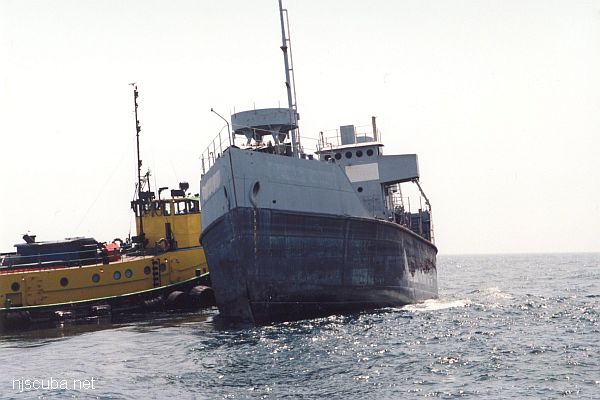
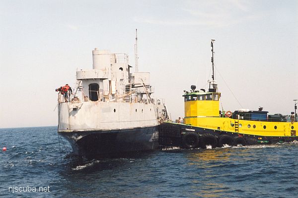
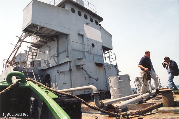
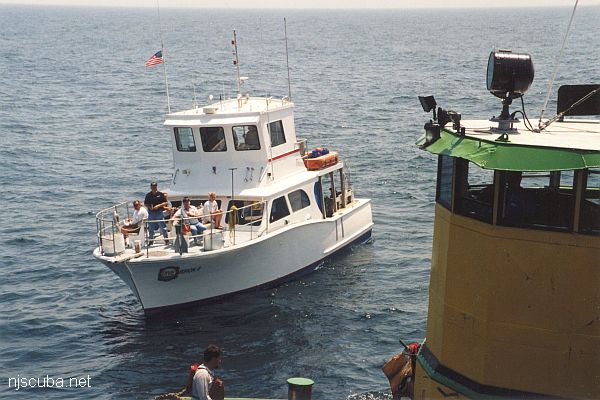
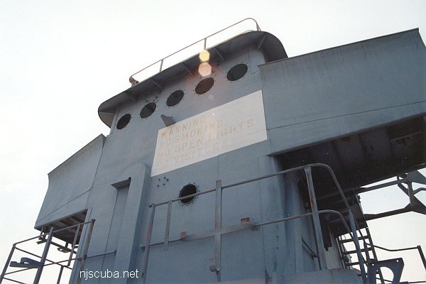
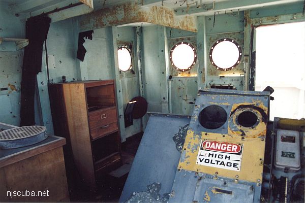
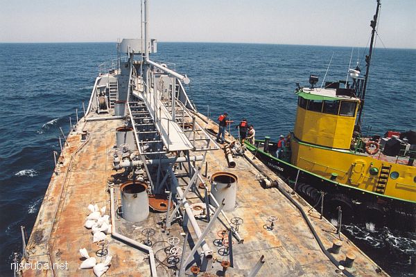
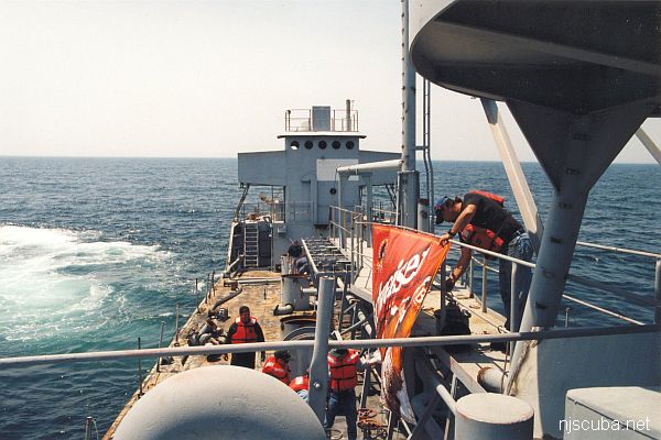
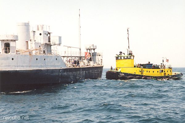
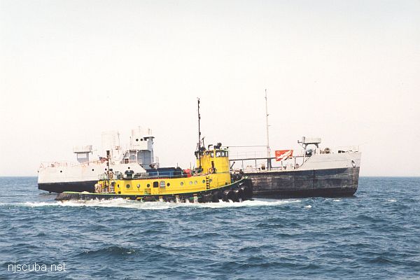
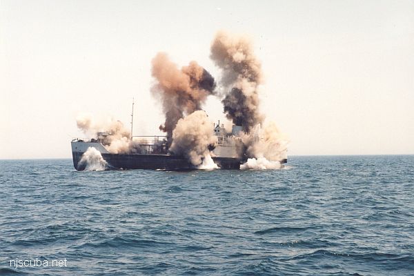
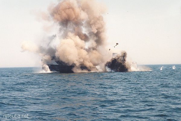
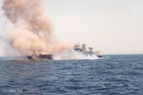
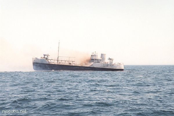
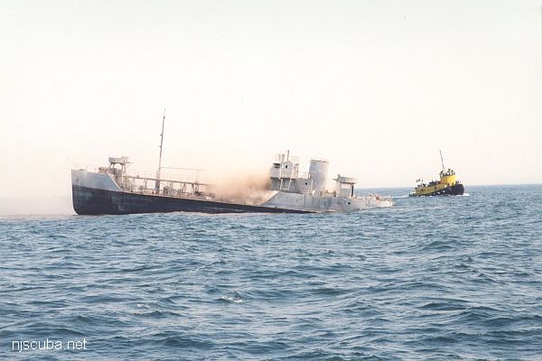
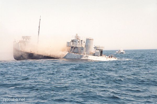
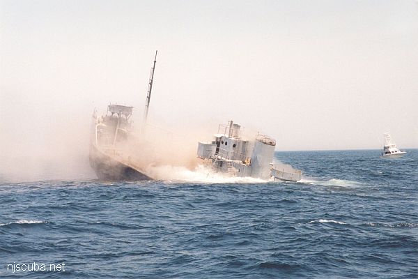
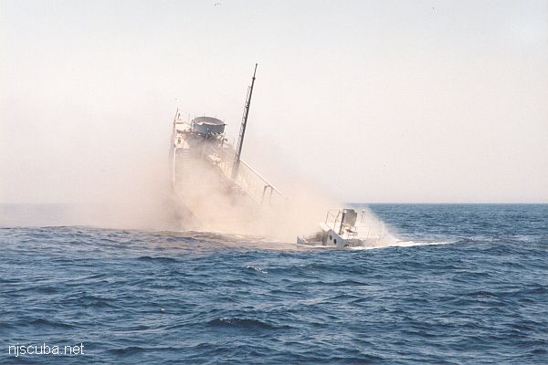
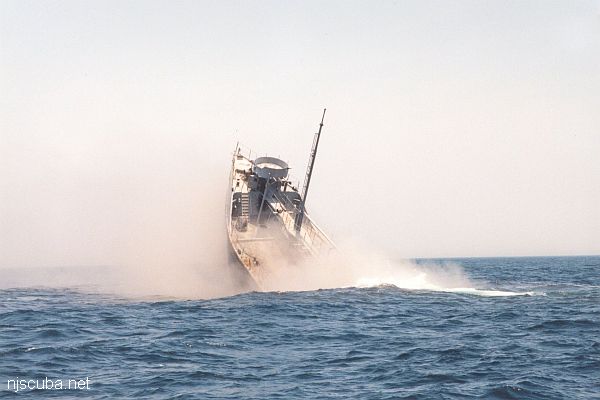
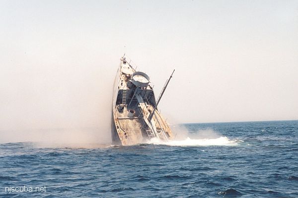
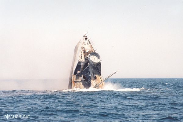
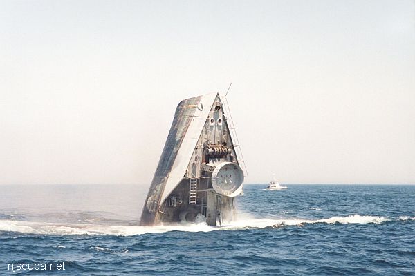
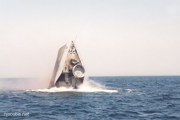
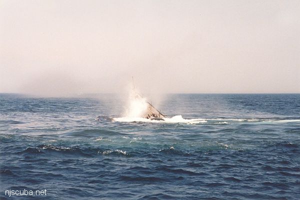
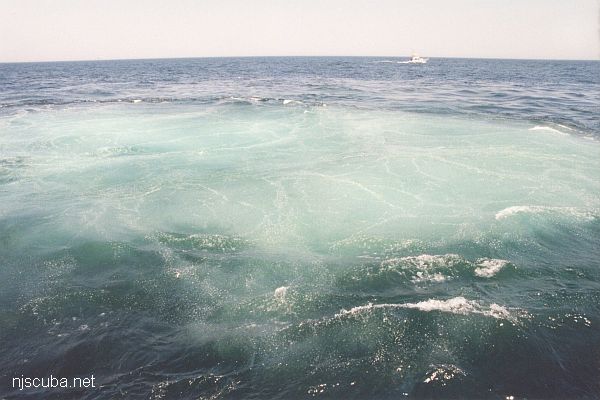
Sinking the ‘Captain Bart’
New Jersey Artificial Reef Sites
- Atlantic City Reef ...
- Axel Carlson Reef ...
- Barnegat Light Reef ...
- Cape May Reef ...
- Deepwater Reef ...
- Delaware Bay Reef
- Garden State N Reef ...
- Garden State S Reef ...
- Great Egg Reef ...
- Little Egg Reef ...
- Manasquan Reef ...
- Ocean City Reef ...
- Sandy Hook Reef ...
- Sea Girt Reef ...
- Shark River Reef ...
- Townsend's Inlet Reef ...
- Wildwood Reef ...
New York Artificial Reef Sites
- Atlantic Beach Reef ...
- Fire Island Reef ...
- Hempstead Reef ...
- Huntington Reef
- Kismet Reef ...
- Matinecock Reef ...
- Mattituck Reef ...
- McAllister Reef ...
- Moriches Reef ...
- Port Jefferson Reef ...
- Rockaway Reef ...
- Shinnecock Reef ...
- Sixteen Fathom Reef
- Smithtown Reef ...
- Twelve-Mile Reef ...
- Yellowbar Reef ...
Delaware Artificial Reef Sites
About the Charts
The red line is the state jurisdiction, nominally 3 nautical miles from shore. This is important for fishing and lobstering, as regulations vary from state to state. Outside the 3-mile limit Federal regulations apply. The blue line is 12 nautical miles from shore, which was once the Federal limit, now 200 miles. The pink bars are the shipping lanes.
The two depth contours on the charts were traced off a digital map of doubtful accuracy. The inner one varies between 100 and 200 feet, check nearby wrecks for a better estimate. The outer contour is the edge of the continental shelf, beyond which the depth increases rapidly to thousands of feet.
All artificial reef activities are controlled by the Army Corps of Engineers, which issues permits for specified materials to be sunk only in specified locations, to avoid creating hazards to navigation. Once a permit for an area is issued, the state may build the reef as it sees fit with little more involvement from the ACOE. Permits must be renewed periodically. The chart above indicates permitted areas in three states, as well as the main approaches to New York harbor. One of the difficulties in selecting a location for a reef is obvious - any place inside the heavily trafficked shipping lanes is out of the question. (Update: used to be out of the question.)
Now with GPS numbers!
Artificial Reef Activity by State
| State ( N to S ) | Population ( 2001 est. ) | Ocean Coastline | # Vessels ( 2005 ) |
| New England | no significant artificial reef building activity | ||
| New York | 19.0 million | 127 miles | ~ 65 |
| New Jersey | 8.5 million | 130 miles | 131 |
| Delaware | 0.8 million | 28 miles | ~ 3? |
| Maryland | 5.4 million | 31 miles | ~ 3? |
| Virginia | 7.2 million | 112 miles | ~ 12 |
| North Carolina | 8.2 million | 301 miles | ~ 35 |
| South Carolina | 4.0 million | 187 miles | ~ 100 |
| Georgia | 8.4 million | 100 miles | ~ 41 |
| Florida (including Gulf) | 16.4 million | 1350 miles | ~ 380 |
| California | 34.5 million | 840 miles | < 10 |
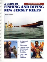
A Guide to Fishing & Diving New Jersey Reefs
NJ Division of Fish & Wildlife, 3rd edition
Includes GPS numbers for all reef sites.
Download your copy of the 3rd edition here. This invaluable book has been out of print for years.
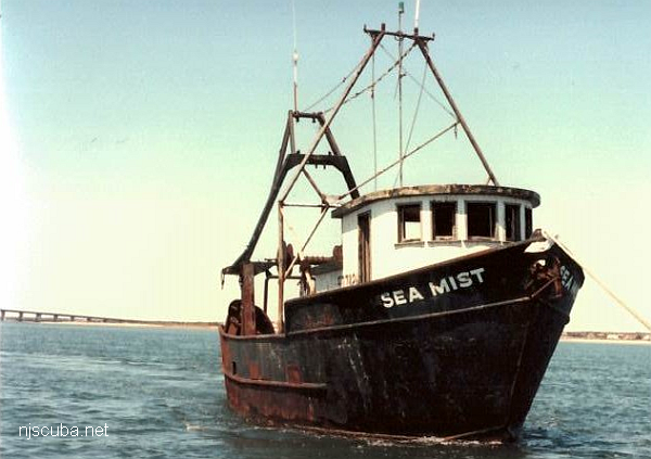
- Type:
- artificial reef, trawler, USA
- Built:
- 1976, Belhaven, NC USA ?
- Specs:
- ( 55 ft )
- Sunk:
- Saturday April 23, 1994 - Shinnecock Artificial Reef
- Depth:
- GPS:
- 40°48.173' -72°28.489'
More: Sea Mist ...
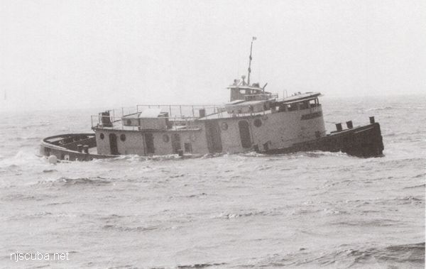
- Type:
- artificial reef, tugboat
- Built:
- 1951, Matton Shipyard, Cohoes NY USA as Edward Matton
- Specs:
- ( 85 x 23 ft )
- Sponsor:
- Ocean Wreck Divers
- Sunk:
- Tuesday September 12, 2000 - Axel Carlson Artificial Reef
- GPS:
- 40°02.473' -73°59.599'
- Depth:
- 80 ft, top at 60 ft
More: Patrick McHugh ...
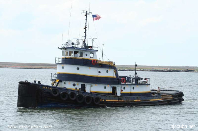
- Type:
- artificial reef, tugboat
- Built:
- 1941, T.S. Marvel Shipbuilding, Newburgh NY as Carrie T. Meseck
- Specs:
- ( 97 x 27 ft )
- Sponsor:
- Carbon Service Corp, GDF, Vincent Pessolano family
- Sunk:
- Thursday September 29, 1994 - Garden State North Artificial Reef
- GPS:
- 39°37.697' -74°01.113'
- Depth:
- 80 ft
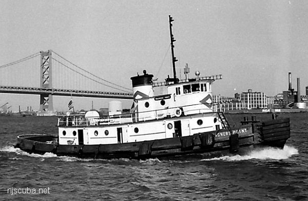
More: Wagner's Point ...
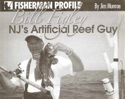
I finally added two "new" artificial reefs, the Carrabassett on the Axel Carlson Reef and the New England Coast on the Shark River Reef. I have been waiting patiently for the numbers to be released, and was just informed that these two sites are undergoing "a period of successional development and monitoring" before publication. These studies were never announced at the time, in fact the New England Coast was kept out of the newspapers entirely, obviously so the science would not be tainted by the public. I imagine this study is a lot like this one, conducted by NJDEP fisheries biologists Jennifer Resciniti and Bill Figley over the course of 8 years, published in 2003.
More: "New" Artificial Reefs ...
Editor's Note:
The New Jersey fishing community owes a world of gratitude to Bill Figley for his tireless service on behalf of recreational angling in the state. Considered the patriarch of the artificial reef program, his model of excellence created over two decades in New Jersey has since been emulated by other states along the East Coast.
New Reef Proposal
This is my modest proposal for a new reef site that could be shared between New York And New Jersey, something that first occurred to me over 20 years ago. As drawn, it is about one square mile. This site has a lot of advantages:
More: New Reef Proposal ...