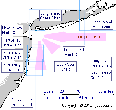
New Jersey Dive Sites (4/30)
More: New Jersey Dive Sites ...
- Type:
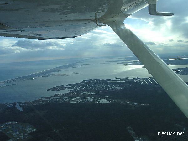
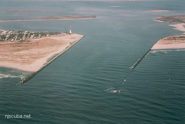
- major ocean inlet with strong current, surf, and heavy boat traffic
- Depth:
- 45 ft
More: Barnegat Inlet ...
Depth: 50-60 ft
More: Barnegat Light Artificial Reef ...
from AWOIS:
H10224/86 -- OPR-C121-WH-86; WRECKAGE WITH 52 FT PNEUMATIC DEPTH GAUGE LEAST DEPTH, WHICH IS BELIEVED TO BE THIS ITEM, APPROXIMATELY 100M SW OF AWOIS POSITION; DIVERS FOUND THE WRECK OF A BARGE, APPROXIMATELY 20 X 45 M; THREE BOILERS AND NUMEROUS OTHER TYPES OF SHIPYARD DEBRIS WERE FOUND STREWN OVER AN AREA OF 360 X 165 FT; IN THE NW CORNER OF THE SITE THE REMAINS OF ANOTHER WRECK WAS FOUND WITH ONLY THE SHELL PLATING AND FLOOR FRAMING REMAINING; APPROXIMATELY 200 FT LONG, 27 FT BEAM AND SHELL PLATING EXTENDING 5 FT ABOVE THE BOTTOM; BOTH ENDS OF THE WRECK TAPERED INTO THE SAND WITH NO BOW OR STERN VISIBLE; ONE OBJECT CONSISTING OF GUARD RAIL TYPE METAL, APPROXIMATELY 2 FT WIDE, 3/8 INCH THICK, AND 40 FT LONG, FORMING A 60 DEGREE ARCH WITH THE MIDDLE STANDING 10 FT OFF THE BOTTOM; SITE CONSISTED OF TWO WRECKS AND SHIPYARD DEBRIS, INCLUDING A BOOM CRANE; LEAST DEPTH TAKEN ON THE TOP OF THE BOILER LOCATED AT THE NORTHEAST SECTION OF SITE. (UPDATED MSD 4/91)
More: BD 1738 ...
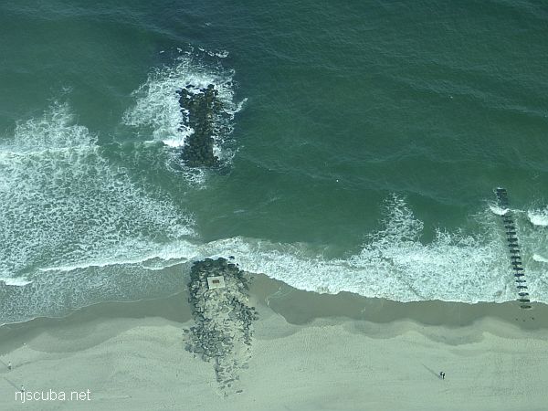
Dozens of jetties up and down the coast have been cut-though at the base like this one, making them inaccessible to fishermen, but not divers !
More: Beach Jetties ...
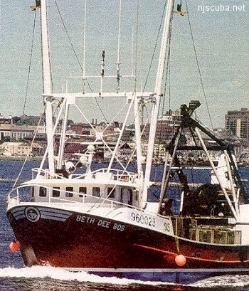
- Type:
- shipwreck, clam dredge, USA
- Built:
- 1990, Bock Marine - Beaufort NC USA
- Specs:
- ( 84 ft ) 96 tons, 4 crew
- Sunk:
- Wednesday January 6, 1999
foundered in rough seas - no survivors - Depth:
- 120 ft
More: Beth Dee Bob ...
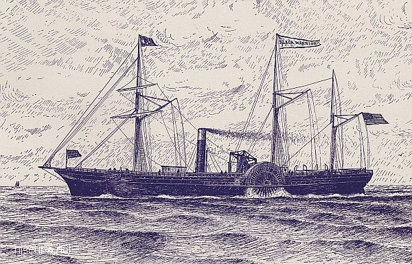
- Type:
- shipwreck, steamer, USA
- Built:
- 1852, New York NY USA
- Specs:
- ( 225 x 37 ft ) 1556 gross tons
- Sunk:
- Sunday February 20, 1859
ran aground in fog - no casualties - GPS:
- 40°25.641' -73°51.135' (AWOIS 2003)
- Depth:
- 35 ft
More: Black Warrior ...
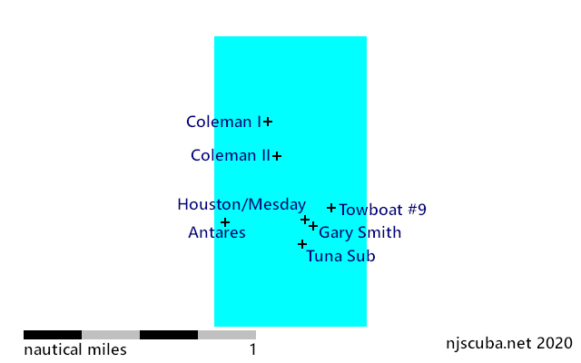
- Type:
- shipwreck, dry-dock barge
- Depth:
I don't know the reason for this offshore barge's name, other than it might well be the real one. Nevertheless, this wood barge, sometimes called a dry dock lies in 120+ of water and is usually a very good lobster dive, albeit a deeper one. Bottom visibility is often cloudy to poor. It's not the best bottom conditions here, but a careful and advanced certified diver can bring home a lot of lobsters for dinner with a dive here. This spot isn't frequently dived.
More: Blue Boy ...
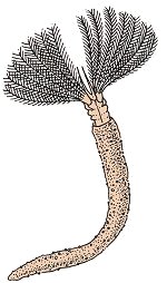
Tube worms live with their bodies buried in tubes that they construct in the soft bottom substrate. Fan Worms ( Sabella spp. and others, 1/8" to 8", right ) are among the most popular sights on tropical coral reefs. Few people realize that they are present in temperate waters as well.
Fan Worms, or "Featherdusters", have a frill of tentacles on the head with which they feed on plankton, and occasionally larger items. Food particles are trapped in sticky mucous and carried down into the mouth. Some Fan Worms have eyespots along the tentacles.
More: Tube Worms ...