Barges (6/10)

barge beached
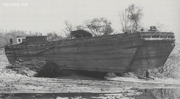
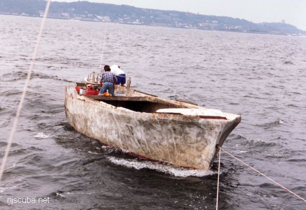
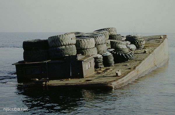
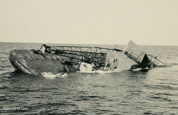
Notice the blocky shape and structure of this stranded but otherwise typical old wooden barge. Barges usually have minimal crews, to tend the lines.

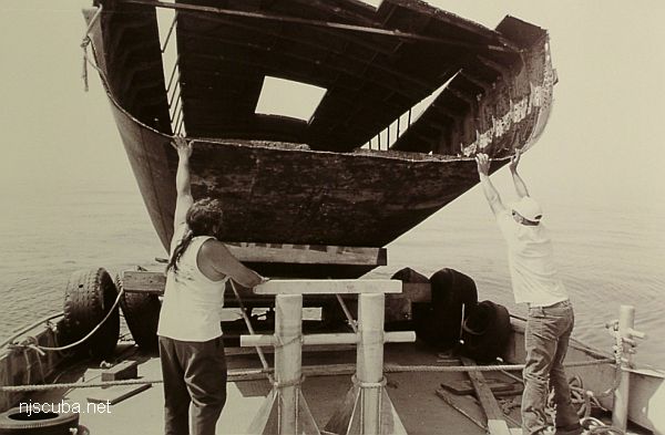
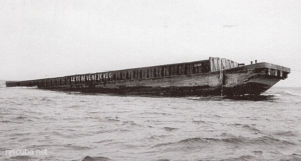
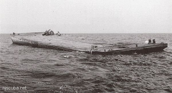
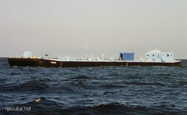
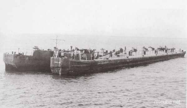
A barge is a vessel that does not have its own means of propulsion ( usually. ) Barges are towed or pushed from place to place by tugboats, or anchored in place to serve as temporary work platforms, floating docks, or storage. Some barges are self-propelled, in a limited way. These are known as scows, and their limited propulsive power restricts them to protected waters without the assistance of a tugboat.

 1  5 6 7  10  

Libra reef
Type:
artificial reef, barge, gravel
Specs:
( 195 ft )
Sponsor:
Hay's Tug & Launch
Sunk:
Thursday June 12, 1997 - Ocean City Artificial Reef
GPS:
39°10.801' -74°32.741'

Lisa Michelle reef
Type:
artificial reef, barge
Specs:
( 110 x 30 ft )
Sponsor:
McNeil's Marina, Cape May County Party & Charter Boat Association
Sunk:
Wednesday August 8, 1990 - Cape May Artificial Reef
GPS:
38°53.505' -74°40.075'

Mantank reef
Type:
artificial reef, barge
Built:
1950, Dravo Corporation, Wilmington, DE USA
Specs:
( 224 x 38 ft ) 997 GT
Sponsor:
BassBarn.com, Ann E Clark Foundation, PSE&G Habitat Restoration Fund
Sunk:
Thursday Sept 5, 2002 - Deepwater Artificial Reef
GPS:
39°58.688' -74°11.410'
Depth:
120 ft

Mary C reef
Type:
artificial reef, barge, tank
Built:
1944, East Coast Shipyards, Bayonne NJ, as AOG-23 Ammonusuc
Specs:
( 240 x 38 ft )
Sponsor:
Eklof Marine Co., Fish America, Atlantic County Reef Society, Princeton Dive Club, Village Harbor Fishing Club, Fish Hawks
Sunk:
Tuesday October 30, 1990 - Garden State North Artificial Reef
GPS:
39°37.168' -74°01.720'
Depth:
80 ft

Michael DePalma reef
Type:
artificial reef, barge
Specs:
( 70 x 28 ft )
Sponsor:
Creedon Tug & Barge Works, Friends of Michael DePalma, GDF, Cape May County Party & Charter Boat Association
Sunk:
Tuesday February 27, 1996 - Wildwood Artificial Reef
GPS:
38°56.970' -74°41.337'

GS Miller reef
Type:
artificial reef, barge
Specs:
( 90 x30 ft )
Sponsor:
Caldwell's Diving Company, Fish America Foundation
Sunk:
Tuesday October 10, 1989 - Garden State South Artificial Reef
GPS:
39°33.621' -74°06.528'


MRMTC 8 reef
Type:
artificial reef, barge
Specs:
( 90 ft )
Sponsor:
Manasquan River Marlin & Tuna Club, Ann E Clark Foundation
Sunk:
Friday Oct 3, 2006 - Axel Carlson Artificial Reef
GPS:
40°03.387' -73°59.386'
Depth:
80 ft

MRMTC 9 reef
Cleanwater 12
Type:
artificial reef, barge
Specs:
( 178 ft )
Sponsor:
Manasquan River Marlin & Tuna Club, Ann E Clark Foundation
Sunk:
Friday Oct 3, 2006 - Axel Carlson Artificial Reef
GPS:
40°03.689' -73°59.165'
Depth:
80 ft


The Office of Coast Survey's Automated Wreck and Obstruction Information System (AWOIS) contained information on over 10,000 submerged wrecks and obstructions in the coastal waters of the United States. Information included latitude and longitude of each feature along with brief historic and descriptive details. The AWOIS system has been discontinued, the replacement is here.

Printed from njscuba.net