Salem Wrecks
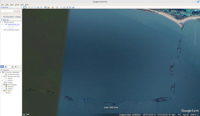
In case you didn't watch the whole video, you can't actually go here or fly a drone without permission from the power company.
Cape May Dive Sites, Dive Sites, Freighters, New Jersey Dive Sites,
Cape May Chart
- Absecon Inlet
- USS Akron
- Alex Gibson
- Alexander
- Almirante
- American
- Astra
- Atlantus
- Azua
- Dorothy B Barrett
- Brigantine Beach Wreck
- USS Blenny
- boiler wreck
- Brian C
- Brigantine Inlet
- Brigantine Buoy Wreck
- Charles Morand
- Cape May Inlet
- Cassandra
- Cayru
- Champion
- USS Cherokee
- China Wreck
- City of Athens
- City of Georgetown
- Clermont
- Corson’s Inlet
- William B Diggs
- dredge
- Admiral DuPont
- Elizabeth Warren
- Evening Star
- car float
- Florida
- Galimore's Cayru
- Gory Wreck
- Great Egg Inlet
- Gypsum Prince
- Hereford Inlet
- Hornet
- Hvoslef
- India Arrow
- Indian River Inlet
- USS Jacob Jones
- John Marvin
- China Junk Wreck
- Kennebec
- King Cobra
- Lemuel Burrows
- Lake Frampton
- Lady Mary
- Linda Snow II
- Marine Electric
- Miraflores
- Misty Blue
- Mohawk
- Montgomery
- USS Moonstone
- EF Moran
- Northern Pacific
- Nuphar
- Oklahoma
- Patrice McAllister
- Pet Wreck
- Poseidon
- Ranald
- RJ Walker
- Southern Lillian
- USS S-5
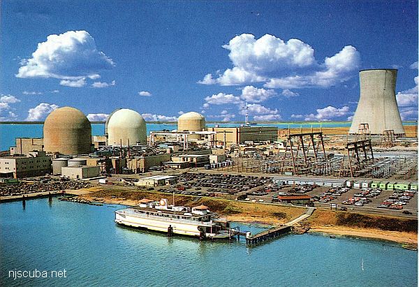
- Salem
- Salem
- San Jose
- Sea Girt
- Shookus
- Sindia
- Slabs
- General Slocum
- Southern Sword
- Townsend's Inlet
- Varanger
- Wayne
- Wily Fox
- YP-387
More: Cape May Dive Sites Chart ...
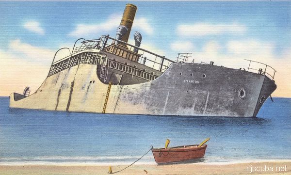
- Type:
- shipwreck, freighter, USA
- Built:
- 1918, Liberty Shipbuilding, Brunswick GA USA
- Specs:
- ( 260 x 43 ft ) 2000 gross tons, no crew
- Sunk:
- Tuesday June 8, 1926
dragged anchor and grounded in storm while awaiting final disposition - Depth:
- 25 ft
More: Atlantus ...
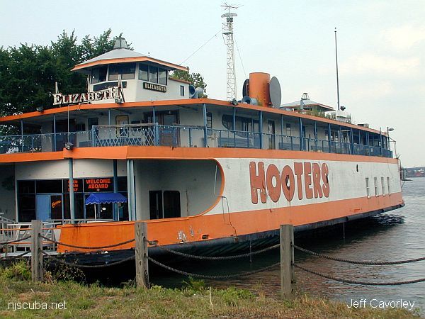
- Type:
- artificial reef, ferry, Central Railroad of New Jersey, USA
- Name:
- All CRRNJ ferries were named for New Jersey towns - Lakewood, Bound Brook, Red Bank, Plainfield, Elizabeth, Wilkes Barre, Cranford, Somerville, Westfield, and Bound Brook
- Built:
- 1901, Harlan & Hollingsworth Wilmington DE USA, as Lakewood
- Specs:
- ( 200 x 44 ft ) 1016 gross tons
- Sponsor:
- NJ Coast 2005 Initiative
- Sunk:
- Wednesday August 3, 2005 - Cape May Artificial Reef
- GPS:
- 38°50.682' -74°43.078'
- Depth:
- 75 ft
More: Elizabeth "Hooters" ...
Questions or Inquiries?
Just want to say Hello? Sign the .