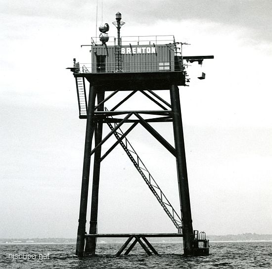
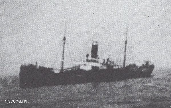
Brenton Reef Lighthouse
- Type:
- artificial reef, light tower, USA
- built:
- 1962, US Coast Guard
- Specs:
- 87 ft tall
- Sunk:
- Friday January 8, 1993 - Shinnecock Artificial Reef
- Depth:
- GPS:
- 40°48.139' -72°28.526'
The Brenton Reef Light was a Texas Tower lighthouse at the entrance to Narragansett Bay, Rhode Island, United States, south of Beavertail Point. Erected to replace a lightship in 1962, it was decommissioned in 1989 due to its deteriorating condition.
This offshore station was marked by a succession of lightships beginning in 1853, with new vessels being assigned to the station in 1856, 1897, and 1935. In the early 1960s, the United States Coast Guard initiated a program to replace these lightships with large steel towers, commonly known as Texas Towers. Brenton reef was selected for such replacement, but a somewhat smaller facility was constructed instead. This light was originally a manned station, with living quarters and galley, as well as engine room to supply power to the light and living quarters. It was connected to the Beavertail Light by submarine cables and maintained by Coast Guardsmen out of the Newport, Rhode Island station, and was converted to fully automatic operation during its active lifetime. At its activation in 1962, it became the second such light tower on the east coast.
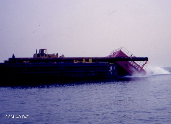
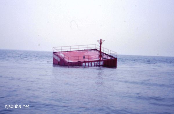
These towers deteriorated relatively quickly, and in 1983 the Coast Guard first suggested decommissioning them. This one was retained, however, due to the proximity of the America's Cup races. In 1989 the Coast Guard announced that the light was to be removed, and in 1992 it was dismantled. The following year the pieces were sunk off Long Island as part of an artificial reef. A lighted buoy replaced the tower at a position somewhat further south, where it remains at present.
Wikipedia
Artificial Reef Sites, Artificial Reefs, Coast Guard Artificial Reefs, New York Artificial Reef Sites, New York Artificial Reefs, Shinnecock Artificial Reef,
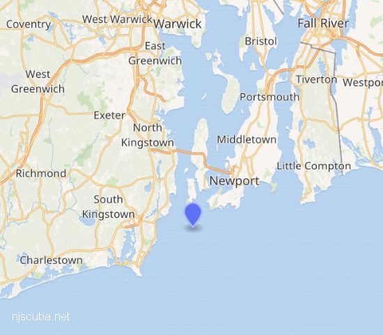
Shinnecock Artificial Reef (historical)
( 40.80139, -72.47293 )
2.0 Nautical miles south of Shinnecock Inlet, 0.55 sq miles
Depth: 76 - 84 ft
More: Shinnecock Artificial Reef ...
Long Island - East Chart
- 3/4 Tug
- Amsterdam
- Andrea Doria
- Atlantic
- USS Baldwin
- Barataria
- USS Bass
- Black Point
- Burnside
- Coastwise
- Coimbra
- HMS Culloden
- Defender
- Dodger
- John A. Downs
- Essex
- USS G-1
- USS G-2
- Gate City
- Gluckauf
- Grecian
- Horton's Point / Commodore
- Hylton Castle
- John C. Fitzpatrick
- Kenosha
- Kismet Artificial Reef
- USS L-8
- Larchmont
- Lexington
- Lightburne
- Linda
- Maiden Creek
- Malden
- Mattituck Inlet
- Mattituck Artificial Reef
- Montauk Inlet
- Moriches Inlet
- Mount Sinai Harbor
- Myronus
- Norness
- USS Ohio
- Old Yankee
- Olinda
- Oregon
- Panther
- Pinnacle
- Ponquogue Bridge
- Port Jefferson Artificial Reef
- Port Jefferson Inlet
- Puszta
- Reggie
- Republic
- USS San Diego
- Sea Wolf
- Sebastian
- Shinnecock Inlet
- Shoreham Nuclear Power Plant
- Smithtown Artificial Reef
- Snug Harbor
- USS Spikefish
- Suffolk
- USS Tarantula
- Tennyson
- Thames
- Thelma Phoebe
- U-853
- Volund
- Block Island Wind Farm
- Wolcott
More: Long Island East Dive Sites Chart ...
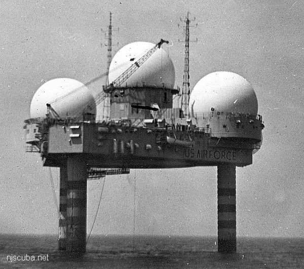
- Type:
- collapsed radar platform, USAF
- Built:
- 1955, Portland ME USA
- Specs:
- ( 67 ft above water) 6000 tons, 14 crew (minimum)
- Sunk:
- Sunday January 15, 1961
storm/structural failure/design deficiency - no survivors - GPS:
- 39°47'56.43" -72°40'08.00" (US Navy 2004)
- Depth:
- 180 ft, starts at 110 ft
More: Texas Tower TT-4 ...
Questions or Inquiries?
Just want to say Hello? Sign the .