Long Island Sound Dive Sites Chart
Long Island Sound - West Chart
- Amsterdam
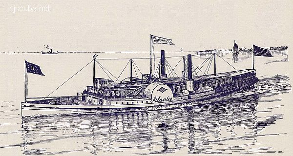
- Atlantic
- Barataria
- USS Bass
- Bayville barge
- Black Point
- Celtic/Cape Race
- Condor
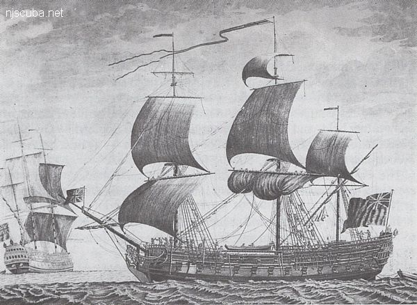
- HMS Culloden
- Defender
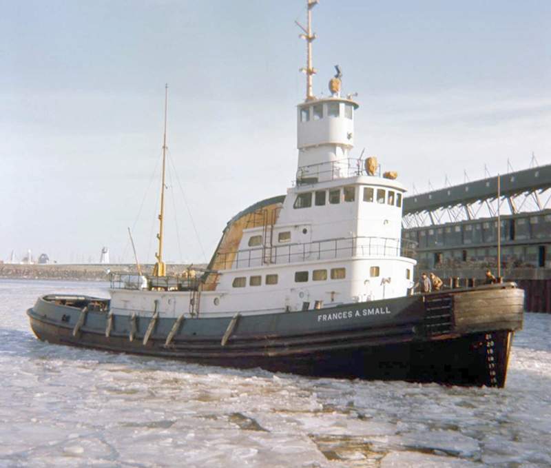
- John A. Downs
- Essex
- Gwendoline Steers
- USS G-1
- USS G-2
- Grecian
- Horton's Point / Commodore
- Huntington Artificial Reef
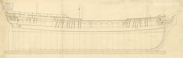
- HMS Hussar
- USS L-8
- Larchmont
- Lexington
- Lightburne
- Malden
- Matinecock Artificial Reef
- Mattituck Inlet
- Mattituck Artificial Reef
- Montauk Inlet
- Mount Sinai Harbor
- Myronus
- USS Ohio
- Olinda
- Pinnacle
- Poling Bros #2
- Port Jefferson Artificial Reef
- Port Jefferson Inlet
- Puszta
- Shoreham Nuclear Power Plant
- Smithtown Artificial Reef
- Snug Harbor
- Thames
- Thelma Phoebe
- U-853
- Volund
- Delaware River Water Gap
- Block Island Wind Farm
Long Island Sound - East Chart
- Amsterdam
- Atlantic
- Barataria
- USS Bass
- Bayville barge
- Black Point
- Celtic/Cape Race
- Condor
- HMS Culloden
- Defender
- John A. Downs
- Essex
- Gwendoline Steers
- USS G-1
- USS G-2
- Grecian
- Horton's Point / Commodore
- Huntington Artificial Reef
- USS L-8
- Larchmont
- Lexington
- Lightburne
- Malden
- Matinecock Artificial Reef
- Mattituck Inlet
- Mattituck Artificial Reef
- Montauk Inlet
- Mount Sinai Harbor
- Myronus
- USS Ohio
- Olinda
- Pinnacle
- Poling Bros #2
- Port Jefferson Artificial Reef
- Port Jefferson Inlet
- Puszta
- Shoreham Nuclear Power Plant
- Smithtown Artificial Reef
- Snug Harbor
- Thames
- Thelma Phoebe
- U-853
- Volund
- Delaware River Water Gap
- Block Island Wind Farm
Long Island Sound averages 60 ft in depth, with the greatest depth of over 300 ft at the eastern end. Tidal effects are strongest at the narrow western end, where all the inrushing water flow piles up and makes tidal variations of up to 7 ft. Strong tidal currents are also prevalent, and visibility tends to be poorer than the open ocean, especially at depth.
- Type:
- shipwreck, steamer, USA
- Built:
- May 1846, Jeremiah Simonson, New York NY USA
- Specs:
- ( 320 x 36 ft ) 1112 gross tons, 75 passengers & crew
- Sunk:
- Friday November 26, 1846
boiler explosion; then grounded during storm on Fisher's Island - 45 casualties - Depth:
- 20 ft
More: Atlantic ...
- Type:
- shipwreck, tugboat, USA
- Type:
- Fraser Shipyards, Superior, WI as Frances A. Small
- Specs:
- ( 113 x 31 ft, 850 tons ) 8 crew
- Sunk:
- Sunday March 3, 1985
collision with one of its own barges - no casualties - Depth:
- 230 ft
More: John A. Downs ...
- Type:
- shipwreck, frigate, British Royal Navy
- Name:
- The Battle of Culloden, where in 1745 the English army massacred the last of the Scottish resistance ( and much of the civilian population ), completing the English conquest of Scotland.
- Built:
- 1776, England
- Specs:
- ( 170 x 47 ft ) 1658 gross tons, 650 crew
- Sunk:
- Monday January 24, 1781
ran aground in storm - no casualties - Depth:
- 20 ft
More: HMS Culloden ...
- Type:
- shipwreck, frigate ( Mermaid-class, 6th-rate ), British Royal Navy
- Name:
- Hussars were light cavalry units of the period, known for their colorful and showy uniforms.
- Built:
- 1763, England
- Specs:
- ( 124 x 33 ft ) 627 gross tons
- Sunk:
- Thursday November 23, 1780
struck a rock - unknown casualties, including prisoners - Depth:
- probably buried in the landfill under the police station near 135th Street
More: HMS Hussar ...
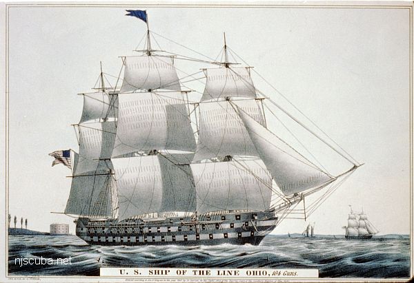
- Type:
- shipwreck, 74 gun ship-of-the-line, U.S. Navy
- Name:
- that place next to Indiana
- Built:
- 1820, New York Naval Shipyard, Brooklyn NY USA
- Specs:
- ( 208 x 54 ft ) 2757 gross tons
- Sunk:
- April 1884
set adrift and grounded by storm while being dismantled, later deliberately burned - Depth:
- 20 ft
More: USS Ohio ...