Sandy Hook Dive Sites (5/11)
Sandy Hook / Rockaway Inlet Chart
- Barge #10
- 120 Wreck
- 3 Sisters
- Ambrose Buoy
- A Street - Shark River
- Acara
- Across
- Adele
- Ajace
- Alex Mac
- Allenhurst Jetty
- Antioch
- Arnoff
- Arundo
- Asfalto
- Aurora
- Ayuruoca
- BA Wreck
- Shark River - Back Bay
- Balaena
- Bald Eagle
- BD1738
- USS Benson
- Beth Dee Bob
- Blue Boy
- Bronx Queen
- Bug Light
- Charles Dunlap
- Cecilia M Dunlap
- Catherine Jackson
- Chauncy Jerome
- Cornelia Soule
- Choapa
- coal (Lido)
- Continent
- crane barge
- Daghestan
- Dragger
- drydock
- Dryland
- Edwin Duke / Stone Barge
- dump
- Dutch Springs
- Edmund Phinney
- East Rockaway Inlet
- Ed's Schooner
- Elberon Rocks
- Eureka
- Finance
- Fort Victoria
- German
- GL78
- Glen II
- I.P. Goulandris
- Gypsy
- Horseshoe Cove
- Alexander Hamilton
- Howard
- Iberia
- Immaculata
- Inshore Schooner
- Jack I
- Joan La Rie III
- Jones Inlet
- Jones Tug
- Klondike Rocks
- Larsen
- Lizzie D
- Long Branch locomotives
- Logwood
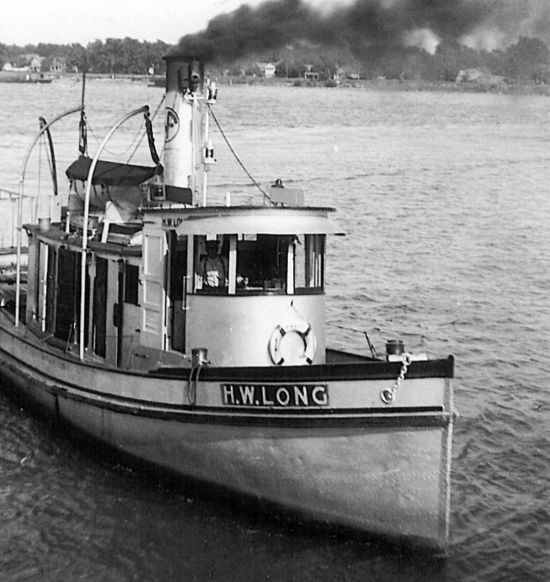
- H.W. Long
- Macedonia
- Mahogany
- Malta
- Manasquan Inlet
- Margaret
- Marion
- Mistletoe
- R.C. Mohawk
- Manasquan Wreck
- Nautilus
- Navesink River
- Northeast Sailor
- New Reef
- New Deal
- New Era
- HMS Pentland Firth
- Long Branch Pier Rubble
- Pinta
- Pipe Barge
- Pliny
- Plymouth
- Pocopson
- Princess Anne
- Ruth Shaw
- Robert A Snow
- Ramos
- Ranger
- Relief Lightship
- Rickseckers
- Rjukan
- Rockaway Inlet
- Rockaway Belle
- Round Valley
- Roy's barge
- Rudder Wreck - Pocono
- Rusland / Adonis
- Scotland Buoy
- Sandy Hook Pilot Boat
- SC-60
- Sea Girt Inlet
- Sea Girt Wreck
- Shark River Inlet
- Shrewsbury Rocks
- Spring Lake Sailor
- Steel Wreck
- Stolt Dagali
- Sylvanus
- Tampa III
- USS Turner
- AWOIS 8087
- AWOIS 8097
- u11
- AWOIS 7509
- AWOIS 7932
- AWOIS 9768
- AWOIS 12966/11422
- AWOIS 1609
- AWOIS 8084
- AWOIS 7940
- AWOIS 7938
- AWOIS 8076
- AWOIS 4600
- AWOIS 8075
- Valerie E
- Vega
- Warrior
- Delaware River Water Gap
- Western World
- Edward W Winslow
- Edward W Winslow
More: Sandy Hook Dive Sites Chart ...
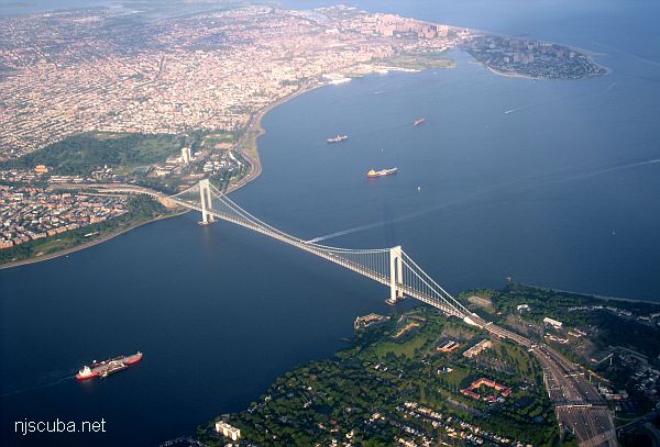
Looking roughly south: Sandy Hook is barely visible at upper-right, Rockaway inlet at the upper-left, Brooklyn at lower-left, Staten Island at lower-right. The shipping channel is also plainly obvious.
More: Hudson/East Rivers ...
- Type:
- shipwreck, barge
- Depth:
- 95 ft
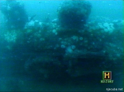
This wreck seems to be one or more wooden barges, possibly garbage barges from the 1920s. There is an anchor in one spot near a machinery pile, and in other spots, the old walls rise perhaps 10 ft off the bottom. But otherwise, everything is pretty broken down. This forms many hiding holes for lobster and rock crabs, and there is one in almost every hole, and some quite large. The Sea Bass are also good-sized. Yellowish natural sponges and bottles are easy to find.
More: Immaculata ...
- Type:
- shipwreck, tanker
- Specs:
- ( 120 ft )
- Depth:
- 115 ft
This is erroneously called a tug, but its shape and size indicate that she was once might have been a small oiler or tanker. The wreck lies upright in the muddy bottom at 120 feet. She comes up 15 feet off the bottom in many places and is mostly intact. I have little idea of age, but her conditions suggest she's been there for 30-40 years or more.
More: Larsen ...
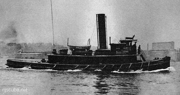
- Type:
- shipwreck, tugboat, USA
- Built:
- 1907, Neafie & Levy, Philadelphia PA USA
- Specs:
- ( 77 x 21 ft ) 122 gross tons, 13 crew
- Sunk:
- Thursday October 19, 1922
unknown, related to smuggling during Prohibition - no survivors - Depth:
- 80 ft
More: Lizzie D ...
- Type:
- 2 identical small locomotives
- Sunk:
- 1850s ?
- GPS:
- 40.274769° --73.872292° (AWOIS 1991)
- Depth:
- 85 ft
More: Locomotives ...

- Type:
- oceanfront pier
- Built:
- 1911
- Depth:
- 15 ft?
More: Long Branch Pier ...

Omega Protein with fishing partner Ocean Harvesters have a long history of collaborating with government agencies and non-profit organizations to offer retired vessels to artificial reef programs. The vessels that have been submerged act as a habitat for marine life, promoting biodiversity and creating recreational fishing and diving opportunities. The former vessels that have been sunk include the F/V Reedville off of the coast of Delaware in 2020, the F/V Barataria Bay off the coast of Mississippi in 2015, the F/V Great Wicomico in the Gulf of Mexico in 2009, and the F/V von Rosenberg off the coast of Mississippi in 2000.
More: Omega Protein Artificial Reefs ...