- Absecon Inlet
- Adriatic
- USS Akron
- Almirante
- Anastasia
- Astra
- Barnegat Inlet
- Brigantine Beach Wreck
- boiler wreck
- Bonanza
- Brick barge
- Brigantine Inlet
- Cornelius Grinnell
- Caddo
- Capt Smitty
- Cassandra
- Charlemagne Tower
- Chaparra
- Chesapeake
- clam boat
- Creole
- Delaware
- dredge
- Duncan
- Emerald / USS Hibiscus
- Francis A Perkins
- William R Farrell
- FF Clain
- Gassoon
- Gory Wreck
- Glory Wreck
- Granite Wreck
- Great Isaac
- Gulftrade (stern)
- Gulftrade (bow)
- Hankins (Big)
- Hankins (Offshore)
- Hankins 3
- Cornelius Hargraves
- Harry Rush
- Hornet
- Ida K
- Inshore barge/tug
- Irene/Truro
- John Minturn
- John Marvin
- Kennebec
- Lake Frampton
- Lake Allure
- Lana Carol
- Lavallette Wreck
- Leon Walter
- Lillian
- Manhattan
- Maurice Tracy
- Mediator
- Meta
- Middle Barge
- Mohawk
- EF Moran
- Mullica River Wrecks
- NJ Aquarium
- Northern 29
- NW Barges
- Offshore Tug
- Oklahoma
- Patrice McAllister
- Park City
- Peerless
- Persephone
- Remedios Pascual
- Reliable
- Ridge Schooner
- Riggy
- RP Resor
- Rump
- Southern Lillian
- Sachem
- Salem
- San Saba
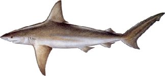
- Sea Hag
- Seaside Crane Barge
- Shookus
- Simala
- Sumner
- Southwest Mohawk
- Thurmond
- Tolten
- Troop Carrier
- Vivian
- Vizcaya
- Yellow Flag
- ZPG-3W
More: Barnegat Dive Sites Chart ...