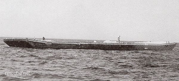
- Type:
- artificial reef, barge
- Specs:
- ( 130 x 30 ft )
- Sponsor:
- Shore Dock Company Inc.
- Sunk:
- I - Friday July 25, 1986
II - Wednesday September 16, 1987 - Sea Girt Artificial Reef - GPS:
- 40°07.305' -73°56.885'
More: Swenson I & II ...
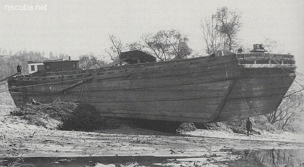
A barge is a vessel that does not have its own means of propulsion ( usually. ) Barges are towed or pushed from place to place by tugboats, or anchored in place to serve as temporary work platforms, floating docks, or storage. Some barges are self-propelled, in a limited way. These are known as scows, and their limited propulsive power restricts them to protected waters without the assistance of a tugboat.
More: Barge ...

More: Swenson I & II ...
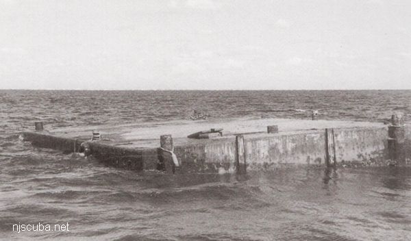
More: Tuna Sub ...
AWOIS 12966:
H10675/96-97 -- OPR-C399-RU; 200% SIDE-SCAN SONAR LOCATED A LARGE RECTANGULAR, UNCHARTED OBSTRUCTION. DIVERS DESCRIBE A BARGE WITH SURROUNDING SCOUR. BARGE RELIEF IN SCOUR IS 2.4 METERS (8 FEET) BUT NEARLY LEVEL WITH THE BOTTOM. LD OF 8.1 METERS (26 FEET) (ENT 12/23/04, SJV)
More: u02 - AWOIS 12966/11422 ...
NM22/46 -- DERRICK BARGE WRECK LIGHTED BUOY 3, BLACK, QK FL GREEN, ESTABLISHED IN 62 FT., 1.75 MILES, 63 DEG. FROM SCOTLAND LIGHT VESSEL. BUOY LOCATED 200 FEET EAST OF SUNKEN WRECK WHICH LIES IN A SE-NW DIRECTION.
H10224/86 -- OPR-C121-WH-86; MAIN SCHEME HYDROGRAPHY AND SIDE-SCAN SONAR INVESTIGATION REVEALED WHAT APPEARED TO BE A WRECK IN FOUR PIECES 447M SW OF WRECK; FOUR DIVES WERE PERFORMED IN 1987; FOUND A BARGE, APPROXIMATELY 50 X 120 FT WITH A PNEUMATIC DEPTH GAUGE LEAST DEPTH OF 63 FT; 0-5 FT VISIBILITY; A STRUCTURE SIMILAR TO A DERRICK CRANE WAS FOUND; HYDROGRAPHER AND EVALUATOR RECOMMENDED DELETING CHARTED SYMBOL AND ADDING 63 WK AS SHOWN ON PRESENT SURVEY. (UPDATED MSD 4/91)
24 NO. 1350; BARGE, SUNK 5/30/46; POS. ACCURACY WITHIN 1 MILE;
More: u03 - AWOIS 1609 ...
H10224/86 -- OPR-C121-WH-86; WHILE INVESTIGATING ITEM 751, AN AREA WITH NUMEROUS SIDE-SCAN SONAR CONTACT WAS FOUND AND DEVELOPED USING SIDE-SCAN AND ECHO SOUNDER; DIVER INVESTIGATION DETERMINED LIMITS OF SITE, NATURE OF WRECKAGE, AND LOCATION OF THE LEAST DEPTH; SITE WAS ORIENTED NORTHEAST-SOUTHWEST; CONSISTS MOSTLY OF SHIPYARD DEBRIS IN THE FORM OF HEAT EXCHANGERS, BUCKLED DECK PLATING, TWISTED ANGLE IRON, WOODEN RIBS, AND PIPING OF VARIOUS LENGTHS AND SIZES; THE NORTHEAST END OF THE SITE CONSISTED OF A BARGE LYING IN A NORTHWEST-SOUTHEAST DIRECTION WITH THE BOW OF THE BARGE DEFINING THE SOUTHEAST WALL OF THE SITE; THE NORTHWEST END OF THE BARGE, THE STERN, WAS COVERED WITH METAL DEBRIS, HAWSER LINES, AND TRAWLER NETTING; DIVERS CONCLUDED THAT THIS SITE IS THE WRECK OF A BARGE THAT WAS FILLED WITH SHIPYARD SCRAP IRON AND DEBRIS; PNEUMATIC DEPTH GAUGE LEAST DEPTH OF 50 FT. (ENTERED MSD 4/91)
More: u13 - AWOIS 7932 ...
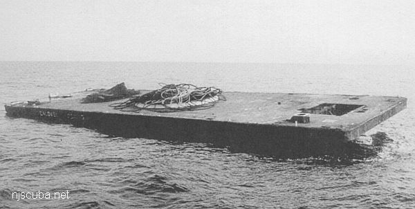
More: Waldorf ...
More: Wards Island ...
More: Wedding barge ...
More: Weeks barge ...
The Diggs was engaged in a salvage operation at the time of her loss and actually settled on top of another shipwreck, of unknown origin. The green blinker buoy for which it is known was removed after the wooden wreck was demolished in the 1970s. Also known as the "Green Blinker Wreck".
More: William B. Diggs ...