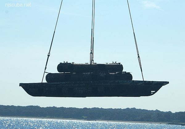
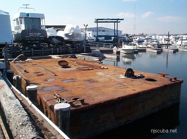
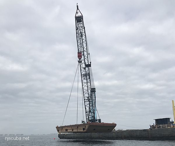
- Type:
- artificial reef, barge, etc
- Specs:
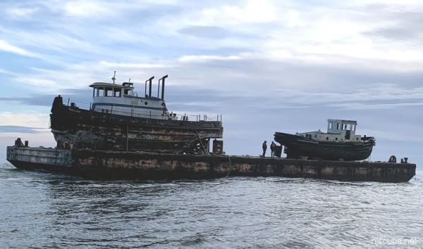
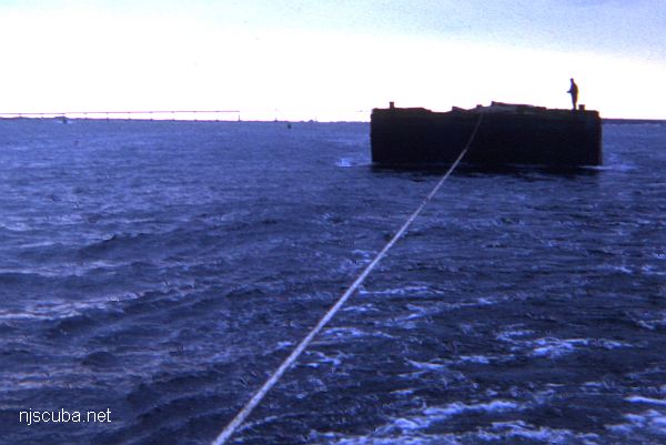
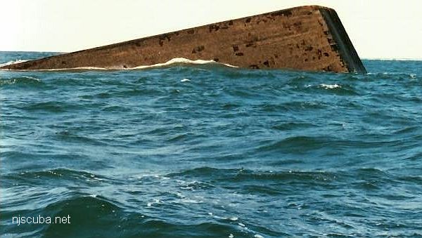
- ( 140 ft )
- Sunk:
- Thursday January 14, 2021 - Little Egg Artificial Reef
- GPS:
- 39°28.340' -74°11.083'
More: barge etc ...
More: barge etc ...
| Name | Description | Sunk | GPS |
| 80 ft steel | 40°31.884' -73°43.297' |
||
| 85 ft steel | 40°31.942' -73°42.894' |
||
| 100 ft steel | 40°31.631' -73°43.029' |
||
| 140 ft steel | 40°31.736' -73°42.736' |
||
| 150 ft steel | 40°31.903' -73°43.166' |
||
| 150 ft wood | 40°31.762' -73°43.306' |
||
| 75 ft steel | Thursday Nov 14, 2019 |
40°31.604' -73°43.611' |
More: barges - Atlantic Beach Artificial Reef ...
The "Ocean Prince" drydock (above) was sunk in 1986 and is well-attested. New York has photos of a clearly different drydock which they place here, but I believe is actually at Shinnecock, and I have placed it there.
| Name | Description | Sunk | GPS |
| 110 ft steel | Thursday Sept 9, 1999 |
40°35.973' -73°13.242' |
|
| Air Force Scow |
110 ft steel | Sunday Oct 14, 2018 |
40°35.914' -73°11.986' |
| Dump Scow DS-24 |
100 ft steel | Sunday Oct 14, 2018 |
40°35.838' -73°12.015' |
| Irvington | 60 ft steel | 2024 | 40°35.949' -73°12.308' |
| Piano Scow | 30 ft steel | Sunday Oct 14, 2018 |
40°35.872' -73°12.022' |
| "Ocean Prince" Drydock #4 |
200 ft steel drydock |
Saturday Nov 29, 1986 |
40°35.704' -73°11.968' |
More: barges - Fire Island Artificial Reef ...
| Name | Description | Sunk | GPS |
| 115 ft steel | 40°31.145' -73°31.736' |
||
| 100 ft wood drydock |
1990 | 40°31.504' -73°31.914' |
|
| Navy | 110 ft steel | 1993 | 40°31.077' -73°31.476' |
| 40 ft steel dredge |
Wednesday Oct 4, 2000 |
40°31.010' -73°32.501' |
|
| 40 ft steel dredge |
Wednesday Oct 4, 2000 |
40°31.010' -73°32.501' |
|
| DB-1 | 75 ft steel derrick |
Friday Aug 10, 2018 |
40°30.971' -73°32.971' |
More: barges - Hempstead Artificial Reef ...
| Name | Description | Sunk | GPS |
| 85 ft | 1965 | 40°38.311' -73°12.435' |
|
| 100 ft | 1965 | 40°38.280' -73°12.496' |
More: barges - Kismet Artificial Reef ...
| Name | Description | Sunk | GPS |
| 46 ft steel | Thursday Aug 22, 2019 |
40°54.604' -73°37.477' |
|
| 40 ft steel | Thursday July 25, 2024 |
40°54.613' -73°37.394' |
More: barges - Matinecock Artificial Reef ...
| Name | Description | Sunk | GPS |
| 60 ft steel | Tuesday (?) Sept 28, 1999 |
40°32.120′ -73°39.605′ |
|
| 40 ft steel dredge |
Thursday Sept 28, 2000 |
40°32.048′ -73°39.326′ |
|
| 40 ft steel dredge |
Thursday Sept 28, 2000 |
40°32.015′ -73°39.295′ |
|
| 37 ft steel crane |
2003 | 40°32.162' -73°39.481' |
More: barges - McAllister Artificial Reef ...
| Name | Description | Sunk | GPS |
| Jean Elizabeth |
190 ft steel | 1995 | 40°43.500' -72°46.482' |
| 60 ft steel | 1995 | 40°43.558' -72°46.340' |
|
| #335 | 80 ft steel | Friday Nov 12, 1999 |
40°43.514' -72°46.309' |
| CFD | 100 ft steel | Thursday Feb 8, 2001 |
40°43.476' -72°46.343' |
| "Pump Boat" | 25 ft steel | Sunday Oct 14, 2018 |
40°43.464' -72°46.601' |
| Self-Propelled Scow #56 |
50 ft steel | Sunday Oct 14, 2018 |
40°43.453' -72°46.612' |
More: barges - Moriches Artificial Reef ...

| Name | Description | Sunk | GPS |
| Lund's | 50' steel crane barge | Thursday Nov 16, 2023 |
40°59.915' -73°04.043' |
More: barges - Port Jefferson Artificial Reef ...
| Name | Description | Sunk | GPS |
| Dump Scow DS-109 |
100 ft steel | Tuesday Oct 9, 2018 |
40°32.614' -73°50.098' |
More: barges - Rockaway Artificial Reef ...
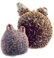
Molgula manhattensis ( right )
Styela Partita ( left )
Sea Squirts are found attached intertidally to subtidally. They show an extraordinary tolerance for brackish and polluted water, which makes them highly survivable in urban areas. Sea Squirts, usually about an inch in diameter, are capable of ejecting a stream of water when agitated, hence the name. Usually found in groups of several animals. See also: Horned Salp.
Tunicates are much more advanced in the evolutionary scheme of things than anemones, having, for example, a circulatory system. The larvae actually even have several features in common with vertebrates, including the precursor of a spinal cord, but these are lost in the sac-like sessile adults.
More: Sea Squirts ...