Moriches Artificial Reef
Moriches Artificial Reef (historical)
2.4 nautical miles south of Moriches Inlet, 0.54 sq miles
Depth: 70 - 75 ft
Moriches Artificial Reef (now)
Moriches Reef was originally very small, but has been expanded greatly. The pink region is the historical area, and the blue region is the new deployment zone, while the full permitted size of the reef is a 1-nm square that encloses the deployment zone. The misalignment in the northern boundary between old and new is accurate.
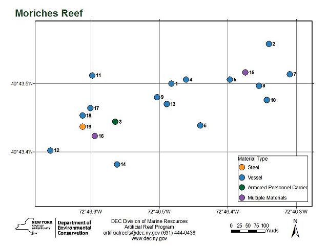
This reef is so tiny, some of these spots are probably within sight of each other underwater !
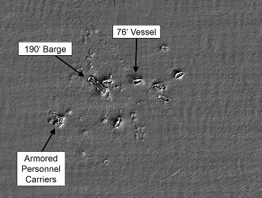
video by Dan Berg
- Type:
- artificial reef, barges
- Depth:
- 70 - 75 ft
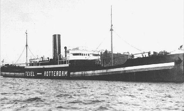
| Name | Description | Sunk | GPS |
| Jean Elizabeth |
190 ft steel | 1995 | 40°43.500' -72°46.482' |
| 60 ft steel | 1995 | 40°43.558' -72°46.340' |
|
| #335 | 80 ft steel | Friday Nov 12, 1999 |
40°43.514' -72°46.309' |
| CFD | 100 ft steel | Thursday Feb 8, 2001 |
40°43.476' -72°46.343' |
| "Pump Boat" | 25 ft steel | Sunday Oct 14, 2018 |
40°43.464' -72°46.601' |
| Self-Propelled Scow #56 |
50 ft steel | Sunday Oct 14, 2018 |
40°43.453' -72°46.612' |
More: barges - Moriches Artificial Reef ...
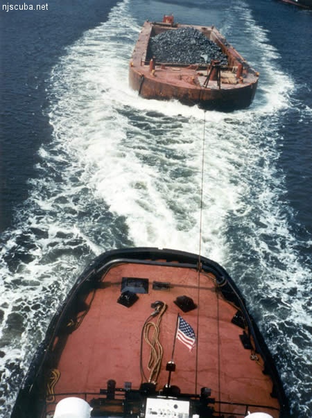
All manner of concrete, steel, and stone rubble from dredging, demolition projects, and other construction is used as artificial reef materials. This material is generally available at very low cost or free from construction companies who are more than happy to get rid of it. Transportation costs determine where this material is used by the Reef Program.
More: Rock & Rubble ...
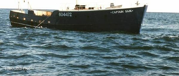
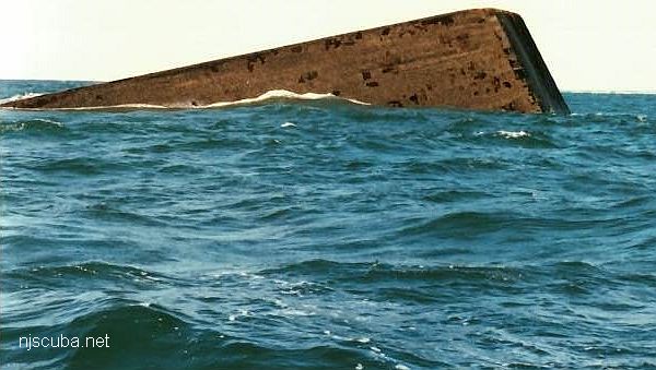
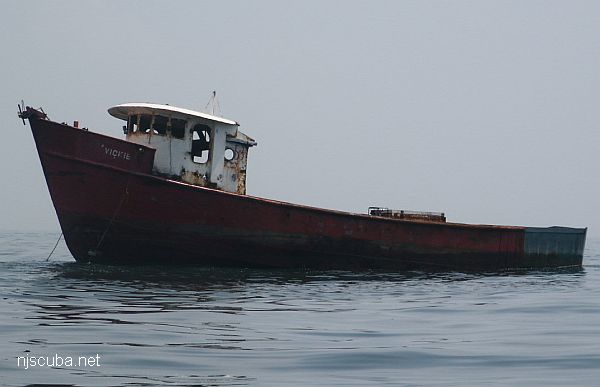
- Type:
- artificial reef, trawler, USA
- Built:
- 1979, Hudson Shipbuilders, Pascagoula MS
- Specs:
- ( 76 ft )
- Sunk:
- Friday November 6, 1998 - Moriches Artificial Reef
- Depth:
- GPS:
- 40°43.506' -72°46.397'
More: Captain Sam ...
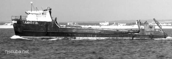
- Type:
- artificial reef, clam dredge
- Built:
- 1983, James K Walker Marine, Moss Point MS USA
- Specs:
- ( 112x24 ft ) 188 gross tons
- Sunk:
- Wednesday March 8, 2000 - Moriches Artificial Reef
- Depth:
- 75 ft
- GPS:
- 40°43.505' -72°46.386'
More: Cape Fear ...
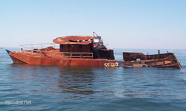
- Type:
- artificial reef, trawler, USA
- Built:
- 1975, Master Marine, Bayou La Bâtre AL USA
- Specs:
- ( 80 ft ) 147 gross tons
- Sunk:
- Friday July 12, 2002 - Moriches Artificial Reef
- Depth:
- GPS:
- 40°43.512' -72°46.598'
More: Ana Palmira ...
- Type:
- artificial reef, trawler, USA
- Built:
- 1972, Master Marine, Bayou La Batre, AL USA
- Specs:
- ( 68 ft ) 91 GT
- Sunk:
- Friday June 18, 2004 - Moriches Artificial Reef
- Depth:
- GPS:
- 40°43.382' -72°46.562'
More: Vickie ...